New Mapping Drone Features 3G/4G Communications and Onboard Processing

By Mike Ball / 26 Sep 2017

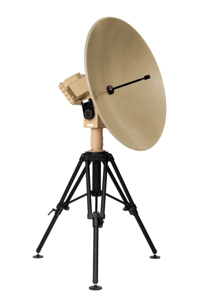
Drone Communications

Discover cutting-edge solutions from 23 leading global suppliers
SUPPLIER SPOTLIGHT
Follow UST

DELAIR UX11 mapping drone

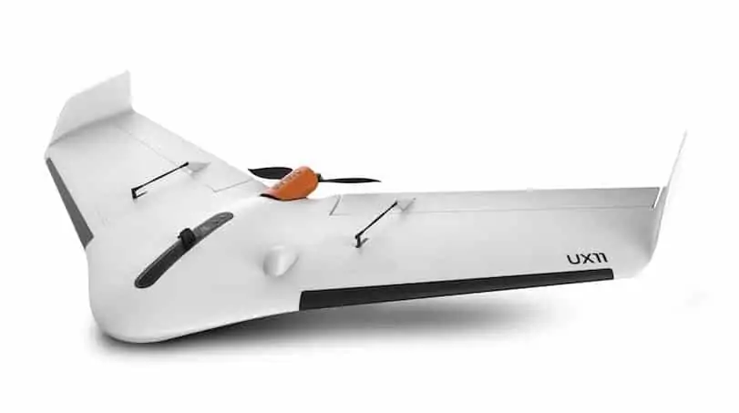
Delair has announced that it will introduce its next-generation professional unmanned aerial vehicle (UAV) for survey-grade photogrammetric mapping, the UX11, at INTERGEO 2017 in Berlin, Germany. The small fixed-wing UAV combines a powerful integrated onboard system, industry-grade sensors, limitless communication range and PPK centimeter-level positioning. The UX11 carries enough onboard computing power to access and process the pictures, then send them to the operator in real-time. It will run automated quality checks on the images (such as blur detection or overlap checks) to help ensure the operator is acquiring quality data.

The UX11’s redundant communications system includes a proprietary line of sight radio and 3G/4G connectivity between the ground control station and the UAV using a worldwide machine-to-machine pre-paid plan. Building on Delair’s experience with beyond visual line of sight (BVLOS) operations, the UX11 is ready for BVLOS flights with unlimited range and adds a new level of safety with this communication link.

“The UX11 by Delair is the ultimate solution for geospatial professionals that demand large-area mapping with centimeter-level precision,” said Michael de Lagarde, Delair’s CEO. “The UX11 will be capable of using its camera for enhanced safety procedures and even running early-stage pre-processing calculations onboard in real time using photogrammetry and deep learning algorithms. This expedites subsequent steps in the data processing chain for an optimized workflow. With the UX11, everything is done for a clear and efficient user experience.”

The UX11 is lightweight, stable, simple to hand-launch at takeoff and it lands precisely where planned using distance measuring technology. New user-friendly Android mission planning software features innovative features such as support for in-flight camera feedback and live data review. Made to help professionals in GIS, survey, and construction optimize area coverage per flight, the UX11 flies for 59 minutes at 122 m (400 ft) altitude above ground level.

The UX11 is a data acquisition system which can be complemented by data processing and analytics software programs to address a range of commercial applications. The geospatial market will benefit from the ability to create 2D and 3D models and then generate elevation profiles, contour lines, slope qualifications and volumetric estimates with high accuracy and resolution using Post-Processed Kinematic (PPK) data and ground control points.

Posted by Mike Ball Mike Ball is our resident technical editor here at Unmanned Systems Technology. Combining his passion for teaching, advanced engineering and all things unmanned, Mike keeps a watchful eye over everything related to the unmanned technical sector. With over 10 years’ experience in the unmanned field and a degree in engineering, Mike’s been heading up our technical team here for the last 8 years. Connect & Contact

Latest Articles

Precision RTK GNSS Positioning for UAVs & Unmanned Systems

RTKdata provides access to a world-leading RTK corrections data network with over 12,000 base stations in more than 140 countries

Mar 27, 2025
WOLF Introduces New VPX Modules with High-Performance Blackwell GPUs

WOLF Advanced Technology has unveiled new 3U and 6U VPX modules featuring NVIDIA Blackwell GPUs, offering high-performance AI computing for rugged systems

Mar 27, 2025
Volatus Expands Medical Delivery Network with Long-Range Drone

Volatus Aerospace is expanding its medical delivery network by integrating RigiTech’s Eiger long-range delivery drone, allowing for extended reach across Canada and underserved regions

Mar 27, 2025
Ruggedizing Products Built for Extreme Conditions with Conformal Coatings

Specialty Coating Systems discusses Parylene conformal coatings and how they can advance the ruggedization of products in environmentally challenging settings

Mar 27, 2025
Enhancing EO/IR Imaging Performance with Velox

Velox outlines the advantages of its compact EO/IR imaging system that delivers stabilized, high-resolution performance for defense, security, and industrial surveillance applications

Mar 27, 2025
Submersible Captures First Sighting of Prickly Shark in French Polynesia

SubC Imaging's latest case study outlines how its 1Cam Mk6 deep-sea camera, mounted on the SEAmagine Aurora submersible, captured a sighting of a prickly shark in French Polynesia

Mar 27, 2025

Featured Content

Be Part of the World’s Largest Business Accelerator for Uncrewed Systems: Applications Now Open

GENIUS NY, a drone and robotics accelerator program, is now accepting applications from tech startups focused on uncrewed aerial systems, to automation and Advanced Air Mobility (AAM)

Mar 25, 2025
How IONA Reaches the Last Mile Through Smart Product Development

In this webinar, learn from Drone Industry Insights about scaling production and supply chain challenges, strategies from Arena by PTC to optimize product development, and how IONA Drones are advancing last-mile delivery

Mar 18, 2025
Nokia Talks to UST about 4G/5G Connected Drone-in-a-Box Advancements

How Nokia is revolutionizing drone connectivity with 4G and 5G, and advancing autonomous operations with the cutting-edge drone-in-a-box solution; Nokia Drone Networks

Mar 16, 2025
Advancing Unmanned Systems Through Strategic Collaboration UST works with major OEMs to foster collaboration and increase engagement with SMEs, to accelerate innovation and drive unmanned systems capabilities forward.