


RIEGL, a leading developer and manufacturer of professional solutions for UAV (unmanned aerial vehicle)-based LiDAR surveying, has partnered with Unmanned Systems Technology (“UST”) to demonstrate their expertise in this field. The ‘Platinum’ profile highlights how their LiDAR sensors, laser scanning systems and drone platforms can provide reliable high-quality data for forestry, construction, mining, topography, hydrographic surveys and many other applications.

RIEGL’s unique Waveform-LiDAR technology allows echo digitization and online waveform processing, with multi-target resolution for penetrating even dense foliage. The wavelength of the miniVUX-2UAV is also optimized for the measurement of snowy and icy terrain. Mechanical and electrical interfaces are provided for external IMU integration, and scan data can be stored on an easily accessible SD card, or streamed via LAN-TCP/IP.

A 75-degree field of view and ultra-fast data acquisition rate of up to 1.8 MHz makes the sensor ideally suited for high point density corridor mapping applications. RIEGL’s state-of-the-art Waveform-LiDAR technology provides echo digitization, online waveform processing, and multi-target capability for penetrating even dense foliage.
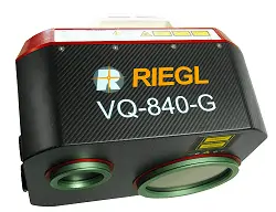
A measurement rate of up to 200 kHz and high scanning speed of up to 100 scans/sec provides superior spatial resolution, and the system offers concurrent full waveform storage of all measurements for subsequent analysis. The VQ-840-G is ideal for a wide range of applications, including coastline and shallow water mapping, surveying for hydraulic engineering, and hydro-archaeological surveys.

With a 46-degree field of view, the sensor utilizes a circular scan pattern that produces excellent point density and point distribution. RIEGL’s state-of-the-art Waveform-LiDAR technology allows echo digitization and online waveform processing, with multi-target resolution for penetrating even dense foliage.
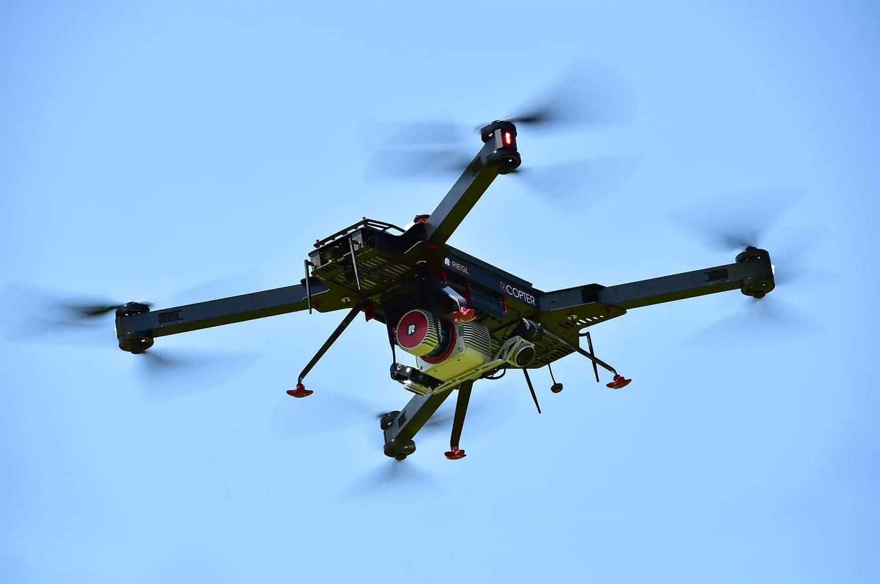
The complete system is designed for acquisition of high-accuracy, high-resolution laser scan and image data for a wide variety of survey-grade professional applications, such as precision agriculture and forestry, aerial pipeline inspection and urban environment surveying.

Critical safety features include the RiCopterControl redundant flight control system, and an ADS-B/Mode-S transponder that allows the UAV to be used in conjunction with air traffic management and in close proximity to manned aircraft. The command and control link is available in 433, 868 or 915 MHz, and the system can deliver 5.8 GHz video downstream.
To find out more about RIEGL and their drone-based LiDAR mapping and surveying solutions, please visit their profile page:
https://www.unmannedsystemstechnology.com/company/riegl/


