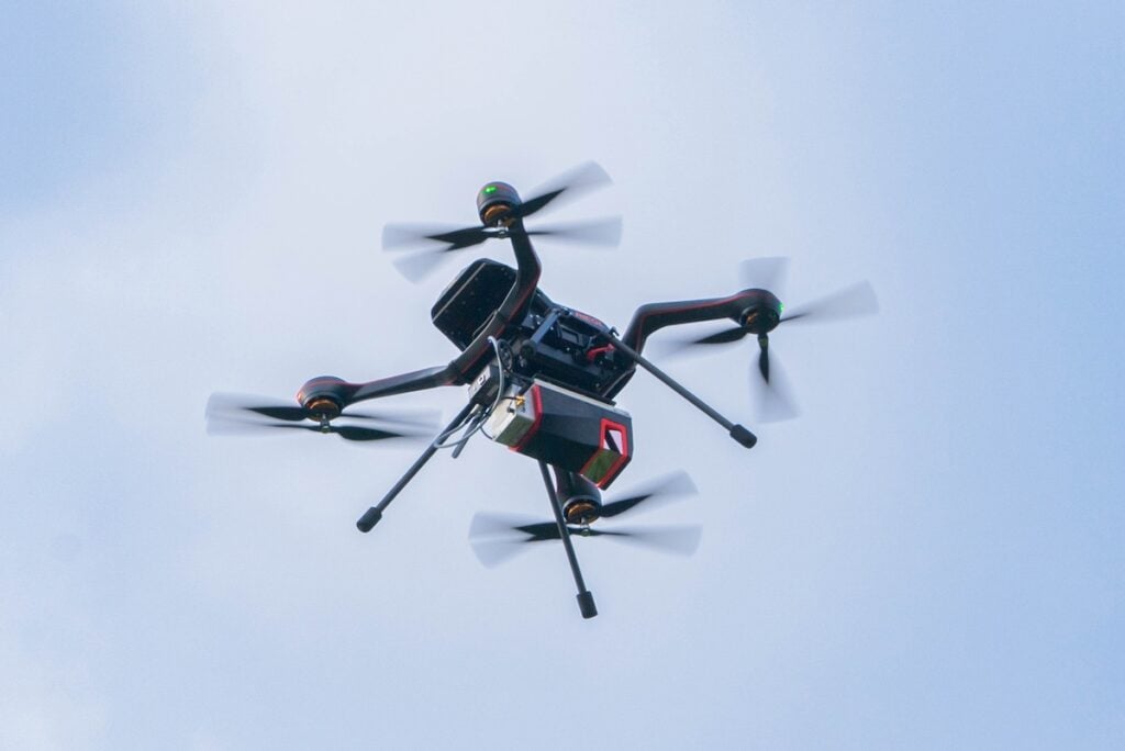
Plymouth Marine Laboratory has selected RIEGL’s VQ 840 GL Topo Bathymetric LiDAR sensor to support its pioneering research into aquatic environments, enhancing its capacity to collect high resolution data for marine and freshwater studies.
Designed for deployment on remotely piloted aerial platforms, the sensor will be integrated into a comprehensive environmental monitoring project funded by the UK Research and Innovation Natural Environment Research Council under the Net Zero Aerial Capability program. This development represents a major step forward in airborne LiDAR-based surveying for shallow water bathymetry and nearshore terrain mapping, enabling data acquisition in complex and sensitive environments while minimizing environmental impact.
With the integration of RIEGL’s advanced LiDAR technology, PML aims to refine its data collection methodologies and set new standards for environmental data acquisition in challenging coastal and inland water conditions.
Aser Mata Torollo, Earth Observation Scientist with PML, said, “It has been a pleasure to work with RIEGL so far. We are very excited for the unique capabilities this new sensor will bring and the groundbreaking environmental research that will make possible to improve our understanding of blue carbon habitats by collecting very high-resolution bathymetry in shallow waters that would not have been possible otherwise. We hope that during the three years of this project we can keep this partnership with RIEGL to assess the sensor in different marine environments and develop new applications based in the derived RIEGL data products.”
Jonathan Robinson, Manager of Technical Sales for RIEGL UK, added, “We are excited to bring our advanced laser scanning technology to PML, a leader in marine research. RIEGL UK and RIEGL Laser Measurement Systems experts look forward to supporting PML in adopting our innovative technology.”
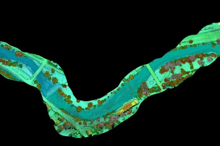
The RIEGL VQ 840 GL delivers precise bathymetric measurements using green wavelength laser technology capable of penetrating water surfaces to detect seabed and subaqueous features in shallow, clear-water environments. The sensor offers full waveform recording, customizable scanning parameters, and a wide field of view, providing researchers with the flexibility to tailor system settings to suit specific survey objectives and environmental conditions. These features will support PML’s benchmarking efforts, allowing the team to harmonize operational parameters with project requirements and environmental variables to improve accuracy and consistency.
A key component of the project is the development of a national best practice framework for airborne bathymetric surveying. PML will conduct comparative tests of the RIEGL system alongside other bathymetric and terrestrial sensors across a variety of real-world scenarios. Findings will be published and shared openly, supporting widespread adoption and technical standardization across the UK scientific community.
The project, titled “A remotely piloted aerial Green LiDAR for mapping bathymetry of shallow waters and elevation of boundary land,” involves close collaboration with leading UK institutions including the British Geological Survey, National Oceanography Centre, Scottish Association for Marine Science, and the UK Centre for Ecology and Hydrology.
The ultimate aim is to make this technology and its associated data openly available to researchers nationwide, enabling broader use of UAV-based bathymetric LiDAR in support of sustainable environmental management and climate resilience.