Microdrones VTOL UAV Solutions Used for Forensic Mapping

By Mike Ball / 04 Jul 2019

Mapping Drones

Discover cutting-edge solutions from 22 leading global suppliers
SUPPLIER SPOTLIGHT
Follow UST

Microdrones forensic mapping UAV

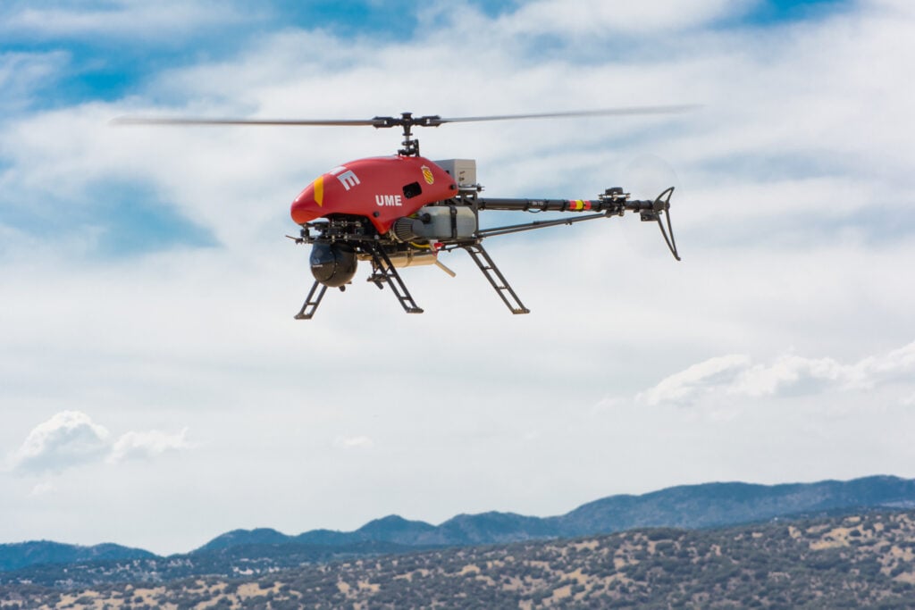
Microdrones, a developer of professional unmanned aerial vehicle (UAV) solutions, has announced that it is partnering with CSI Mapping, a provider of forensic mapping solutions for accident reconstruction, crash scene training and equipment.

Steve McKinzie, President and CEO of CSI Mapping, conducted a thorough worldwide search to find the optimal integrated aerial solution to assist in collision scene reconstruction and investigation using unmanned aircraft systems. He concluded that Microdrones commercial grade products should be the standard.

McKinzie said, “Our focus was locating the finest product made with the best workmanship and the most reliability. No other product set the bar as high as Microdrones. Our biggest concern is a failure in flight, which is alleviated by partnering with Microdrones. Their integrated solutions have gained the trust of more than 1000 businesses worldwide. They have taken the guesswork out of the process, so you are ensured a perfectly integrated aerial solution that performs flawlessly from start to finish. We don’t buy our police officers kit cars to patrol in and they deserve a product like Microdrones to perform their jobs in a reliable, safe manner.”

CSI Mapping’s area of specialty is critical incident management on highways, which are highly dynamic and dangerous environments. Operations are designed not to further complicate the scene but to assist in the quick accurate documentation of roadway geometry and evidence. Microdrones mdMapper, mdLidar and mdTector solutions can help reduce time spent at collision sites, allowing for rapid restoration of traffic flow and the safety of investigative members.

“The mdMapper units will by far be the core of our application,” notes McKinzie. “The mdLidar unit will be the product that leads the industry in safely collecting data points. As you know highways carry large volumes of chemicals. The mdTector, we hope, will be the first of many chemical detectors that can save the lives of first responders. Equipment can be replaced while the preservation of life and limb is paramount. I am confident that CSI Mapping and Microdrones partnership will continue to provide the best service and product to our public servants.”

Posted by Mike Ball Mike Ball is our resident technical editor here at Unmanned Systems Technology. Combining his passion for teaching, advanced engineering and all things unmanned, Mike keeps a watchful eye over everything related to the unmanned technical sector. With over 10 years’ experience in the unmanned field and a degree in engineering, Mike’s been heading up our technical team here for the last 8 years. Connect & Contact

Latest Articles

FAA Approves Canadian UAVs’ Sparrowhawk™ Radar for BVLOS Drone Operations

Canadian UAVs have detailed recent FAA approval of its Sparrowhawk™ Radar system, enabling advanced drone operations for police first responders in U.S. urban airspace

May 22, 2025
OceanAlpha to Demonstrate High-Endurance Autonomous USV in Dubai

OceanAlpha will demonstrate its L25 USV in Dubai, showcasing autonomous survey technology designed for offshore applications, long-endurance missions, and real-time data acquisition

May 22, 2025
Sagetech Partners to Expand BVLOS UAS Capabilities

Sagetech Avionics and MatrixSpace are advancing BVLOS capabilities for uncrewed systems with integrated detect and avoid technologies for safe, scalable UAS operations

May 22, 2025
New Gimbaled Imaging System Released for Attritable Platforms

The new HD25-LV-C by Trillium Engineering is a low-cost, gimbaled imaging system weighing less than 400g and designed to provide advanced imaging and processing capabilities for expendable sUAS

May 21, 2025
Hybrid Navigation Solution for Enhanced Resilience Against GPS Jamming & Spoofing

The new navigation solution successfully demonstrated by Advanced Navigation utilizes a software-fused inertial-centred architecture and a new laser velocity sensor

May 21, 2025
Ascent AeroSystems & Gremsy Partner on UAS Sensor Integration

Ascent AeroSystems and Gremsy agree to sign an MoU at XPONENTIAL 2025 to explore advanced sensor integration and UAS development opportunities

May 21, 2025

Featured Content

Final Call to Apply for GENIUS NY Program

The application window for GENIUS NY, the premier uncrewed systems accelerator, closes May 28th. Learn about this incredible opportunity and explore how GENIUS NY champions innovation as the official XPO+ Launcher sponsor, at XPO Booth 3613

May 20, 2025
WarrenUAS Secures FAA 44807 Exemption, Expanding Large UAS Training Capabilities

WarrenUAS has received FAA 44807 approval to train students on unmanned aerial systems weighing over 55 pounds in the NAS, placing it among only five U.S. organizations with this clearance, and expanding its national training leadership

May 15, 2025
Product Spotlight: Durable Lightweight Lithium-Ion Batteries for UAVs

American Lithium Energy (ALE)'s energy-dense lithium-ion battery cells combine high power output with built-in safety features, ideal for UAV and eVTOL applications in challenging environments

May 14, 2025
Advancing Unmanned Systems Through Strategic Collaboration UST works with major OEMs to foster collaboration and increase engagement with SMEs, to accelerate innovation and drive unmanned systems capabilities forward.