


How can LIDAR contribute to archeological prospecting and exceptional heritage management?
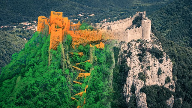
In 2021, L’Avion Jaune, a french aerial survey company was mandated by Association Mission Patrimoine Mondial to map 7 fortified castles. This organization was created to set up and drive the application strategy for the city of Carcassonne (South of France) and its sentinel mountain castles to successfully obtain UNESCO World Heritage certification. These castles are spread out over 60 kilometers of mountainous terrain and are not easily accessible. To address this issue, a LIDAR Explorer was integrated on a helicopter and therefore, allowed them to map the castles.
Register now to discover how YellowScan Explorer is operated to provide 3D data useful for detecting reliefs and ruins under canopy suggesting undiscovered human activity and manage these historic sites.
This webinar session will last approximately 20 minutes followed by 10 minutes of Q&A.
This webinar will be in French with English subtitles.
Key take-aways:
- Fast and accurate survey of distant sites
- Airborn LIDAR workflow, from capture to final outputs
- Digital Terrain Models and mapping tools for archeologists


