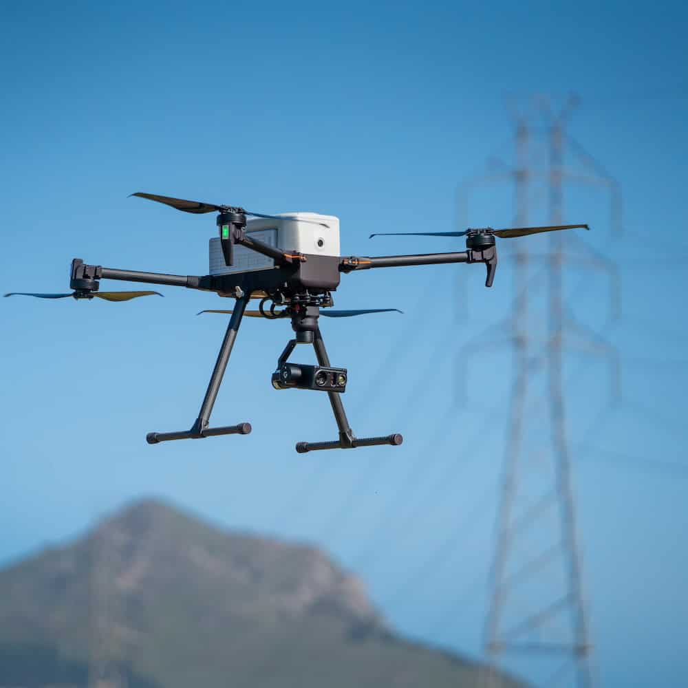



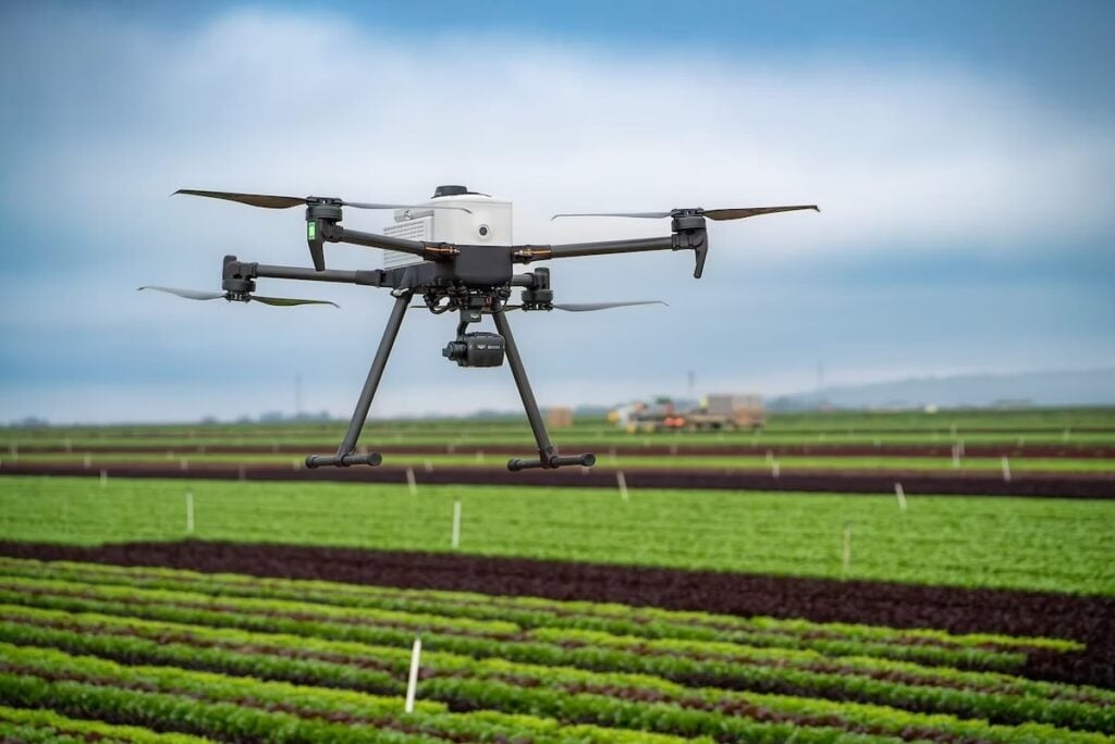
Agricultural drone surveys become more useful when flights can be repeated under consistent conditions throughout a growing season. For programs using the IF800 Tomcat and IF1200 from Inspired Flight Technologies, mission repeatability, sensor compatibility, and positioning accuracy are central considerations in applications ranging from crop health monitoring and field trials to plant phenotyping and breeding research.
A single aerial survey can provide a detailed view of field conditions at a particular moment. Repeating that survey at consistent intervals, using the same altitude, airspeed, and flight lines, creates a record of crop development from planting through harvest.
This approach reduces variation introduced by the aircraft and its operation, making it easier to distinguish changes in vegetation from differences in how the data was collected.
Establishing a reliable agricultural unmanned aircraft system (UAS) program therefore involves more than selecting an aircraft with suitable endurance or payload capacity. The sensors, positioning system, mission planning capabilities, processing software, and operational procedures must all support consistent data acquisition.
Agricultural Drone Applications and Data Collection Requirements
Agricultural UAS generally fall into two distinct categories: aircraft that apply agricultural inputs and platforms used for remote sensing and data collection.
Spray and spread drones are evaluated primarily on characteristics such as tank capacity, application swath width, and flow rate. Data collection aircraft are assessed according to endurance, sensor payload capacity, positioning accuracy, and the consistency of their flight operations.
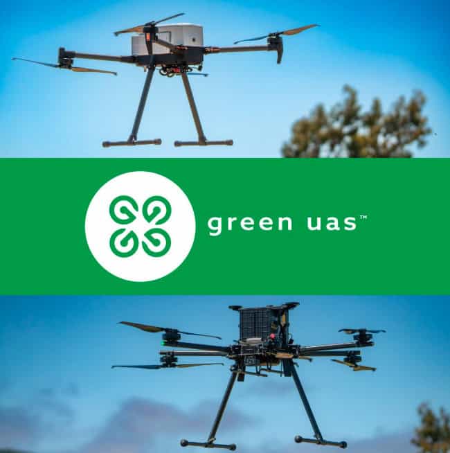
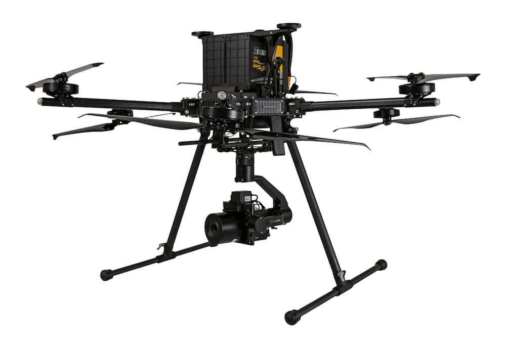
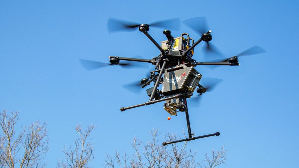
The Inspired Flight IF800 Tomcat and IF1200 belong to the second category. Neither is configured for spraying or spreading, and agricultural operations requiring both application and mapping capabilities generally use separate fleets.
Agricultural data collection platforms support a range of monitoring, mapping, and research activities, including:
- Stand counts and crop emergence assessment
- Crop health monitoring and stress detection
- Plot-level research and replicated field trials
- Nitrogen and nutrient status evaluation
- Irrigation assessment and water stress monitoring
- Plant phenotyping and breeding trials
- Weed and pest pressure mapping
- Yield estimation and harvest planning
- Field boundary mapping and drainage analysis
In these applications, sensors collect georeferenced imagery and measurements that can be processed into vegetation indices, maps, and models.
The resulting datasets can support crop scouting, comparative trial analysis, and agricultural management decisions. The value of those outputs depends partly on the quality and consistency of the underlying measurements.
Why Repeatable Flight Operations Matter in Crop Monitoring
Longitudinal crop monitoring requires data collected under comparable conditions. Changes in flight altitude, speed, or survey coverage can introduce variation that complicates comparisons between observation dates.
Altitude differences affect ground sample distance, while changes in airspeed can influence motion blur. Variations in flight lines may also result in different plants being captured during successive surveys.
These inconsistencies can make it more difficult to determine whether differences in processed imagery reflect changes in the crop or changes in data acquisition.
Two operational capabilities are particularly relevant to maintaining repeatability: stored flight missions and consistent positioning.
Stored Mission Planning
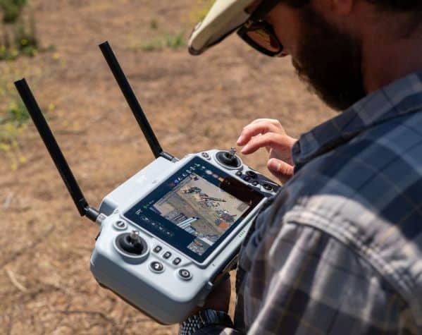
Inspired Flight aircraft support onboard mission planning, allowing established survey routes to be reused across successive flights.
Once a mission has been configured, operators can repeat the same flight without rebuilding the route for each survey. This also allows different operators to perform the same mission using an established flight plan.
For more complex operations, QGroundControl supports desktop-based mission planning.
Stored missions are particularly useful for agricultural programs collecting data at regular intervals, including weekly surveys or monitoring conducted every two weeks throughout the growing season.
RTK and PPK Positioning
Positioning consistency is another important consideration, particularly when datasets from different dates must be spatially aligned.
Networked Transport of RTCM via Internet Protocol (NTRIP) Real-Time Kinematic (RTK) corrections help maintain consistent aircraft positioning and flight paths between missions.
NTRIP RTK is included as standard on Inspired Flight aircraft and is suitable for most field-scale agricultural monitoring requirements.
Research programs involving small plots or precisely defined treatment boundaries may require greater positioning accuracy.
For these applications, compatible Sentera RTK and Post-Processed Kinematic (PPK) workflows support centimeter-level positioning of collected imagery.
The distinction is important because positional requirements vary substantially between general crop scouting and replicated research trials. Field-scale monitoring may not require the same level of geospatial precision as an experiment in which adjacent plots receive different treatments.
Positioning methods should therefore be selected according to the research or management objective rather than assuming that every agricultural mission requires survey-grade accuracy.
Sensor Selection for Agricultural Remote Sensing
Agricultural UAS payload selection depends on the measurements needed and the stage of crop development being monitored.
Different sensors provide information about plant appearance, physiological condition, surface temperature, terrain, and canopy structure.
Many crop monitoring programs consequently use different sensors over the course of a growing season rather than relying on a single payload for every mission.
RGB Imaging for Crop Emergence and Field Mapping
High-resolution RGB cameras capture visible-spectrum imagery suitable for general field documentation, plant population assessment, and mapping.
Common applications include stand counts, emergence assessment, photogrammetry, and orthomosaic generation.
RGB imaging is often a practical choice for early growth-stage surveys where the primary objective is to establish crop population, distribution, or visible field conditions.
Multispectral Imaging for Vegetation Assessment
Multispectral sensors collect reflectance measurements across selected wavelength bands, supporting vegetation analysis beyond conventional RGB photography.
These measurements can be processed into indices such as the Normalized Difference Vegetation Index (NDVI) and Chlorophyll Index Green (CIG).
NDVI is calculated using reflectance in the red and near-infrared bands and is commonly used to assess variation in vegetation vigor.
Multispectral indices can help identify differences associated with chlorophyll activity, nutrient status, and plant stress that may not be apparent in visible imagery.
However, an index primarily identifies where vegetation characteristics differ. It does not independently establish the cause of that variation, making ground verification an important part of interpretation.
Thermal Imaging for Irrigation and Water Stress
Thermal sensors measure relative surface temperature and can support the evaluation of irrigation conditions and plant water stress.
Thermal observations must be interpreted alongside environmental variables, including weather, time of day, and surface conditions.
These factors can influence temperature measurements and should be considered when comparing data acquired during separate missions.
LiDAR for Terrain and Canopy Structure
Light Detection and Ranging (LiDAR) sensors generate three-dimensional point clouds that can be used to characterize terrain and vegetation structure.
Agricultural applications include terrain modeling, drainage analysis, and assessment of crop canopy architecture.
LiDAR provides structural information that complements the physiological measurements obtained from spectral imaging.
This distinction is relevant to research programs examining relationships between plant structure, development, and functional characteristics.
Hyperspectral Imaging for Plant Physiology Research
Hyperspectral sensors collect measurements across numerous narrow bands of the electromagnetic spectrum.
The additional spectral detail allows researchers to investigate changes in plant physiology that may occur before visible symptoms develop.
Measurements can be used to examine variations associated with photosynthetic activity, water use, and growth patterns.
One example involves the University of Sydney node of the Australian Plant Phenomics Network (APPN), which operates coaligned hyperspectral payloads, including the GRYFN GOBI and CALVIS, on Inspired Flight IF1200 aircraft.
The arrangement supports research into plant physiological characteristics using aerial hyperspectral observations.
Hyperspectral and LiDAR data can also provide complementary information, with spectral measurements describing plant chemistry and function and LiDAR observations characterizing canopy structure and architecture.
Integrating Agricultural Sensors Across Different Missions
Sensor compatibility can affect the flexibility of an agricultural research program, particularly when measurement requirements change between growing seasons.
Some UAS platforms support payloads from only one manufacturer, while others require custom mounting or integration work to accommodate additional sensors.
Inspired Flight aircraft support direct integration with payloads from Sentera, MicaSense, YellowScan, and GeoCue, alongside hyperspectral options such as Resonon.
This range of integrations allows programs to select payloads according to their monitoring or research requirements.
Aircraft payload capacity remains an important constraint, however. The number, type, and combined weight of sensors determine whether a mission can be completed using a single-payload platform or requires an aircraft configured for multiple instruments.
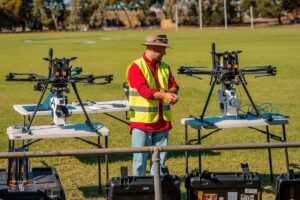
Field Example: Identifying Early Crop Stress with Multispectral Data
Early-stage crop stress can be localized and unevenly distributed, making it difficult to identify through ground-based observation alone.
A field survey conducted at Babe Farms in California demonstrated the use of multispectral imagery to distinguish different crop conditions during early development.
An Inspired Flight IF800 equipped with a Sentera 6X sensor collected CIG and NDVI data while operating at 10 m/s.
The resulting imagery differentiated healthy vegetation from areas showing nitrogen stress and patchy stands while those conditions remained localized.
Although the survey provided information from an individual flight, repeating the same mission on a fixed schedule would allow observations to be compared over time.
This is particularly relevant to crop management programs seeking to monitor how a localized condition develops or changes between field visits.
Comparing the IF800 Tomcat and IF1200 for Agricultural Programs
Aircraft selection depends on the payload requirements, flight duration, and type of data collection planned.
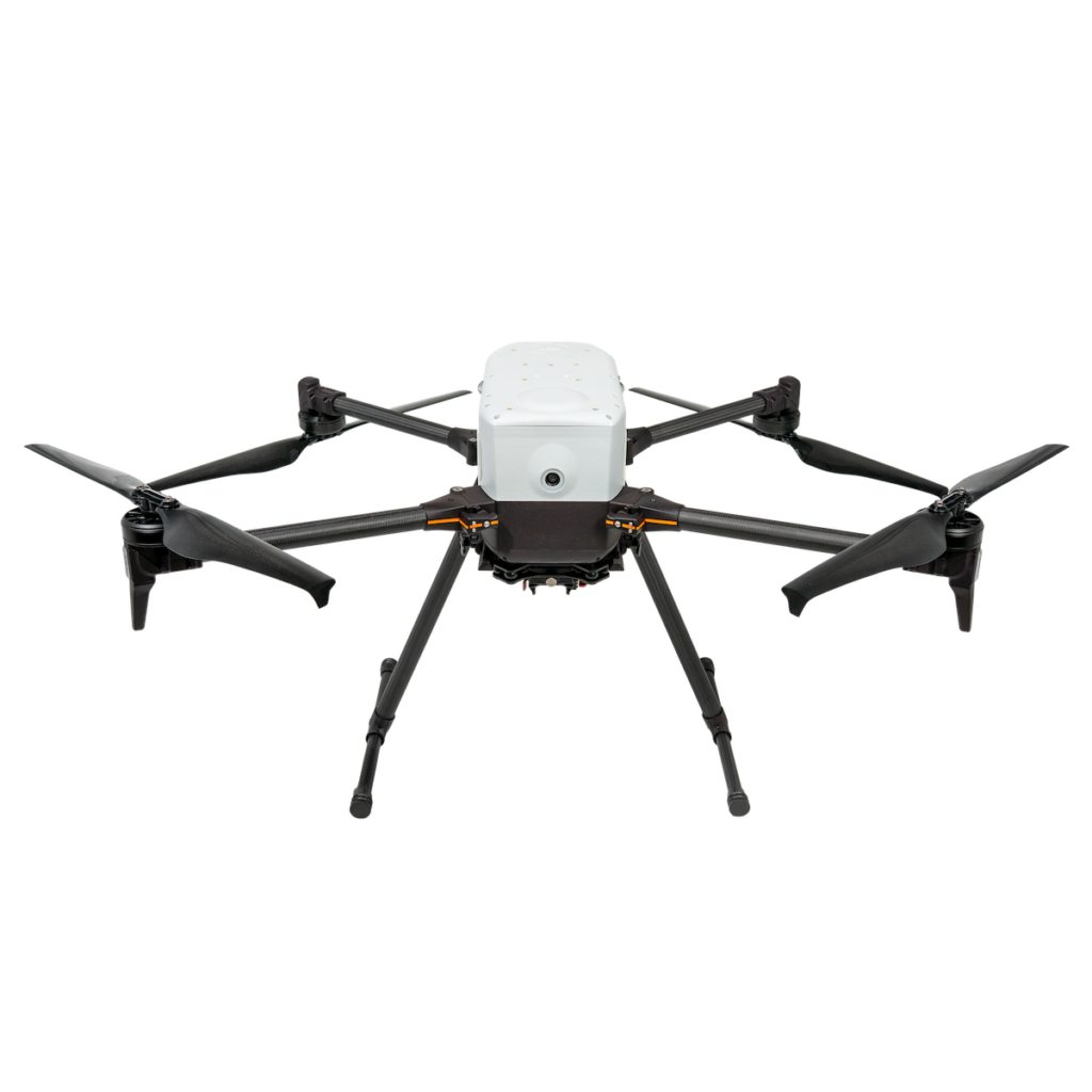
The IF800 Tomcat supports routine agricultural scouting and plot-level monitoring with a single sensor, while the IF1200 accommodates heavier payloads and configurable multi-sensor missions.
IF800 Tomcat for Routine Agricultural Monitoring
The IF800 Tomcat carries one multispectral or optical sensor per flight and supports applications such as crop emergence surveys, stand counts, crop health monitoring, and plot-level research.
Its maximum endurance is 54 minutes, with more than 35 minutes of flight time carrying a 3.3 lb payload. Maximum payload capacity is 6.6 lb.
Portability is an operational consideration for programs conducting frequent surveys across multiple fields or research sites.
An aircraft that can be transported and prepared for repeated missions supports regular data acquisition throughout the growing season.
For single-sensor agricultural workflows, the IF800 provides a platform for combining scheduled flights with established survey routes and compatible imaging payloads.
IF1200 for Multi-Sensor Research and Phenotyping
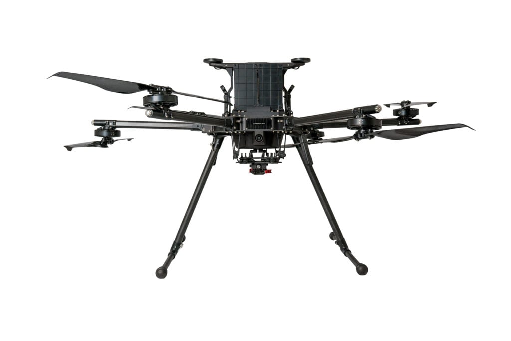
The IF1200 supports heavier hyperspectral payloads and configurations involving multiple sensors, including dual-payload arrangements.
Its maximum endurance is 43 minutes, with more than 35 minutes of flight time carrying an 11 lb payload. Maximum payload capacity is 19 lb.
These capabilities are relevant to research programs collecting several types of measurements during the same flight.
Applications include multi-modal plant phenotyping and breeding trials that require combinations of spectral and structural data.
The IF1200 is also modular and field-serviceable, characteristics that may be useful where sensor configurations or research objectives change between seasons.
Both the IF800 and IF1200 use a shared payload standard and operating workflow, allowing compatible sensors and trained operators to move between the two aircraft.
This provides a common operational basis for programs that use the IF800 for routine scouting and the IF1200 for more demanding research missions.
Data Processing and Agricultural Software Compatibility
Selecting an agricultural UAS also involves evaluating how collected data will be processed and incorporated into existing workflows.
A platform may meet flight endurance and sensor requirements but still create operational difficulties if its data cannot be used with the organization’s established analysis tools.
Data collected using Inspired Flight aircraft can be processed through software including:
- Pix4Dfields
- Sentera FieldAgent
- Solvi
- Agisoft Metashape
These tools support agricultural imagery processing and analysis workflows.
Collected data can also be incorporated into proprietary processing pipelines, an approach used by some research institutions and larger agricultural operations with existing analytical systems.
For programs carrying out repeated surveys, consistency in processing methods is another consideration when comparing datasets collected at different times.
Operator Training and Long-Term Mission Consistency
Agricultural UAS programs also depend on operators being able to execute repeatable missions throughout the season.
Personnel with previous experience flying consumer or prosumer aircraft for crop scouting will encounter familiar elements in the Inspired Flight operating workflow.
Stored mission plans allow established survey patterns to be reused without reconstructing flight routes for each operation.
This is useful when multiple pilots conduct surveys or when the same mission is repeated across successive growing seasons.
Using established mission configurations can reduce the operational variation associated with manually rebuilding survey routes.
Inspired Flight provides support through its U.S.-based Customer Success Team.
Each aircraft is supplied with a one-year factory warranty, with additional coverage available through Inspired Care.
NDAA Compliance and Federally Funded Agricultural Research
Procurement requirements can be a significant factor when agricultural UAS programs involve government contracts or federal funding.
Programs operating under USDA contracts, land-grant university research agreements, or federally funded agricultural initiatives may be subject to restrictions concerning eligible aircraft hardware.
Inspired Flight aircraft are American-made, National Defense Authorization Act (NDAA) compliant, and Blue UAS-listed.
These characteristics may be relevant when evaluating aircraft for procurement under applicable funding or contracting requirements.
Compliance obligations generally relate to the funding source and contractual conditions rather than whether an aircraft is operated on privately owned farmland.
Consequently, private agricultural operations are not necessarily subject to the same requirements as federally funded research projects.
Organizations should review the specific compliance provisions associated with their contracts or grant agreements before purchasing equipment.
Establishing eligibility early is particularly important because an aircraft that fails to meet the applicable procurement requirements cannot be made eligible simply through its subsequent delivery or deployment.
Funding Agricultural UAS Programs Through Research and Conservation Grants
Agricultural drone programs may qualify for funding through conservation, research, and demonstration grants when the proposed equipment supports an eligible project objective.
Potential sources include USDA Natural Resources Conservation Service (NRCS) Conservation Innovation Grants, Sustainable Agriculture Research and Education (SARE) grants, state Specialty Crop Block Grants, and opportunities listed through Grants.gov.
Eligibility varies according to the applicant, project purpose, funding agency, and allowable costs.
A proposal involving aerial data collection as part of a defined conservation or research project may be evaluated differently from an application seeking to purchase an aircraft for general farming operations.
NRCS Conservation Innovation Grants
The NRCS Conservation Innovation Grants (CIG) program supports the development and adoption of technologies, tools, and approaches for natural resource conservation on private lands.
Potential applicants include producers, conservation districts, nonprofit organizations, universities, private businesses, and individuals. All non-federal entities may apply, while federal agencies are excluded.
CIG has previously funded projects involving agricultural drone data.
One NRCS-supported project provided 50 percent of eligible expenses, up to $50,000, to refine and demonstrate multispectral drone imagery for restoration planning and monitoring.
Another, larger award supported drone-collected LiDAR and multispectral imaging for precision irrigation and nutrient management across more than 12,000 acres.
The program includes three funding tracks:
- CIG Classic
- CIG On-Farm Conservation Innovation Trials
- State-level CIG competitions administered by NRCS state offices
State competitions are announced separately and often have smaller award ceilings.
Applicants can contact a local NRCS office or state conservationist to identify the relevant funding track and upcoming ranking periods.
Sustainable Agriculture Research and Education Grants
The Sustainable Agriculture Research and Education (SARE) program funds producer-driven and researcher-led agricultural projects.
It operates through four regional programs covering the North Central, Northeast, South, and West.
Eligible applicants vary by grant type and may include producers, agricultural professionals, graduate students, and researchers.
Available opportunities include Farmer/Rancher grants, Partnership grants, Graduate Student grants, and larger Research and Education grants.
Award limits and application requirements differ across regions.
Equipment eligibility requires particular attention. SARE funding may cover project-specific equipment, but expenditure intended to establish or expand regular farming operations is not allowed.
An aircraft used as a research instrument within a defined study may therefore be considered differently from one purchased as general production equipment.
Applicants should review their regional call for proposals and consult their state SARE coordinator before developing an equipment budget.
Specialty Crop Block Grant Program
The USDA Agricultural Marketing Service’s Specialty Crop Block Grant Program (SCBGP) funds projects intended to enhance the competitiveness of specialty crops.
These include fruits, vegetables, tree nuts, dried fruits, horticultural crops, and nursery crops.
Research and development activities relevant to these sectors are among the program’s stated purposes, creating potential opportunities for projects involving aerial data collection.
Eligible subrecipients typically include state and local government organizations, universities, colleges, nonprofits, producer associations, and community-based organizations.
Only state departments of agriculture apply directly to USDA. Producers and other organizations submit applications through their respective states.
State application windows may differ from the federal funding schedule.
Beginning in fiscal year 2027, SCBGP subawards will require a 25 percent cost share from non-federal sources.
Applicants should obtain the relevant request for proposals and application schedule from their state department of agriculture.
Searching Federal Funding Opportunities
Grants.gov provides a centralized search platform for federal funding opportunities.
Search terms relevant to agricultural UAS projects include unmanned aircraft, UAS, drone, precision agriculture, remote sensing, multispectral, phenotyping, irrigation, conservation, and specialty crops.
Because opportunities and funding conditions change, applicants should review the full notice of funding opportunity to confirm eligibility, equipment cost provisions, and project requirements.
A local NRCS office, extension advisor, or institutional grants office may also assist with identifying appropriate programs.
Equipment Documentation for Grant Applications
Aircraft manufacturers cannot determine an applicant’s eligibility or prepare grant applications on behalf of funding agencies.
However, equipment suppliers can provide technical and procurement documentation used in proposal development.
For agricultural programs considering Inspired Flight aircraft, available materials include:
– Itemized equipment quotes and bills of materials, identifying required and optional items separately
– Aircraft and sensor payload specifications
– U.S. manufacturing, NDAA compliance, and Blue UAS documentation
– Recommended configurations for particular crops, missions, or research objectives
– Training and technical support scope
Because agricultural funding cycles are linked to seasonal field activities and application periods, equipment requirements are best established before a grant submission deadline.
This allows applicants to align aircraft configuration, sensor selection, procurement eligibility, and budget justification with the proposed project.
Planning an Agricultural UAS Program Around the Growing Season
The appropriate survey interval depends on crop type, development stage, and the management or research question being investigated.
Programs monitoring changes in plant stress may benefit from a fixed flight schedule, while other projects may require data acquisition at particular growth stages.
Maintaining consistent flight parameters is especially important when comparing observations collected weeks or months apart.
Aircraft and sensor choices should follow the intended measurement requirements.
An operation focused on emergence counts and routine scouting may need a single optical or multispectral sensor. A breeding or phenotyping project may require multiple measurements collected during the same pass, making a multi-sensor aircraft configuration more appropriate.
Similarly, field-scale mapping and plot-level research do not necessarily require identical positioning workflows.
NTRIP RTK may be sufficient for routine monitoring, while research involving precise treatment boundaries may justify compatible survey-grade RTK/PPK methods.
The aircraft must also meet the flight duration and payload requirements of the intended survey, support established processing software, and satisfy any procurement conditions associated with the project’s funding.
For programs operating over multiple seasons, stored mission plans and consistent operator procedures help maintain comparable datasets as personnel, sensors, or research priorities change.
The IF800 Tomcat and IF1200 support different portions of this workflow, from single-sensor scouting and plot trials to heavier hyperspectral payloads and multi-sensor plant research.
Ultimately, the effectiveness of agricultural UAS data collection depends not only on the capability of an individual aircraft or sensor, but also on the ability to reproduce the required measurements throughout the monitoring period.
Read Drones in Agriculture: Building a UAS Program for Crop Monitoring, Field Trials and Research on the Inspired Flight Technologies website.