T-MOTOR details key considerations for propulsion system reliability and performance in payload carrying UAVs, focusing on testing in real operating conditions, payload requirements, and its A, Navigator, and S series propulsion systems
Intelligent Energy has developed the IE-SOAR range of lightweight hydrogen fuel cell modules, doubling the energy-to-mass ratio of batteries to enable longer flight times and more efficient drone operations
Advanced Navigation has developed resilient, ITAR-free inertial navigation systems designed to maintain absolute positioning confidence for naval vessels operating within highly contested environments where GPS signals are frequently jammed or corrupted
Beechat has highlighted the advantages of the Reticulum protocol for building decentralized, resilient networks that maintain secure communications in environments where traditional infrastructure is unstable, damaged, or entirely unavailable
Sightline Intelligence explains how machine learning performance in defense applications is shaped by training data, performance metrics, and system architecture, with a focus on reliable edge deployment beyond model-level capability
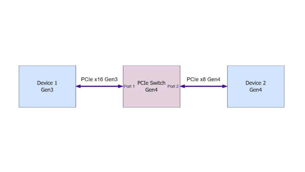
WOLF Advanced Technology has released a technical whitepaper detailing how PCIe switches enable lane-rate conversion, supporting data transfer between ports with different PCIe generations and lane configurations
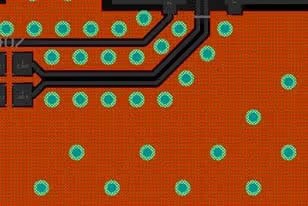
San Francisco Circuits outlines key PCB design strategies for managing copper traces, thermal performance, and electrical safety in high-current and high-voltage applications to ensure reliable system operation
AIR6 SYSTEMS used Gotonomi’s satcom solution during BVLOS power line inspection trials, validating reliable C2, LTE-satellite failover, and low-bandwidth video performance
Embention introduces advanced autopilot systems for one-way drones, delivering GNSS-denied navigation, embedded vision, and precision targeting for loitering munitions and counter-UAS missions
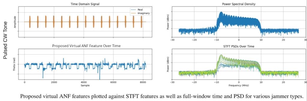
EDGE Microwave examines the use of lightweight learned algorithms for pre-correlation GNSS RFI classification, focusing on real-time performance and efficient operation on embedded platforms
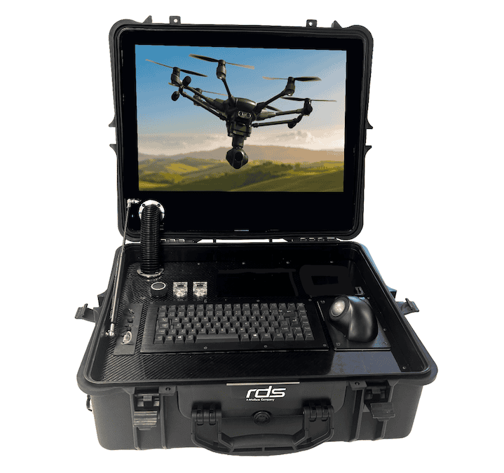
Review Display Systems (RDS) details the development of a portable Ground Control Station for Uncrewed Surface Vehicles, integrating proprietary safety systems within a rugged all-in-one platform for reliable operation in marine and defense environments
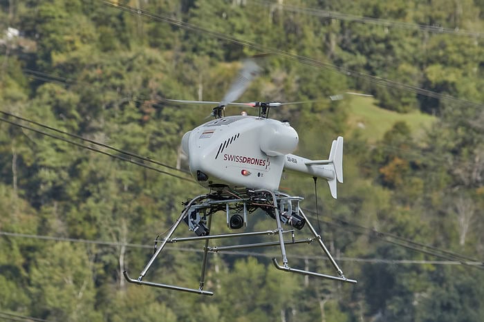
SwissDrones has engineered high-endurance autonomous systems to replace crewed helicopters, significantly reducing carbon emissions and operational costs while enhancing safety and data precision for critical infrastructure inspections and long-range public safety missions
Hollyway is transforming industrial drone operations by replacing traditional charging cycles with a robotic battery swapping system that redeploys aircraft in under 50 seconds to ensure uninterrupted mission continuity and efficiency
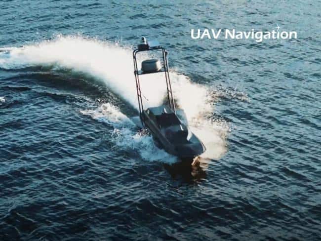
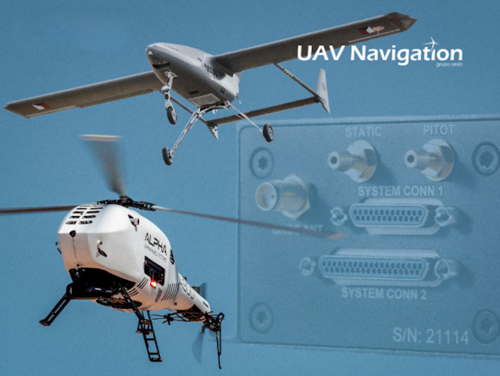
UAV Navigation-Grupo Oesía outlines how its Guidance, Navigation, and Control systems enable UAS to deliver persistent and safe Intelligence, Surveillance, and Reconnaissance operations, supporting autonomous flight and continuous monitoring in complex environments
Knight Optical examines how beam expander design, optical components, and material selection influence laser performance, supporting reliable operation across defence applications including rangefinding, LiDAR, and remote sensing systems
HOBBYWING highlights how its latest H15MD Plus coaxial propulsion system supports reliable heavy-lift unmanned aerial vehicle timber operations in –25.8°C conditions, demonstrating efficiency and consistent motor temperature performance
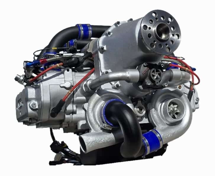
Flygas explores the GAS418HA (180hp), a supercharged four-stroke gasoline engine designed for high-altitude and medium-altitude long-endurance (MALE) UAV applications, highlighting its performance and suitability for demanding drone operations
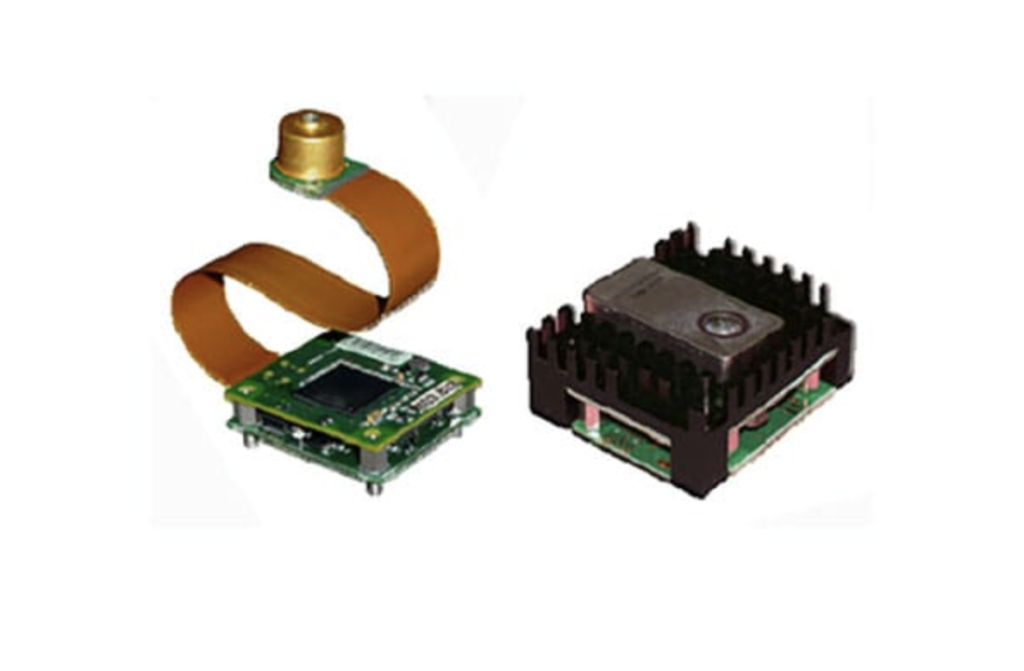
Analog Modules delivers high-sensitivity rangefinder receiver/processor modules providing calibrated, compact laser ranging with advanced signal correction, multi-target handling, and flexible system integration options
Pelican Products details how it developed a single integrated case for Sechan Electronics’ ground control station, improving portability, reducing size requirements, and ensuring protection in harsh military environments
Maris-Tech examines how AI-driven fusion of EO, IR, and radar data enhances real-time situational awareness and target identification in ISR operations
Advancing Unmanned Systems Through Strategic Collaboration
UST works with major OEMs to foster collaboration and increase engagement with SMEs, to accelerate innovation and drive unmanned systems capabilities forward.