


Geospatial Analysis Software
Discover cutting-edge solutions from 4 leading global suppliers
SUPPLIER SPOTLIGHT
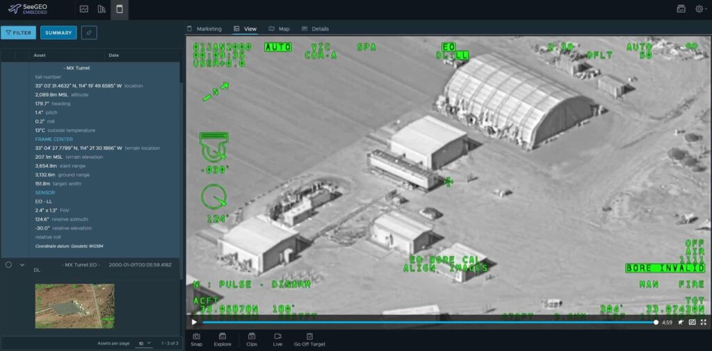
SeeGEO™ software by Textron Systems is purpose built to solve problems across the spatial-temporal spectrum. Providing unmatched industry experience, the web-based platform includes best in class tools for visualizing and interacting with geospatial imagery and video, and enables users to rapidly search, discover, exploit, analyze and collaborate in real-time.
SeeGEO is…
- An image-focused platform that enables analysts to perform their tasks within a web browser
- An algorithm-focused platform that can incorporate Computer Vision (CV) and other AI tech to bring cutting edge capability to imagery and video analysts, allowing them to sift through data and provide actionable insights
- A video-focused platform that leverages full-motion video (FMV) metadata to track events and data in real time or post mission to enable decision makers to make faster, more accurate judgements
- A structured observation management (SOM) capture platform that creates an internal database for establishing pattern of life for multiple use cases
In the article 25 Ways to Stream, Archive, Collaborate, Exploit with SeeGEO™ Software, Textron Systems expands on the uses of SeeGEO software across the following industries:
- Military and National Intelligence
- Maritime
- City government, county government, local government
- Oil, electric, gas industry
- Local police and fire departments, search and rescue
- Mining


