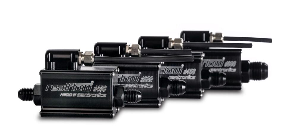
Sentronics’ RealFlow® D-Series is a range of ultra-compact ultrasonic fuel flow sensors for UAV platforms, combining high-accuracy real-time fuel monitoring with multi-fuel compatibility and a Low-SWaP profile for commercial and defense applications
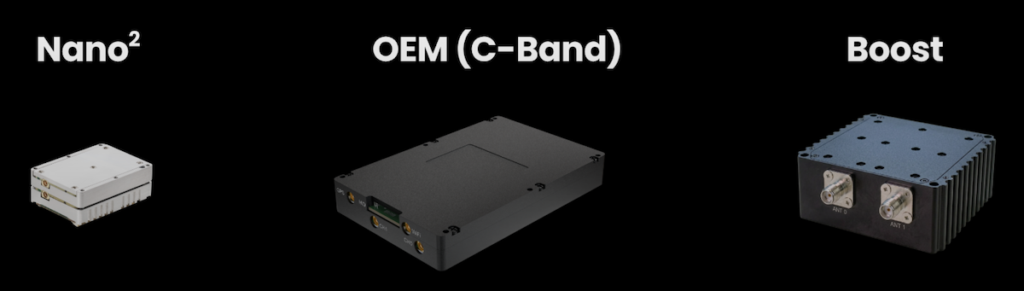
Doodle Labs explores how its Boost bi-directional amplifier supports long-range and tactical drone operations in contested RF environments by extending operational range and improving communication resilience and link reliability
Intelligent Energy explores how hydrogen fuel cells are enabling longer-range BVLOS drone inspections by improving endurance, reliability, and operational efficiency for critical infrastructure missions
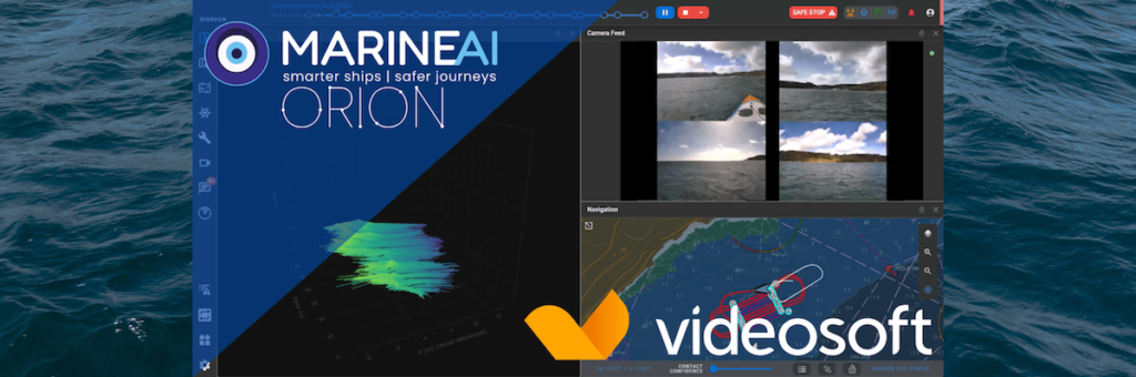
Videosoft Global discusses its collaboration with Marine AI to support low-bandwidth real-time video streaming, situational awareness, and inspection workflows for autonomous and remote maritime operations across constrained offshore communication networks
Calian’s CRPA and resilient GNSS solutions help defence platforms maintain reliable positioning, navigation, and timing in contested environments where GPS can be disrupted by jamming or spoofing
Beechat Network Systems examines how fibre-optic tethering, onboard AI, and frequency hopping technologies are being used to improve drone resilience against jamming and electronic warfare threats
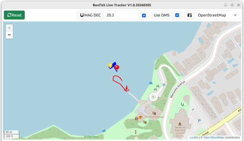
Boxfish Robotics details its AUV Software Suite, which combines the SafePath Mission Planner, Boxfish Commander, and Boxfish Live Tracker applications to support autonomous underwater survey planning, mission execution, and spatial visualization
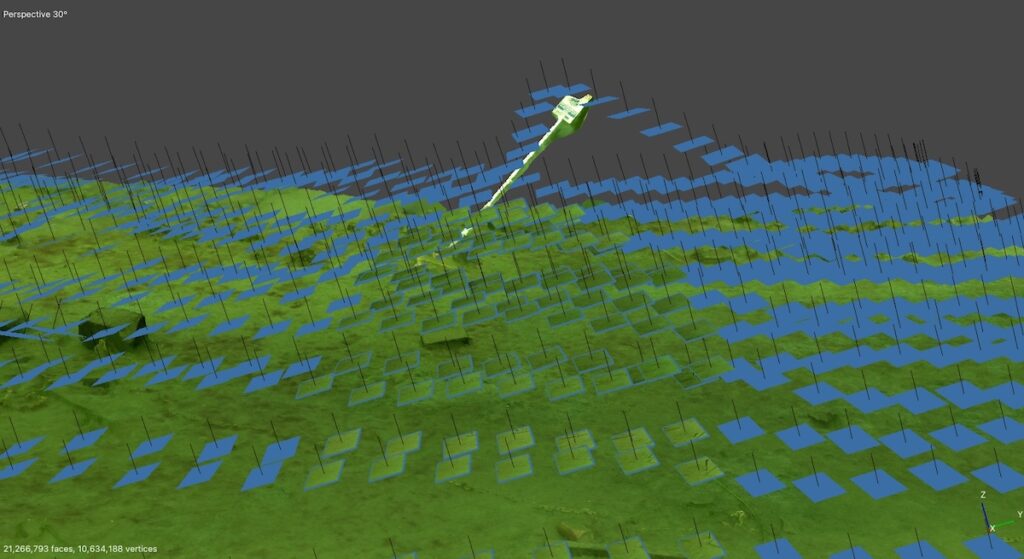
Drone as a Service by ZenaDrone examines how aerial 3D scanning improves construction progress tracking, quantity verification, and site accuracy through photogrammetry, LiDAR, and survey-grade data collection
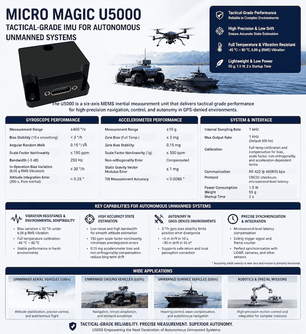
Micro-Magic’s U5000 tactical-level IMU combines low-noise sensing, vibration resistance, and high-rate data acquisition for navigation and control in autonomous unmanned platforms
Knight Optical has highlighted how multispectral imaging systems transform crop health management by detecting stress and nutrient deficiencies weeks before symptoms become visible, significantly reducing pesticide use and protecting global food yields
Aurora Flight Sciences applies simulation, hardware-in-the-loop testing, and flight evaluation to support the development, validation, and risk reduction of advanced autonomous vertical takeoff and landing aircraft systems
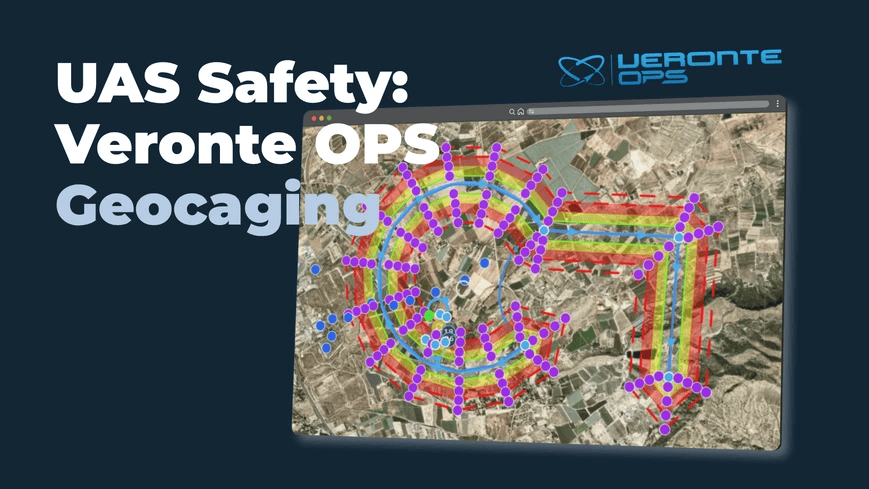
Embention has introduced advanced geocaging functionalities within Veronte OPS to provide unmanned aerial systems with dynamic three-dimensional volume containment, ensuring aircraft operate strictly within designated safe zones through precise virtual perimeters
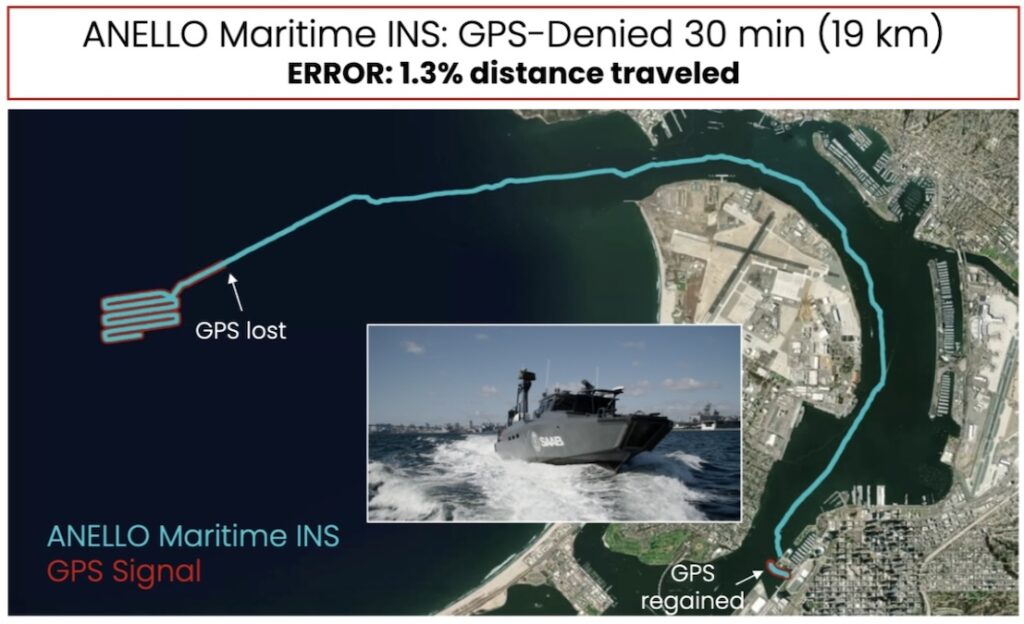
ANELLO Photonics explores how its SiPhOG™-based Maritime INS enables resilient low-drift navigation for maritime platforms operating in GPS-denied environments
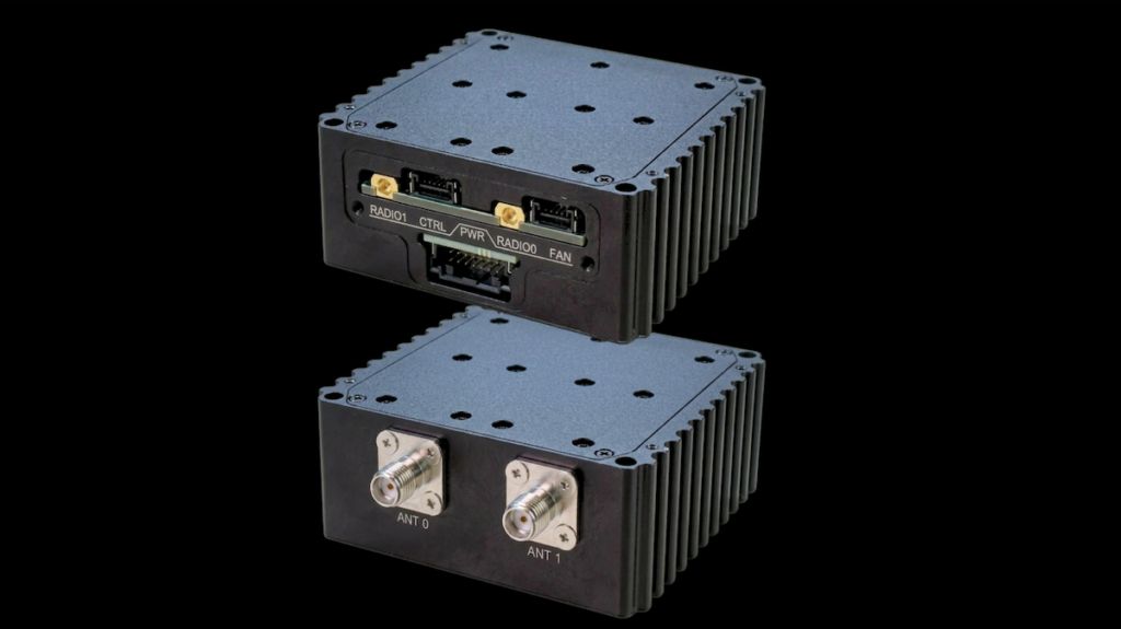
Doodle Labs details how communications technologies including C-band radios, mesh networking, and compact RF systems are being developed to improve range, resilience, and spectrum access for UAV and autonomous platforms operating in challenging European RF environments
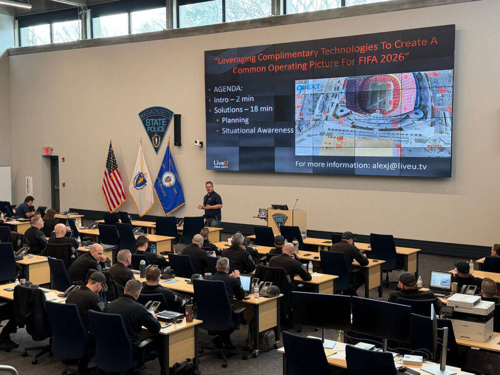
LiveU explores the security realities of FIFA World Cup 2026, as Global Defense & Security Specialist Kevin Cresswell examines emerging threats, policing challenges, and the role of real-time intelligence
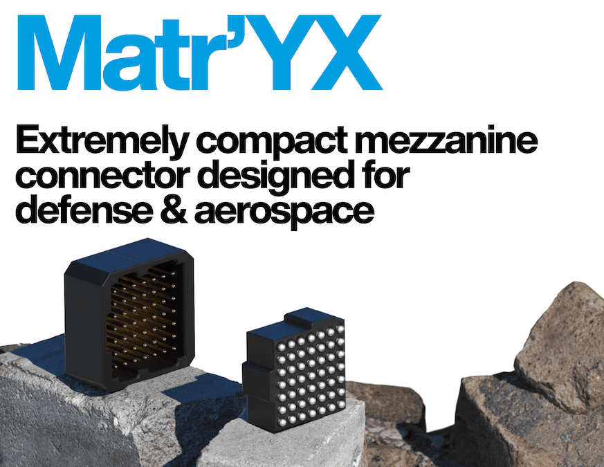
Nicomatic’s Matr’YX connector is a high-density board-to-board interconnect solution featuring a compact 1 mm pitch BGA architecture, high-speed data transmission, and a rugged four-point contact design engineered for demanding defense and aerospace electronic systems
AdaCore details how the Alire skill integrates Ada and SPARK with the Zephyr RTOS, simplifying cross-compilation, interoperability, and deployment across a range of supported embedded hardware platforms
WOLF Advanced Technology’s latest whitepaper examines how decision-centric C5ISR architectures are reshaping command effectiveness in contested and increasingly data-intensive operational environments
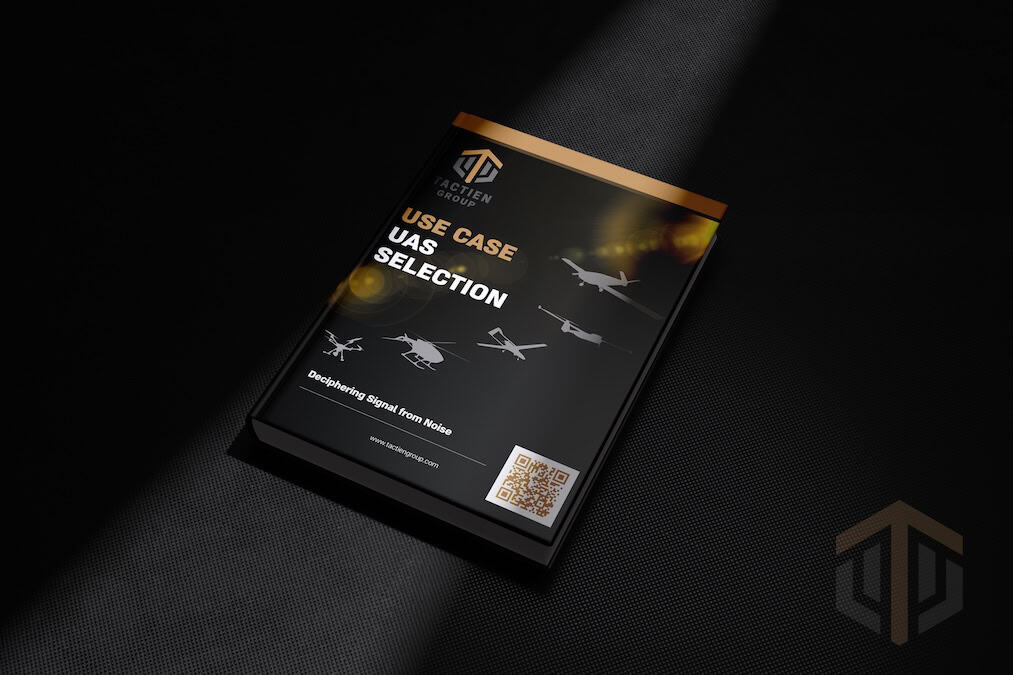
Tactien Group’s Aircraft Selection & Industry Validation process provides independent, data-driven evaluation of unmanned aircraft systems for critical infrastructure procurement decisions
Hollyway’s automated payload swapping system enables drones to switch between optical and thermal sensors during a single landing cycle, expanding operational flexibility across multiple mission environments
UAVOS Founder and CEO Aliaksei Stratsilatau examines the engineering constraints, systems design requirements, and autonomy considerations associated with the DARPA Lift Challenge and future VTOL aircraft development
Maris-Tech explores advanced edge computing solutions designed to address critical latency and bandwidth bottlenecks in military ISR missions, enabling real-time threat detection and autonomous multi-sensor fusion at the tactical edge
Boxfish Robotics is advancing autonomous underwater vehicle operations by integrating DVL sensing and stereo camera perception to navigate complex environments while maintaining strict route consistency required for high-quality survey data
Advancing Unmanned Systems Through Strategic Collaboration
UST works with major OEMs to foster collaboration and increase engagement with SMEs, to accelerate innovation and drive unmanned systems capabilities forward.