Embention has enhanced its Veronte OPS control station software to include sophisticated 3D volume containment systems designed to restrict aircraft within specific mission boundaries. These features have been developed to act as a critical safety net for modern flight operations by utilizing virtual barriers.
Advanced Volume Containment Mechanisms
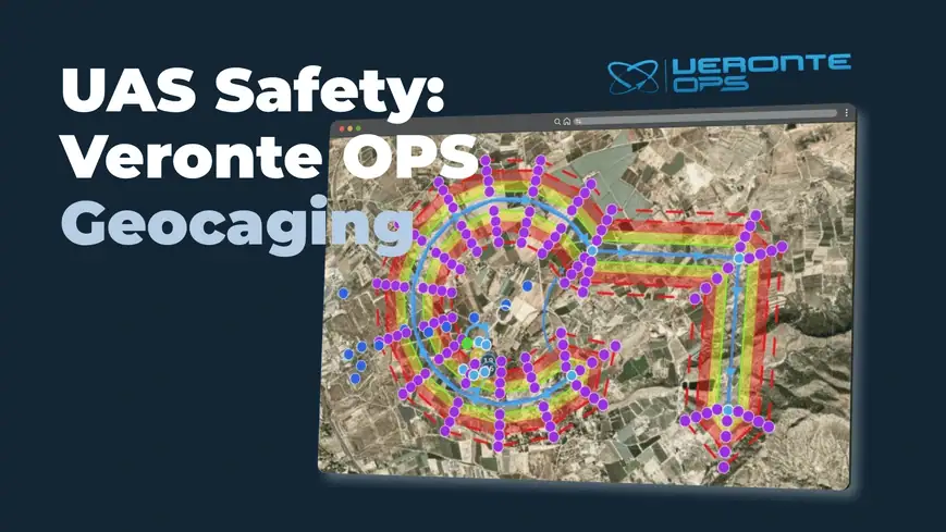
The geocaging system operates by defining a three-dimensional airspace for an individual mission. When an unmanned aerial vehicle approaches these predefined limits, the system engages a mechanism of virtual barriers. Each barrier can be configured to trigger automatic events executed by Veronte Autopilots or to send immediate critical alerts to the control station. This multi-layered approach has been designed to ensure that aircraft do not inadvertently breach operational airspace, maintaining compliance with aviation regulations.
Manual and Automated Setup Processes
Establishing secure boundaries has been simplified through the “Create geocaging area” function in Veronte OPS. This tool allows operators to manually map operational limits around a specific location. By defining these parameters before deployment, all structural safety measures and barrier events are active before the UAV leaves the ground.
For missions spanning larger distances, the “Geocaging on route” functionality has been developed to provide a more efficient workflow. Rather than manually drawing static areas, the system analyzes the planned flight path and generates a containment corridor along it. This automation follows the route sequentially according to the direction of the waypoints.

Technical Implementation on Flight Routes
The generation of this specialized safety corridor has been reduced to a four-step technical process:
- A right-click is executed on a waypoint, typically the starting point of the flight route.
- The lateral containment distance is entered into the interface.
- Barrier distances and corresponding geocaging trigger events are tuned to match the mission risk profile.
- The containment area is generated automatically around the flight path.
The automation algorithm has been upgraded to support complex flight plans containing intricate curves and maneuvers. These continuous updates to the flight control software reflect a commitment to operational excellence. By integrating these robust tools with the Veronte Autopilot, engineering teams can ensure missions adhere to high standards of safety and technological innovation.
Read UAS Safety: Veronte OPS Geocaging for more information.