
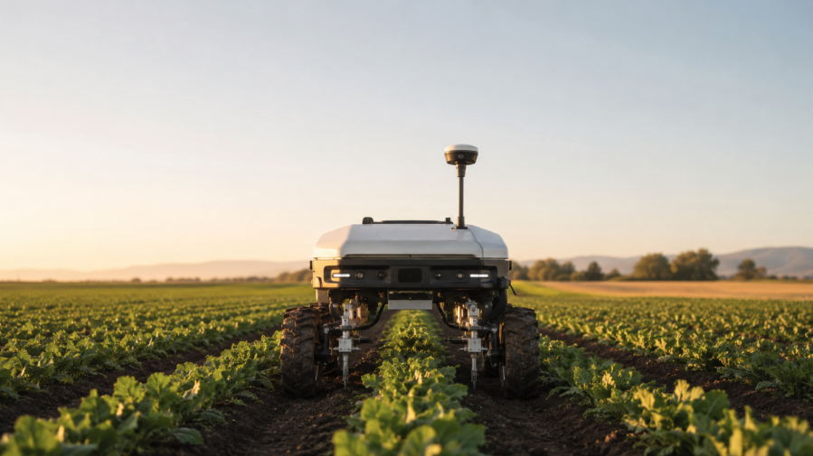
Reliable centimeter-level positioning in agricultural robots, UAVs, and unmanned ground vehicles (UGVs) depends on more than GNSS receiver accuracy. RTKdata highlights how correction network performance influences the ability of autonomous platforms to maintain Real-Time Kinematic (RTK) FIX solutions under challenging field conditions, where satellite visibility, communication reliability, and correction latency can affect positioning accuracy.
For OEMs and system integrators, selecting a suitable receiver is only part of the process. The correction service must also support consistent positioning performance in the platform’s intended operating environment.
Maintaining RTK FIX Stability
Centimeter-level accuracy is valuable only when a receiver can establish, maintain, and recover an RTK FIX solution reliably.
For example, a precision-weeding robot navigating narrow crop rows may achieve approximately 2 cm accuracy under FIX conditions. However, a transition to FLOAT during a headland turn could introduce decimeter-level uncertainty. If FIX recovery takes 30 seconds, the autonomy system must recognize the temporary reduction in positioning quality.
Baseline length and correction quality are important factors in FIX stability. Longer distances between the rover and reference station or virtual reference point make atmospheric effects harder to model and can slow ambiguity resolution.
Nearby physical base stations or properly generated Virtual Reference Station (VRS) solutions help minimize effective baseline length. Multi-constellation, multi-frequency corrections also provide redundancy when satellite visibility is restricted by orchards, tree lines, greenhouses, or canopy.
Correction Latency and Connectivity
Correction age directly affects RTK performance. Delayed correction data can reduce positioning quality, making it important to monitor both correction age and GNSS solution status.
Communication reliability is another consideration. UGVs crossing cellular coverage boundaries and UAVs operating at range may experience intermittent connectivity. Integrators should therefore account for temporary correction interruptions and implement graceful-degradation behavior rather than allowing individual missed correction epochs to cause immediate system failure.
Bandwidth requirements also influence integration. Full multi-constellation correction streams consume more bandwidth than minimal feeds, potentially competing with telemetry, video, and payload communications. Correction message types, supported constellations, and update rates should be selected according to platform requirements.
Position Updates, Heading, and Sensor Synchronization
Autonomous control systems often require higher position update rates than conventional surveying applications. Frequent updates support UGV cross-track correction, repeatable autonomous mowing routes, and precision UAV mapping.
Heading requirements must also be considered. Single-antenna GNSS cannot reliably determine yaw when stationary or moving slowly. Dual-antenna moving-base configurations may therefore be necessary for slow-moving agricultural robots, hovering UAVs, and platforms requiring motion-independent heading.
Production navigation systems commonly combine GNSS and Inertial Measurement Unit (IMU) data through an Inertial Navigation System (INS) or state-estimation filter. Accurate synchronization, often supported by the receiver’s Pulse-Per-Second (PPS) output, is essential because timing errors can undermine otherwise accurate positioning.
Reference Frames and Vertical Accuracy
An RTK FIX solution does not guarantee alignment with mission-planning or mapping data.
RTK coordinates depend on the correction source’s datum and reference frame. Differences between this reference and those used by Geographic Information System (GIS) layers or mission planners can introduce positional offsets.
Vertical references are equally important. GNSS receivers typically output ellipsoidal height, while terrain-following, drainage planning, earthworks, and agricultural water-management applications may require orthometric height referenced to mean sea level or a geoid model.
RTK Accuracy and Operational Resilience
RTK can improve standalone GNSS accuracy from meters to centimeters, supporting robotic row following, repeatable field paths, targeted spraying, precise geofencing, and mapping.
However, RTK does not independently protect against jamming, spoofing, cellular outages, obstructed satellite visibility, or integration errors.
Multi-constellation corrections can reduce dependence on individual GNSS constellations, while correction age and FIX status help autonomy systems assess positioning quality.
RTKdata provides a single NTRIP-based correction service for evaluating RTK performance across UAVs, UGVs, agricultural robots, and other GNSS-enabled platforms before production deployment.
Coverage information, integration options, and a 30-day trial are available at www.rtkdata.com.