



CompassX is AEVEX’s family of AI-driven navigation and autonomy technologies for unmanned operations across air, ground and maritime domains. Built on open standards, the ecosystem combines modular hardware, multi-sensor fusion and intelligent software to provide resilient positioning, situational awareness and autonomous mission capabilities. Its scalable architecture enables integration across different platforms and mission requirements, including operations in GPS-degraded or denied environments.
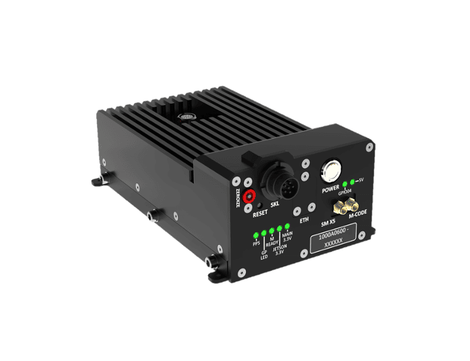
The NDAA-compliant CompassCore hardware stack provides a rugged foundation for sensing, navigation and computing, integrating IMU, GNSS, magnetometer, real-time clock and air data inputs with processing for AI and autonomy workloads. Open interfaces enable integration into AEVEX and third-party platforms.
CompassVision adds vision-based navigation using image processing, nonlinear sensor fusion and machine learning, with AI-driven scene matching and real-time integrity monitoring.
CompassPNT provides assured positioning and timing through multi-sensor fusion and advanced algorithms, with capabilities including relative navigation, integrated timing and high-speed positioning.
CompassEngage brings together mission planning, perception and visual guidance for autonomous target engagement in GPS-denied environments. Terrain, imagery and environmental information provide mission context for its AI-based recognition capabilities.
CompassEarth adds geospatial intelligence, combining imagery processing, terrain modeling and real-time visualization. It ingests video, imagery, radar, communications and weather data to provide a unified operational picture, with aircraft tracking, searchable archives and tools for generating intelligence products.