
Showcase your capabilities
If you design, build or supply GNSS Compass Modules, create a profile to showcase your capabilities and connect with visitors who have an active requirement for your solutions.


GNSS compass modules provide precise heading and orientation data for unmanned systems, enhancing navigation accuracy by integrating satellite positioning with onboard sensors. These advanced compass modules are crucial for applications requiring reliable and continuous heading information, ensuring stability and performance in complex environments. From drones to autonomous maritime platforms, GNSS compass technology supports critical operations across a multitude of industries and commercial applications.
Read the Technology Overview

High-Accuracy Navigation & Positioning Solutions for Unmanned & Autonomous Vehicles

Military-Grade UAV Autopilot Systems for Advanced & Ultra-Reliable Flight Control

High-Performance GNSS/RTK/GPS PNT Solutions for Drone & Robotics OEMs & Systems Integrators

Professional UAV Components & Sensors: Drone Flight Controllers, GNSS Modules, Telemetry Solutions
If you design, build or supply GNSS Compass Modules, create a profile to showcase your capabilities and connect with visitors who have an active requirement for your solutions.

GNSS compass modules are commonly employed in drone and unmanned systems platforms to deliver precise heading and orientation data. By leveraging signals from global navigation satellite systems (GNSS) such as GPS, Galileo, BeiDou, and GLONASS, they provide a robust alternative to traditional magnetic heading sensors, eliminating issues caused by electromagnetic interference or magnetic anomalies.
A GNSS compass module is a navigation and heading sensor that determines an unmanned platform’s orientation and position using satellite signals. Unlike traditional magnetic compasses that depend on Earth’s magnetic field, GNSS compasses measure the phase difference between GNSS signals received by multiple antennas mounted at a fixed distance apart to calculate true heading. This eliminates susceptibility to magnetic interference, making them ideal for applications requiring high precision and reliability.
GNSS compass modules are essential for autonomous drones, robotics, and unmanned systems operating in environments where magnetic sensors struggle, such as near steel structures, high-voltage power lines, or in vehicles producing significant electromagnetic interference.
GNSS compass modules work by utilising multiple GNSS signals and a form of real-time kinematic (RTK) positioning to determine heading and orientation. A dual-antenna configuration is typically used, where two antennas are mounted on a fixed baseline a known distance apart. By analysing the phase difference between satellite signals received at each antenna, the system can calculate accurate heading and orientation for the unmanned platform. This method ensures true heading calculations, independent of motion or magnetic disturbances.
Unlike a magnetic heading sensor, which uses Earth’s magnetic field to determine direction, GNSS compasses calculate heading geometrically using satellite data. This process is highly resistant to interference, enabling reliable performance in environments where traditional methods fail. Additionally, many GNSS compass modules incorporate inertial navigation systems (INS) with accelerometers and gyroscopes to enhance stability and accuracy, creating a robust navigation solution that can operate even during brief GNSS outages.
GNSS and GPS compass modules are equipped with a range of advanced features that make them ideal for unmanned systems:
GNSS compass modules provide accurate heading data by calculating phase differences between GNSS signals. This eliminates reliance on magnetic fields and ensures reliable orientation data in dynamic environments.
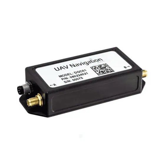
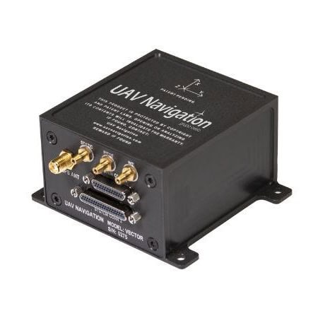
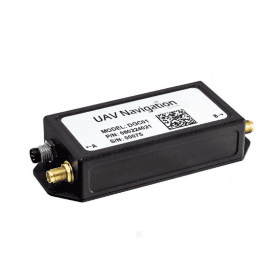
GNSS compass for high-accuracy heading estimation by UAV Navigation
Modern GNSS compass modules utilise multiple satellite constellations, including GPS, Galileo, BeiDou, and GLONASS. This multi-band support enhances signal availability and improves accuracy, even in areas with poor satellite visibility, such as urban environments or dense forests.
Dual-antenna setups allow GNSS compasses to calculate heading without requiring movement, making them ideal for both stationary and mobile platforms. Multi-antenna systems provide additional redundancy and increased accuracy for larger unmanned vehicles.
Unlike magnetic heading sensors, GNSS compasses operate independently of magnetic fields, ensuring reliable performance near large metal structures, power lines, or other sources of electromagnetic interference.Lightweight and Compact Designs
GNSS compass modules designed specifically for drones and other unmanned systems feature lightweight, compact designs for easy integration into space- and weight-sensitive platforms.
Many GNSS compass modules are built to withstand harsh environments, featuring waterproof and shock-resistant enclosures that protect internal components during extreme weather or vibrations.
Some modules combine GNSS data with inputs from heading sensors, accelerometers, and gyroscopes, creating a fully integrated navigation system that reduces errors and provides resilience during GNSS outages.
GNSS compass modules are essential for a variety of drone and robotics applications, including:
Autonomous Drone Navigation
For drones, accurate heading and orientation data is essential for maintaining flight paths, navigating waypoints, and stabilising onboard cameras or sensors. GNSS compass modules ensure drones can operate autonomously with reliable precision, making them indispensable for a wide range of commercial, industrial and military use cases.
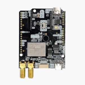
GNSS Compass Module and RTK Receiver by ArduSimple
Precision Agriculture
GNSS compasses are used in agricultural drones to enable accurate navigation during tasks such as crop monitoring, pesticide spraying, and soil analysis. The resulting high precision ensures optimal coverage and minimises waste, improving overall efficiency.
Inspection and Surveying
Inspection drones equipped with GNSS compasses can perform tasks in areas with heavy magnetic interference, such as near bridges, pipelines, or industrial facilities. The modules provide reliable orientation data for consistent and accurate inspections.
Search and Rescue Operations
In search and rescue missions, GNSS compass modules ensure that drones can navigate challenging terrains and maintain stable heading, even in environments with minimal satellite visibility or high electromagnetic interference.
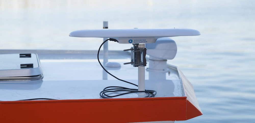
Marine Robotics
For unmanned surface vehicles (USVs) and unmanned underwater vehicles (UUVs), GNSS compass modules enable precise navigation and stabilisation during tasks such as oceanographic research, offshore inspection, or environmental monitoring.
Defence and Security
Military drones and robotics rely on GNSS compass modules for targeting, situational awareness, and navigation in complex environments. Their resistance to interference and robust design make them suitable for tactical operations in urban or battlefield conditions.
Delivery Drones
Delivery drones require accurate heading sensors to navigate congested urban areas and deliver cargo efficiently. GNSS compass modules ensure stable flight paths and precise waypoint navigation, enhancing the reliability of autonomous delivery systems.

 Searching Companies & Products


 Subscribe to the Weekly eBrief
The latest engineering and technical developments straight to your inbox - join thousands of engineers who receive it.
Subscribe to the Weekly eBrief
The latest engineering and technical developments straight to your inbox - join thousands of engineers who receive it.