




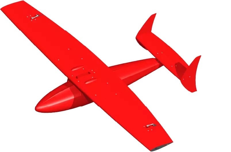
FlipiX is a remotely operated towed vehicle designed to enhance autonomous and uncrewed survey operations across bathymetric, geophysical, and unexploded ordnance missions. Deployable from unmanned surface vessels or conventional platforms, it enables multi-sensor data acquisition within a single run, improving operational efficiency and reducing survey time. The system supports payloads such as side scan sonars and magnetometers, with a design focused on stable, low-altitude data collection close to the seabed. Its compact footprint and compatibility with lightweight launch and recovery systems allow deployment from small vessels, including RHIBs.
Engineered for precise motion control, FlipiX maintains stable altitude, pitch, and roll during operation, supporting consistent data quality even during maneuvering such as turns. The platform offers controlled positioning of sensors near the seabed and operates across typical survey depth ranges, with towing speeds suited to efficient coverage. Positive buoyancy enhances safety and simplifies deployment, particularly in USV-based operations. With user-friendly control software and flexible payload integration, FlipiX provides a versatile solution for modern survey requirements in both crewed and uncrewed environments.
Specifications:
| Dimensions: | 1.8 m x 2.7 m x 0.4 m (without payload) |
| Weight (air): | 68 kg (without side scan sonar) |
| Buoyancy: | Positive |
| Depth rating: | 300 m |
| Operational depth: | Up to 50 m |
| Towing speed: | 3 to 7 knots |
| Dive/climb speed: | 16 to 20 m/min |
| Emergency climb speed: | 40 m/min |
| Vertical accuracy: | 0.2 m |





