


The company has extended its 23-Series range of NFB (Nadir/Forward/Backward)-scanning sensors with the addition of two new products, the VUX-160²³ and the VUX-120²³.
The VUX-160²³ provides up to 2.4 MHz PRR, 400 lines/sec, 10 mm accuracy, 5 mm precision and an extended measurement range of up to 1800 m with only 2.65 kg in weight. It is able to capture up to 32 targets per pulse and offers excellent penetration capabilities for applications such as forestry. This sensor also supports fully integrated IMU/GNSS electronics for convenient system integration and can be integrated with up to 5 cameras.
Phoenix LiDAR Systems has secured the first purchase of the new RIEGL VUX-160²³ to add to their portfolio of RIEGL sensors. Rob Dannenberg, Chief Operating Officer of Phoenix LiDAR Systems commented, “RIEGL USA is a key partner for us, and we are excited to offer the Ranger Ultra +, featuring the RIEGL VUX-160²³ right in time for our 10-year anniversary.”
The VUX-120²³ offers a higher PRR up to 2.4 MHz and higher measurement rates, further increasing efficiency for tasks with higher point density requirements. Both sensors are ideal choice for corridor mapping applications, and are available as stand-alone UAV LiDAR sensors or in various fully-integrated laser scanning system configurations with optional cameras.
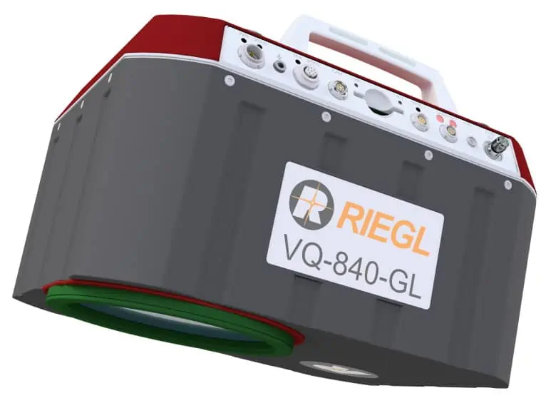
RIEGL have also introduced the VQ-840-GL, a new design based on the proven high-performance VQ-840-G topo-bathymetric LiDAR scanner. With the same form factor, an internal redesign and additional use of lightweight structural components, it provides a weight reduction of 20% down to 9.8 kg (20 lbs). This makes it even more suitable for UAV integration and applications such as combined topographic and bathymetric surveying in coastline and shallow water mapping as well as river surveying.


