


CHC Navigation (CHCNAV) is inviting distributors of professional mobile mapping solutions to apply for partnerships that will enable them to provide a wide range of products that can be tailored to potential customers’ needs in their region. CHC Navigation offers a complete portfolio of mobile mapping solutions for a variety of applications, including roads and highways corridor mapping and asset management, archaeology and heritage modelling, power line inspection, digital terrain modelling (DTM), 3D city modelling, and more.
The CHCNAV dealer program includes extensive sales, marketing and technical support to ensure effective business development.
Click here to get in touch with CHC Navigation and find out more about partnership opportunities
CHC Navigation’s AlphaAir and AlphaUni airborne and terrestrial mobile mapping solutions combine state-of-the-art high-performance hardware, such as long-range laser scanners, high-resolution HDR panoramic cameras, and advanced GNSS receivers, with a high-precision IMU.
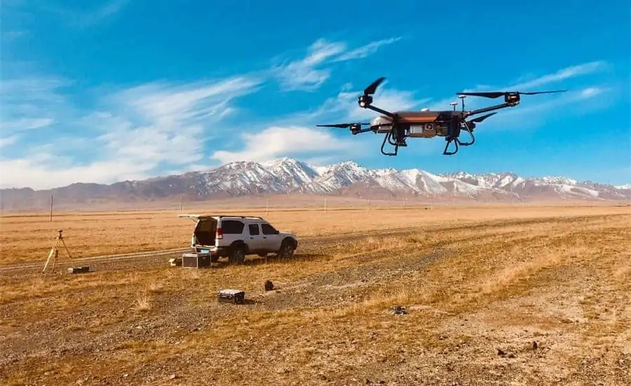
AlphaAir 450 is a lightweight and rugged system that integrates a high-performance laser scanner with an industrial-grade professional 26 MP camera and a high-precision inertial navigation system for high-quality data collection.
AlphaAir 1400 and AlphaAir 2400 are premium airborne laser scanners with 1430 and 2150 metre scanning ranges for high-density LiDAR corridor mapping applications, designed for use on UAV (unmanned aerial vehicle) and manned platforms at altitudes of up to 720 and 1400 metres respectively.
AlphaUni 900 and Alpha 3D are high-precision, long-range laser scanners with unique Waveform-LiDAR technology from Riegl and a high-accuracy inertial navigation system, ideal for demanding surveying missions in the air, on the ground and on water.
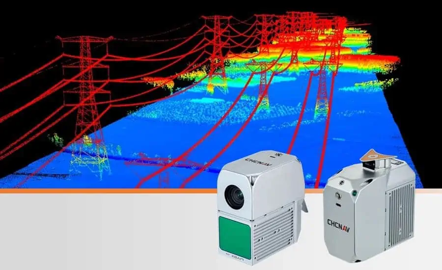
Power line imagery captured by the AlphaAir 450 LiDAR
CHCNAV UAVs are designed to meet professional applications such as survey and mapping projects related to infrastructure, utilities, mining, and agriculture that may require a high payload capacity, extended flight time, advanced camera stabilization, and fully autonomous control.
The BB4 UAV is a high-end UAS that combines CHCNAV’s highly integrated technology with a fully automated flight control system from DJI. The BB4 can be equipped with mobile mappers from CHCNAV.
The P330 PRO VTOL drone is a high-performance vertical takeoff and landing (VTOL) fixed-wing UAS equipped with an orthophoto camera and other optional sensors, such as an oblique camera for 3D modeling applications, to address the most demanding mapping and topographic survey applications.
Clients can also benefit from a complete workflow thanks to a pre- and post-processing software suite that can process captured raw data, including POS trajectories, LiDAR data and RGB images, and provide DEM/DTM generation, semi-automated feature extraction, automatic data classification, and dedicated power line and road inspection. With an intuitive interface and efficient workflow, the CHCNAV software significantly improves the productivity of 3D mapping projects.
CHC Navigation’s complete portfolio of mobile mapping products provides a solution for all projects and budgets, helping users to save time, reduce costs and complete projects in the most effective way.
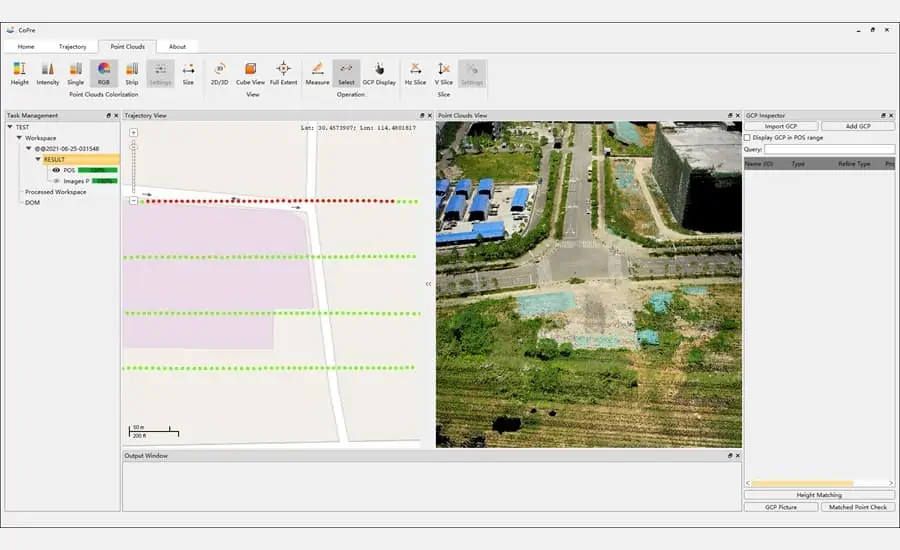
CHCNAV point cloud processing software
George Zhao, CEO of CHC Navigation, commented: “We foresee strong growth potential, as most of our customers are looking for reliable and affordable technology solutions to move from 2D mapping to 3D reality capture using LiDAR and imagery.”


