


YellowScan and Acecore Technologies have collaborated to develop a fully integrated UAV (unmanned aerial vehicle) LiDAR solution that combines the YellowScan Mapper and Acecore Zoe quadcopter to provide high-accuracy point cloud data and flight versatility in one package. This partnership marks the first time that the two companies have worked together to develop a complete solution of this type with system components specially configured to work together.
Unlike other YellowScan solutions, the YellowScan Mapper is a purely aerial LiDAR solution that is ideally flown at 70m above ground level. Although it is designed to fit most professional drones and comes with an integrated camera module, YellowScan has worked with Acecore to configure Mapper to take full advantage of the Zoe platform. YellowScan Mapper is ideal for general topography projects and is particularly suited for civil engineering, powerline, forestry and archaeology missions. The YellowScan Mapper seamlessly integrates with existing YellowScan software solutions, LiveStation and CloudStation, making it easy to live-stream pointcloud data while the system is flying, and comprehensively post-process, visualize and export survey data right after the flight.
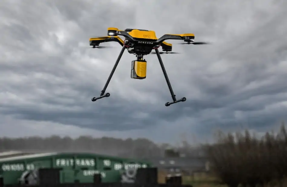
The Acecore Zoe is a highly versatile quadcopter, designed to perform under a wide variety of conditions. The hand-made carbon fiber drone will carry the YellowScan Mapper with its RGB camera module for 28 minutes continuously, taking only 90 seconds to ascend to 70 meters AGL and initialize the YellowScan Mapper’s IMU (inertial measurement unit). The optional laser guided terrain following mode keeps Zoe at a constant height, ensuring a quality output throughout the survey area.
Jorrit Linders, founder and CEO of Acecore Technologies, commented: “Seeking partnership with YellowScan makes a lot of sense for us, it enables us to supply the worldwide market with true end-to-end LiDAR mapping solutions with an unmatched level of support and after-sales service.”
Tristan Allouis, CTO of YellowScan, said: “Despite the fact that the Mapper is designed to be agnostic to the UAV it is mounted on, the opportunity to make sure that their Zoe drone and our Mapper LiDAR solution work seamlessly benefits our clients. Both companies have been around for a long time and that translates into a user experience that is second to none.”


