Showcase your capabilities
If you design, build or supply Drone Fleet Management, create a profile to showcase your capabilities and connect with visitors who have an active requirement for your solutions.


Find suppliers of Drone Fleet Management Systems for Unmanned Vehicles, UAV, UAS, USV & UGV. Including Time Based Maintenance & Drone Management Software.
Read the Technology Overview
Fully Autonomous Multirotor Drones & Hybrid VTOL UAVs With AI Capabilities
Certified UAV Communications, Navigation, Control, Surveillance, and Combat ID Solutions
Comprehensive Hardware & Software Solutions for Drone Operations & Airspace Integration
Autonomous UAS, Research & Inspection UAVs for Industrial Inspection, Survey & Mapping
If you design, build or supply Drone Fleet Management, create a profile to showcase your capabilities and connect with visitors who have an active requirement for your solutions.

Drone management software allows fleet managers and operators to streamline and improve processes for a wide range of unmanned industries, including UAV inspection, delivery, mapping and surveying. It provides a convenient way to manage tasks, track productivity and facilitate effective communication between pilots, managers and data processing personnel.
Scaling up from a single drone or a small number of aircraft, to large fleets involves a wide range of challenges, including a massively increased amount of data generated. Fleet management platforms provide a convenient way to handle these increased requirements, and are often provided on a software as a service (SaaS) basis, allowing users to opt for more powerful features as their business grows. As part of the wider drone software ecosystem, these platforms integrate operational management, data handling and automation capabilities to support increasingly complex unmanned operations.
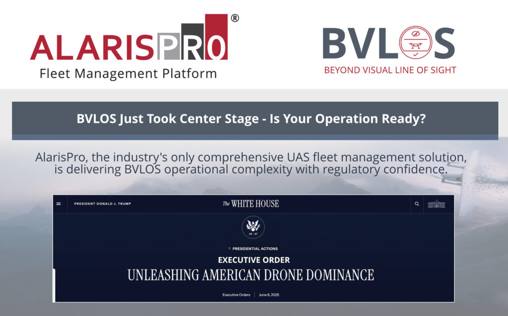
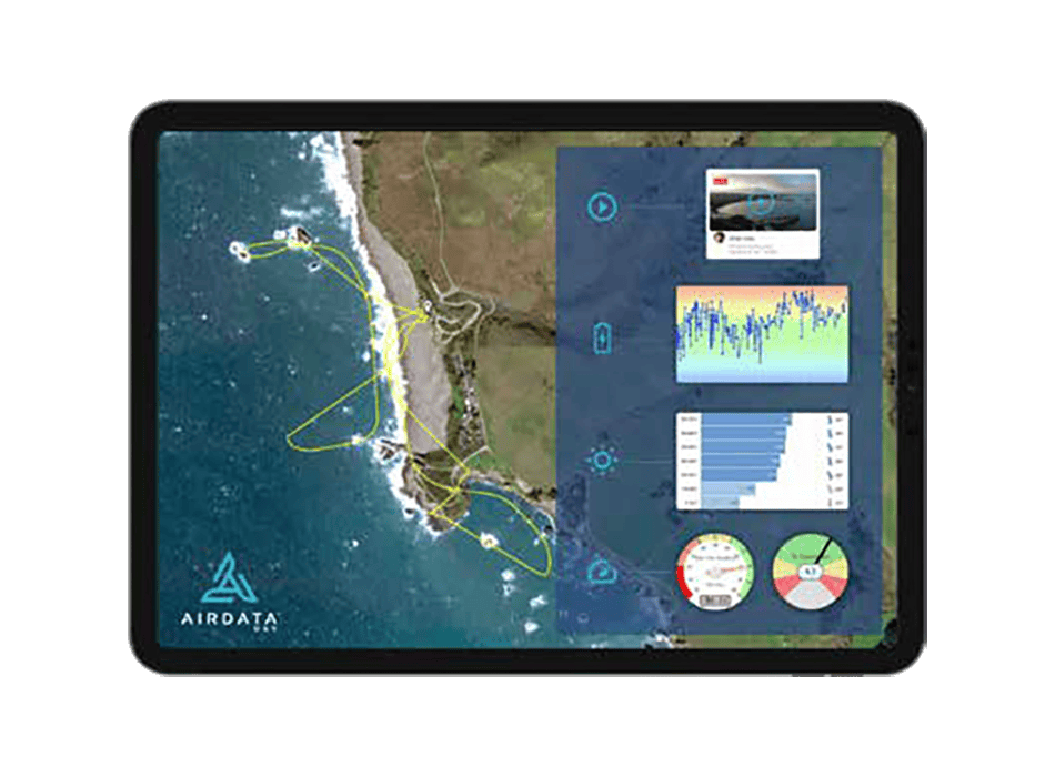
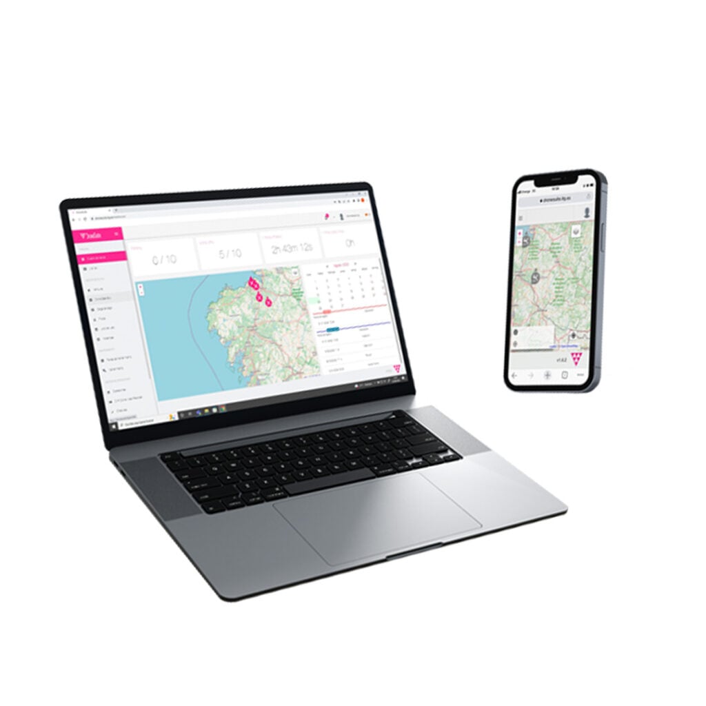
Drone fleet management software by AlarisPro
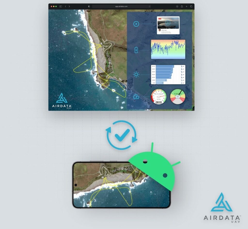
UAV (unmanned aerial vehicle) fleet management software may be cloud-based, allowing managers and pilots to access and update records and information from anywhere in the world.
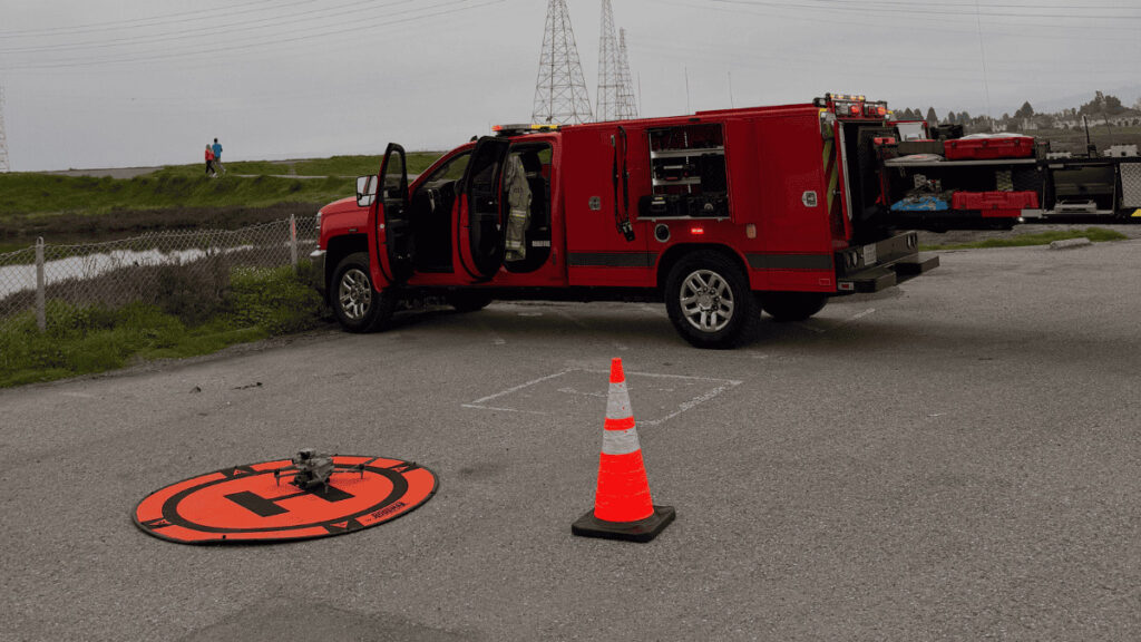
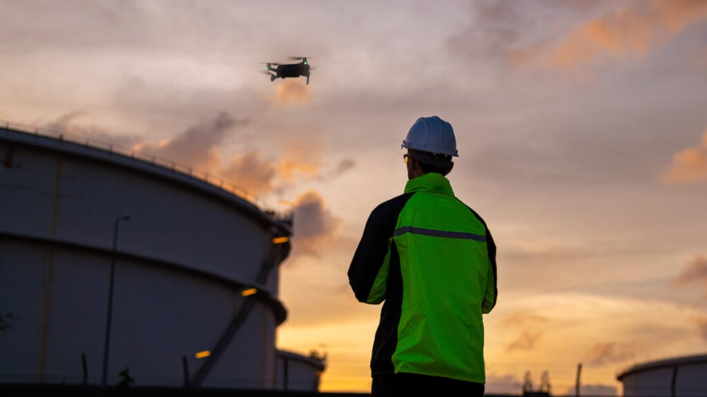
Pilots: This capability is especially useful for drone pilots working in the field, who can use a convenient mobile phone or tablet app to log their work. This simplifies detailed record keeping, putting flight plans and post-flight details at the whole team’s fingertips in near real-time.
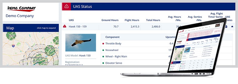
Owners: UAV management software is essential for maintaining complete records for quality adherence and safety compliance, as well as for certifications such as the FAA’s COA, Part 107 Waivers and 333 exemptions. The software systems may also include features that enable unmanned traffic management (UTM) capabilities such as Remote ID and LAANC (Low Altitude Authorization and Notification Capability). Simple exportable CSV files make it easy for fleet owners to collate required data for internal and external audits, reports and drone insurance requirements.

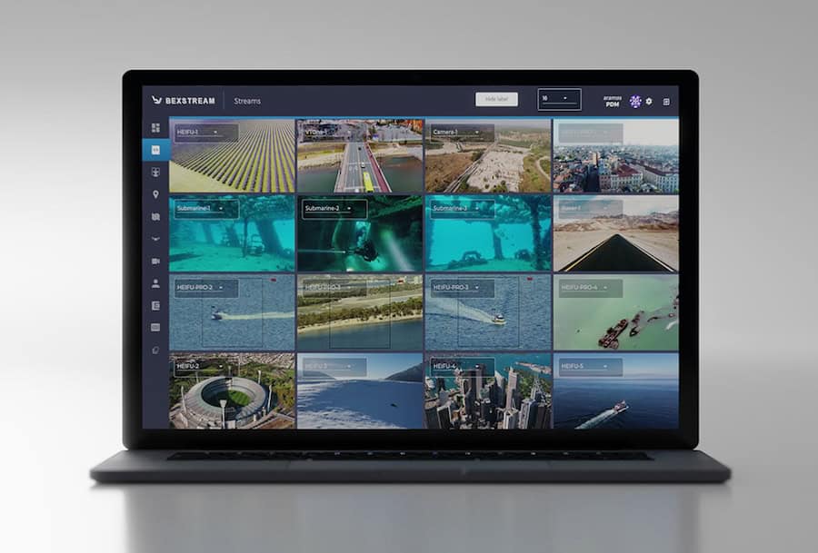
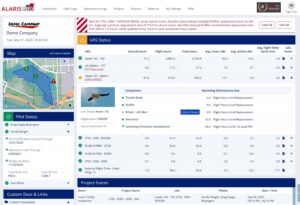
beXStream Remote Control & Management Software by Beyond Vision
Another important capability of drone fleet software is the management of maintenance tasks and schedules. This involves the tracking of routine tasks including calibration and replacement of parts such as rotors, and enables time-based preventative maintenance that must be performed to reduce downtime and risk of catastrophic failure. Some platforms will provide features similar to those used in manned aviation, such as checklists and component-level pre- and post-flight checks, as well as tracking of component MTBF (mean time before failure) and MTBR (mean time before replacement).

 Searching Companies & Products


 Subscribe to the Weekly eBrief
The latest engineering and technical developments straight to your inbox - join thousands of engineers who receive it.
Subscribe to the Weekly eBrief
The latest engineering and technical developments straight to your inbox - join thousands of engineers who receive it.