Forestry, Agriculture & Farming News & Articles

UAS Summit & Expo 2022 Dates & Call for Abstracts Announced

Produced by UAS Magazine, UAS Summit & Expo will provide attendees with a comprehensive overview of the current state of the UAS industry


Mar 30, 2022
New Centimeter-Level Positioning Sensor for Autonomous Vehicles 

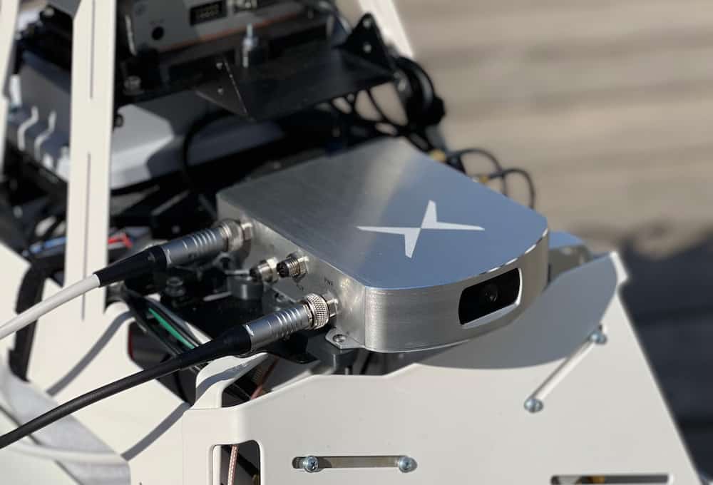
Fixposition’s Vision-RTK 2 positioning sensor combines positioning satellites, computer vision, and inertial sensors to enable precise, autonomous vehicle and machine navigation in demanding areas

Mar 29, 2022
New Solar Powered UAV Boasts 10 Hour Flight Time 

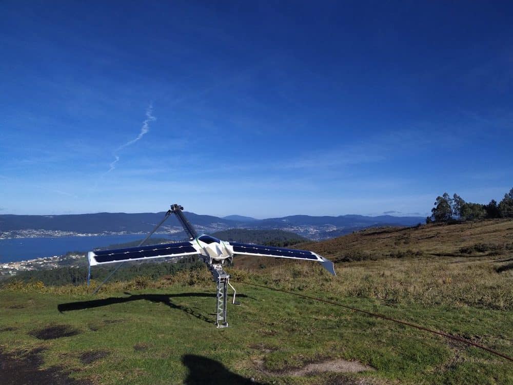
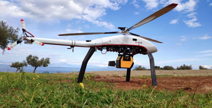
UAV Instruments CIES 2.2 Solar Powered has solar panels in its wings that enable a flight time of up to 10 hours for photogrammetry, surveying, remote sensing, reconnaissance or precision agriculture operations

Mar 23, 2022
New Partnership to Develop Embedded Solutions for Rugged Robotics

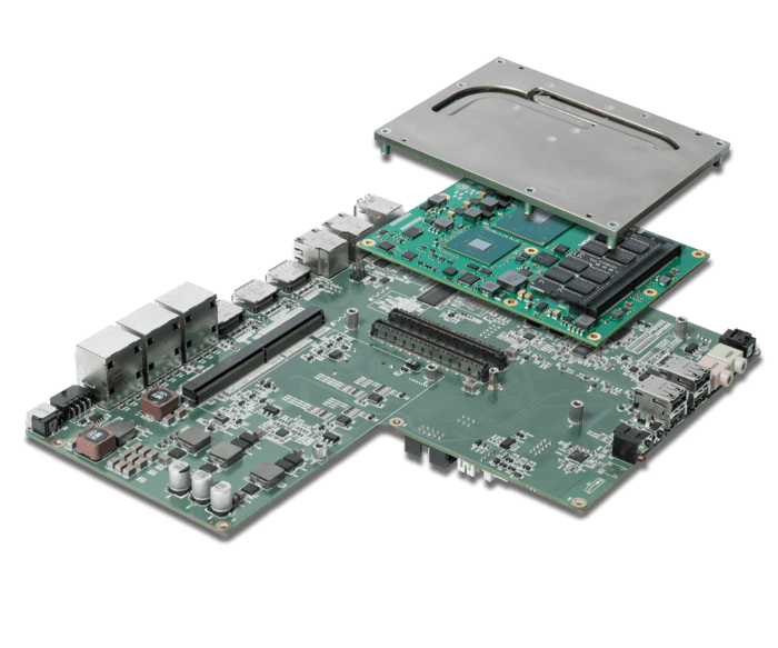
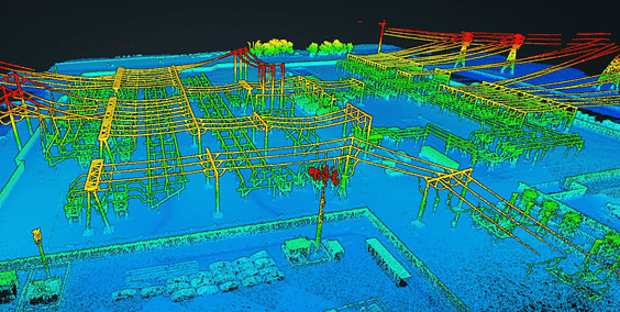
congatec and Etteplan aim to provide OEMs and system integrators with application-ready solutions designed for the digitalization of mobility in rugged environments

Mar 22, 2022
Federal Support for Drones in Agriculture Training Program

United States Congress and Administration appropriate $750,000 to cutting-edge Warren drone training program that benefits farmers

Mar 22, 2022
Plymouth Rock Technologies Develops Autonomous Drones for Law Enforcement & Emergency Rescue

PRT drones are designed with autonomous and BVLOS operations in mind, and feature AI capabilities and advanced sensors

Mar 15, 2022
ComNav Technology Applies BeiDou GNSS Technology in Africa

ComNav Technology has confirmed that it has completed a number of successful projects in Africa, applying BeiDou GNSS technology to...

Feb 25, 2022
New Add-Ons for FIFISH V6 EXPERT ROV

The latest iteration of the award-winning FIFISH V6 series underwater Remotely Operated Vehicle (ROV) from QYSEA Technology is now equipped...

Feb 02, 2022
High-Precision LiDAR Scanning for Forestry

RIEGL’s LiDAR scanners have been featured in an article published in GIS Resources Magazine that highlights how the technology is...

Jan 25, 2022
YellowScan Selects New Global Partner in China

YellowScan has confirmed the addition of EcoTech Ltd to the company’s network of Global Partners. EcoTech focuses on the promotion,...

Jan 20, 2022
Mobile Command Center Added to Drone Training Program

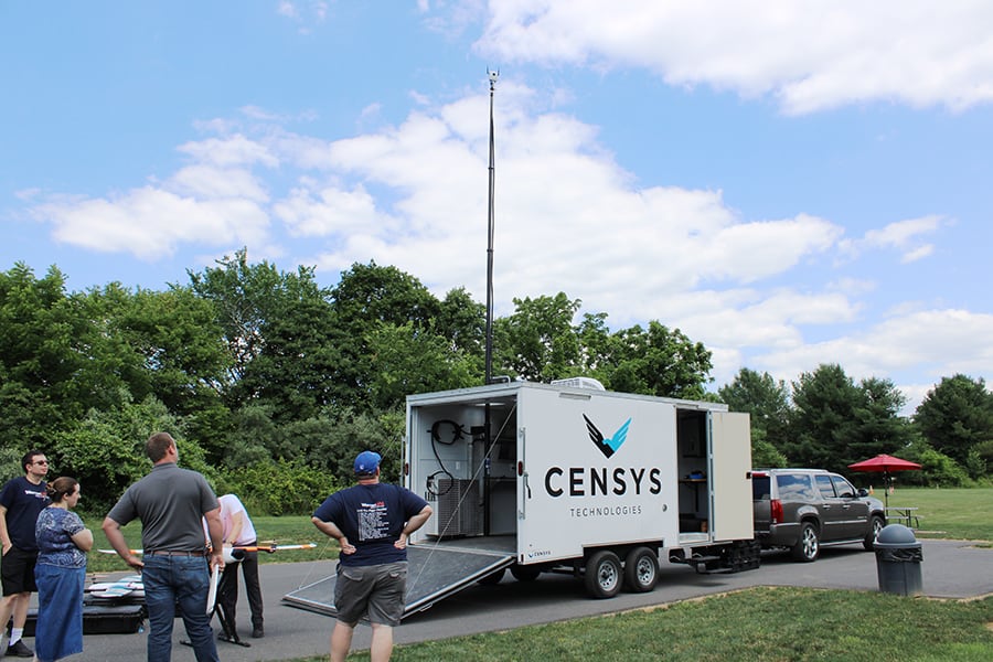
Warren Community College has taken delivery of a fully integrated Mobile Command Center which will be available to students on the Unmanned Systems training program, giving them practical experience controlling drones from commercially available equipment already used by enterprises in industry.

Dec 14, 2021
AI Performance on MicroSys System-on-Module Platforms

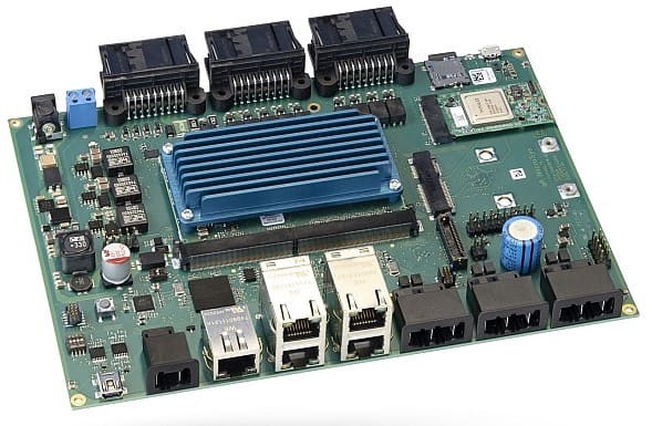
MicroSys Electronics’ new embedded System-on-Module (SoM) platform miriac AIP-S32G274A, which is based on NXP S32G vehicle network processors, now supports...

Dec 02, 2021
Teledyne Geospatial to Showcase Lidar Survey & Mapping Solutions

Teledyne Geospatial has confirmed that it will be showcasing its LiDAR survey and mapping solutions at the Geo Business 2021...

Nov 23, 2021
Using LiDAR to Quantify Effects of Climate Change

YellowScan has released a case study detailing how its Mapper drone LiDAR sensor has been used to quantify the effects...

Nov 15, 2021
New Multispectral Drone Sensor Unveiled

MicaSense has launched the RedEdge-P, the company’s new multispectral sensor for UAVs (unmanned aerial vehicles) that provides three times the...

Oct 29, 2021
YellowScan Selects New European Distributor

YellowScan has selected MOST Robotics as the newest member of the global distribution network for the company’s UAV (unmanned aerial...

Oct 07, 2021
Precision Agriculture Solutions Incorporate NovAtel GNSS Receiver

Hexagon | NovAtel has confirmed that its SMART7 GNSS receiver has been selected as the default configuration choice for Fendt...

Sep 23, 2021
New congatec Module Gives Qseven Designs a Performance Boost

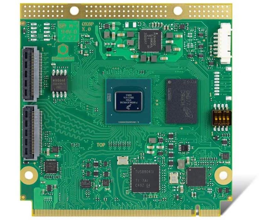
congatec has celebrated the 15th anniversary of Qseven Computer-on-Modules with the introduction of the conga-QMX8-Plus, a new Qseven module based on the...

Sep 14, 2021
New Long-Range UAV LiDAR Solution Unveiled

YellowScan has introduced a new long-range, compact LiDAR solution designed to be mounted on fixed-wing or multirotor UAVs. Capable of catching points up to 600m away, the YellowScan Explorer can be used for a variety of laser scanning applications including surveying, forestry, environmental research, archaeology, industrial inspection, civil engineering, and mining.

Sep 07, 2021
Autonomous AgriTech Demonstrated on Case IH Magnum

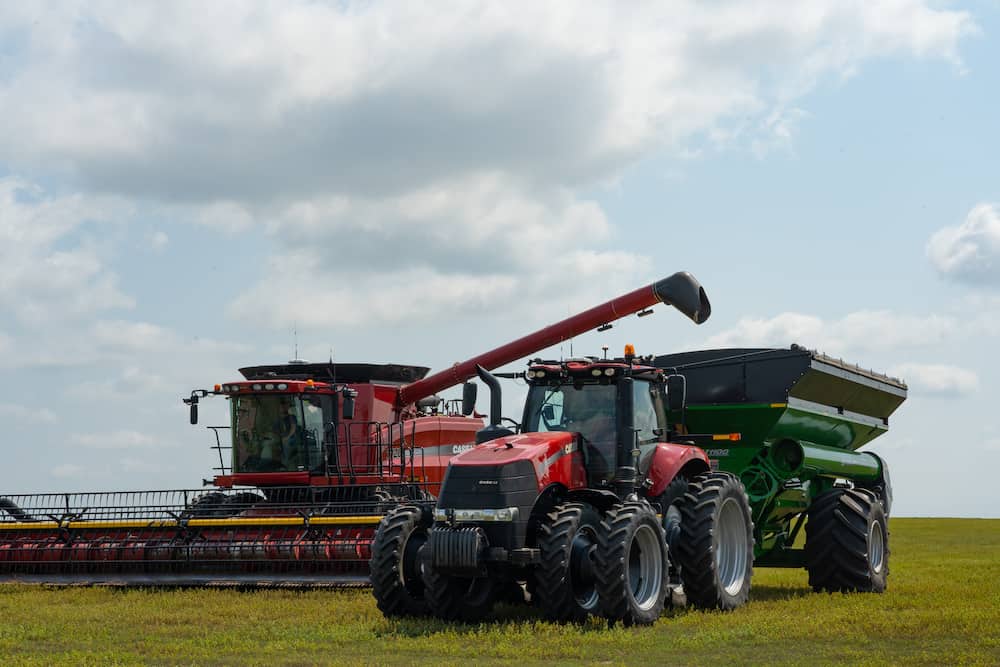
Driverless Ag Technology company, Raven Industries, Inc., showcased and demonstrated the company’s OMNi suite of technology at the U.S. Farm Progress...

Sep 06, 2021
Positioning Solution Launched for Precision Agriculture & Robotics

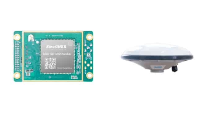
ComNav Technology has launched a professional smooth positioning solution for precision agriculture and other robotics applications, combining the company’s K803...

Aug 31, 2021
Growing Demand for Drone Pilots in Agriculture

In this article, the team at Drone Digital explore the increasing use of drones in agriculture, potential future uses, and look at the rising demand for qualified drone pilots and operators. They also unveil their new online platform that connects farmers with pilots in their area, to help them find the right professionals for their project requirements.

Aug 30, 2021
New Production Concept for Agricultural Survey VTOL Drone

Leading Unmanned Aerial Vehicle (UAV) producer in Thailand, HG Robotics has expanded its development and manufacturing partnership with COBRA International....

Aug 10, 2021
Autonomous Edge Vision AI Solutions for Mission-Critical Use

Plainsight has formed a partnership with CP Technologies to provide civil and commercial market customers with autonomous, edge-deployed vision Artificial...

Aug 06, 2021
Expansion of Analytics Software for Agricultural Drones

Global crop protection company, ADAMA, and aerial analytics provider, Agremo, have announced an expansion program of the ADAMA Eagle Eye drone...

Aug 02, 2021
Providing Actionable LiDAR Point Cloud Deliverables

Inertial Labs has released an article detailing how LiDAR data collected by UAVs (unmanned aerial vehicles) can provide valuable metrics...

Jul 22, 2021
Advancing Unmanned Systems Through Strategic Collaboration UST works with major OEMs to foster collaboration and increase engagement with SMEs, to accelerate innovation and drive unmanned systems capabilities forward.