


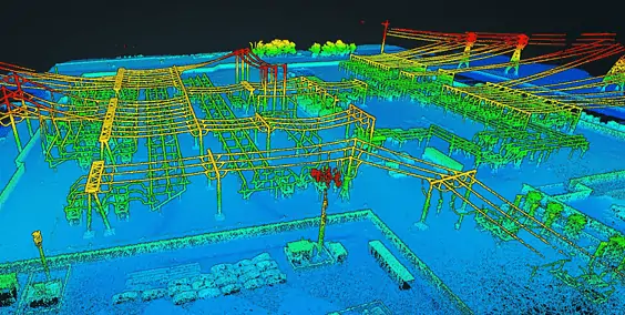
Inertial Labs has released an article detailing how LiDAR data collected by UAVs (unmanned aerial vehicles) can provide valuable metrics and actionable data for a wide variety of applications such as topographic mapping and asset inspection.
Read the full article on Inertial Labs’ website
The article covers:
- An overview of the essential components in a LiDAR system – the laser scanner and the GPS-aided INS (inertial navigation system)
- Using datums to ensure that data points are accurately georeferenced
- Converting between datums
- The difference between a geographic coordinate system (GCS) and a projected coordinate system (PCS)
- Point classifications and the creation of DTMs, DSMs, and DEMs
- LiDAR for tree and forestry analysis
- How drone-based LiDAR systems such as Inertial Labs’ RESEPI allow businesses to quickly and efficiently gather data, create models and map large areas
Inertial Labs’ LiDAR Remote Sensing Payload Instrument (RESEPI) is a modular complete remote sensing solution that provides real-time and post-processed generation of point cloud products, and can be integrated with a range of different LiDAR scanners. To find out more, read the full article on Inertial Labs’ website.


