Forestry, Agriculture & Farming News & Articles

UAVOS Demonstrates Use of Drones for Forestry Inspection 

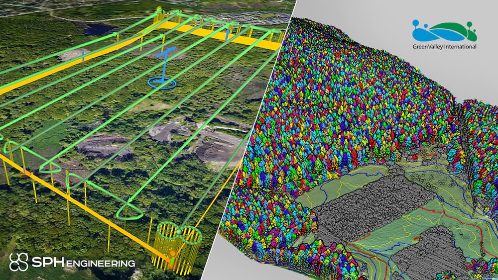
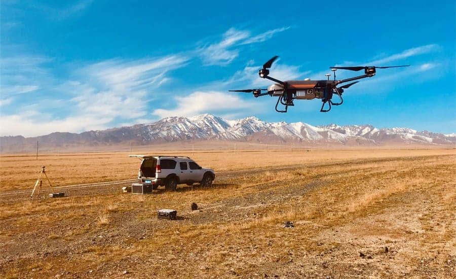
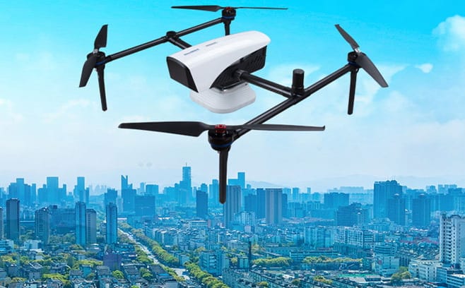
UAVOS used a Borey fixed-wing UAV to demonstrate how drones can optimize and improve the way data is collected and analyzed, help to reduce environmental risks, and generate economic wealth in the sector

Aug 05, 2022
Multiple-Stream Video Platform with Edge AI Acceleration Launched

Maris-Tech’s Jupiter-AI provides a hardware and software solution for remote platforms’ video streaming, recording, debriefing and AI at the edge

Jul 28, 2022
eVTOL Transportation Growth Strengthened by Capital Investment

Embention has received investment from Axon Partners to strengthen its growth in global industrial UAV and eVTOL markets

Jul 22, 2022
27-Mile BVLOS Waiver Awarded by FAA to Commercial Drone Inspection Company

Soaring Eagle Technologies, using Iris Automation’s advanced Detect and Avoid system Casia, has been approved for a BVLOS waiver to inspect up to 27 linear miles of commercial infrastructure

Jul 22, 2022
CHC Navigation Launches Global GNSS RTK Network Partner Program

The company provides full support and a range of partnership models to suit a variety of business needs

Jul 18, 2022
Censys Raises $8.3 Million in Oversubscribed Series A Funding Round

These new funds will be used to help the company transition from a UAS company to an airborne intelligence company

Jul 06, 2022
New Multi-Camera Solution for NVIDIA Jetson AGX Orin

The camera is designed to support AI-based embedded vision applications such as autonomous mobile robots

Jul 04, 2022
NovAtel SMART7 GNSS Receiver Featured in New JCB Tractor

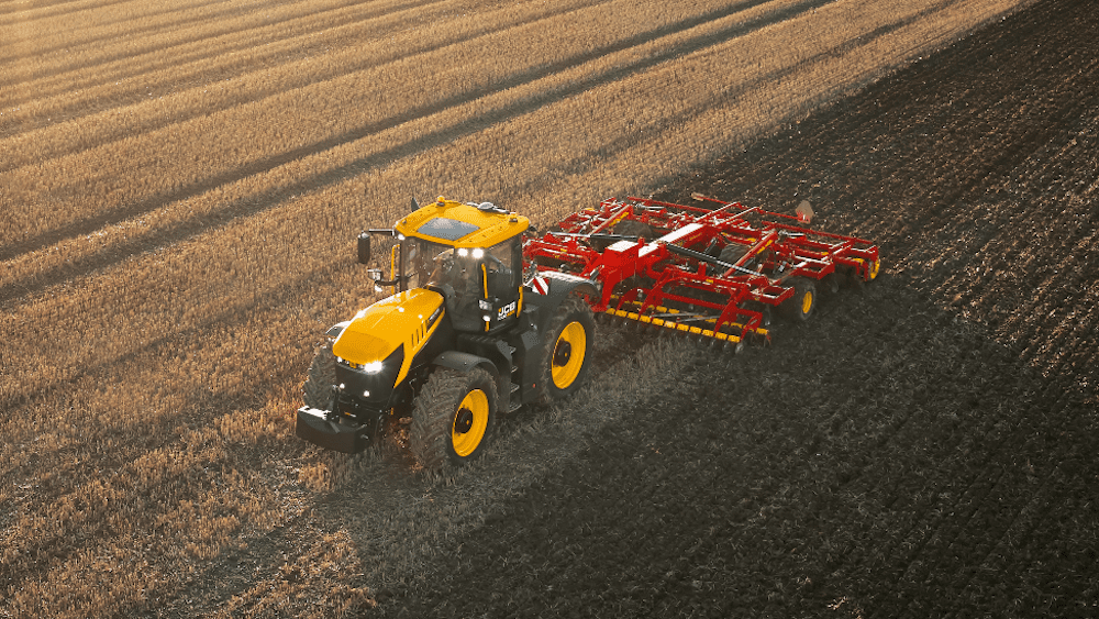
The SMART7-I included in the Fastrac iCON tractor is a rugged, waterproof, all-in-one GNSS SMART Antenna designed and tested specifically for the agriculture industry

Jun 30, 2022
CHCNAV Announces APAC Business Tour 

The company will visit Mongolia, South Korea, Japan, Myanmar, Laos, Thailand, Vietnam, Cambodia, Malaysia, Philippines, Indonesia, Australia, and New Zealand from July to September 2022

Jun 29, 2022
New Drone Technologies Partnership for LiDAR Data Collection & Processing

SPH Engineering and GreenValley International align UgCS mission planning software and LiDAR360 data processing software for UAV-based LiDAR surveying

Jun 28, 2022
Drone Agnostic Autonomous Remote Drone Nesting Station Released

Volatus Aerospace’s AERIEPORT is built to withstand extreme temperatures and 24/7 remote flight operations

Jun 21, 2022
Autonomy & Positioning Reality Summit Earns IEEE Accreditation

The Summit is part of Hexagon's HxGN LIVE Global 2022 digital reality solutions conference

Jun 13, 2022
Phase One Unveils Aerial Solutions with Near Infrared Capabilities

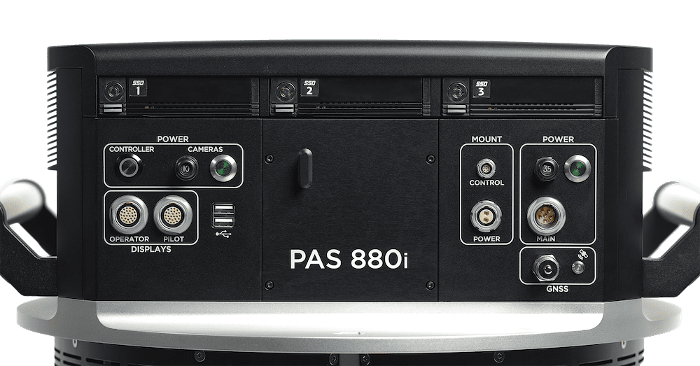
The addition of a near-infrared sensor to the PAS 880 and PAS 280 solutions expands their utility in applications related to agricultural monitoring, environmental preservation, and land use/land cover programs

May 27, 2022
Atmos Integrates Topcon’s Hardware & Correction Services into UAS Surveying Solution

Topcon develops and optimizes GNSS boards for highly precise positioning applications in the global construction, geospatial and agriculture markets

May 24, 2022
Vision-Enhanced RTK-GNSS Positioning System for Autonomous Vehicles

The Vision-RTK 2 combines high precision RTK-GNSS with deeply fused inertial and visual sensors

May 18, 2022
Conference Program Announced for Commercial UAV Expo 2022

The educational program focuses on how drone technology is solving problems and creating meaningful ROI across various industries

May 18, 2022
Tickets Now Available for INTERGEO 2022 

INTERGEO will welcome back visitors 18-20 October 2022 at Messe Essen for face-to-face meetings and exchanges with international companies, innovative start-ups and the leading minds in the industry

May 10, 2022
New Collaboration Offers Drone Collision Mitigation Services in Switzerland

INVOLI and the Swiss Federation of Civil Drones (SFCD) will promote the use of drone Remote ID trackers among SFCD members for safe, efficient, and scalable drone operations in Switzerland

May 10, 2022
Distributor Opportunities for Mobile Mapping Professionals

CHC Navigation offers a complete portfolio of UAV and mobile mapping solutions for a wide variety of applications

Apr 28, 2022
Beluga Drone to Embed uAvionix Autopilot & CNPC Ecosystem

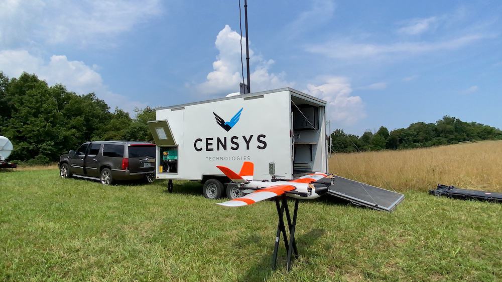
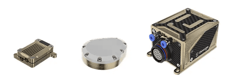
Beluga will include the uAvionix George G3, a CubePilot-based autopilot designed to DAL-C safety standards, and the truFYX EXT GPS which will provide high-quality avionics at a low SWaP consumption and cost

Apr 28, 2022
Off-Road Autonomy Platform Launched for Vehicles in Complex Terrain

Stratom’s Summit Off-Road Autonomy Platform is a highly configurable software system that accelerates the implementation of unmanned systems to boost operating efficiency and profitability

Apr 26, 2022
YellowScan Selects New US Distributor

Terrestrial Imaging will distribute and support YellowScan's complete hardware and software solutions for UAV LiDAR scanning

Apr 20, 2022
EuroLink Targets US Market with Beluga Family of Mini-Drones 

The Beluga platform has been in development for three years and has passed stringent TRL7 & TRL8 project requirements meeting demanding performance metrics

Apr 14, 2022
New RTK-Capable Drone Mapping Solution Released

The multi-constellation solution can carry up to 3kg and fly for up to 50 minutes

Apr 08, 2022
New Embedded Smart Mobility Solutions for Autonomous Vehicles

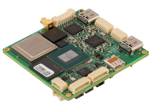
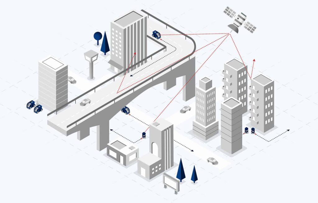
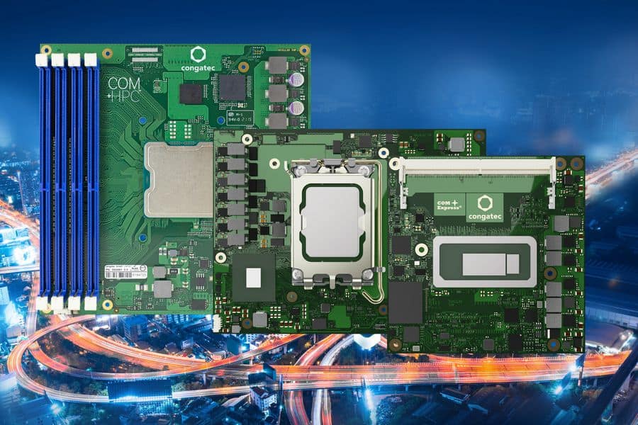
The new solutions are designed to enable mobility OEMs to tackle the wide variety of tasks necessary for designing next-generation smart autonomous mobility controllers

Apr 05, 2022
Round Six of GENIUS NY Business Accelerator Now Open

Applications are being accepted for the business accelerator program through May 31, 2022 from tech startups focused on unmanned systems, Internet of Things (IoT), big data, and robotics

Apr 01, 2022
Advancing Unmanned Systems Through Strategic Collaboration UST works with major OEMs to foster collaboration and increase engagement with SMEs, to accelerate innovation and drive unmanned systems capabilities forward.