


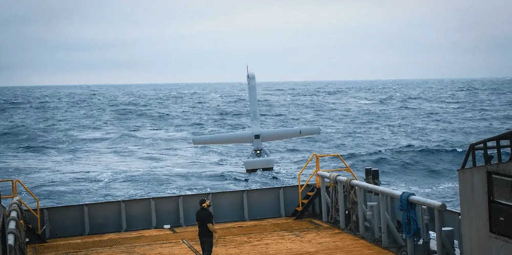
Kongsberg Geospatial has successfully conducted sea trials of the Shield AI V-BAT Unmanned Aerial System (UAS) on behalf of the Canadian Coast Guard, operating from a small cargo vessel far offshore in international waters.
The Canadian Coast Guard is conducting trials of the long-endurance Vertical Take-Off and Landing (VTOL) UAS surveillance system for possible deployment on Canadian Coast Guard Vessels under a project funded by Defence Research and Development Canada (DRDC).
The Shield AI V-BAT aircraft was selected due to its ability to combine VTOL from the small confines aboard ship with the long endurance of a fixed-wing aircraft while carrying multiple sensors.
Kongsberg Geospatial teamed with Shield AI to deploy the V-BAT VTOL UAS for a three-day sea trial in international waters in the Gulf of Mexico. The trials tested the capability of the aircraft to provide rapid launch and recovery, long endurance, and confined space take-off and landing from a moving vessel in a variety of weather conditions, during the day, and at night.
In addition to tracking and identifying other ships at long ranges, the flights conducted a variety of simulated missions designed to emulate real-world situations where the Canadian Coast Guard would use the drones, such as for locating and tracking dye patches that simulated wreckage or oil spills, and locating life preservers in choppy seas and in a variety of weather conditions.
The V-BAT operators used Kongsberg Geospatial’s IRIS UxS software to safely pilot the aircraft at long ranges from the launch vessel. The IRIS software provides a comprehensive situational awareness picture of the operational airspace, data from a variety of sensors and data feeds – and shows the location of other aircraft and surface ships, as well as the launch vessel and the ‘ownship’, or drone being operated.
Sensor data feeds from the cameras and sensors carried by the UAS were ingested, at real-time, into the Kongsberg Geospatial Modular ISR Data Analysis and Storage system (MIDAS). The MIDAS system records video and other data from the UAS, and serves as a ‘mission intelligence coordinator’ to view current and historical sensor feeds of the UAS within a temporal and geospatial context to increase sensor utilization effectiveness.
“While the sea conditions were perhaps a little rougher than expected, they were ideal for testing the launch and recovery capabilities of the V-BAT from a small ship under the kind of conditions you might expect during real operations,” said Rex Hayes, a retired US Navy and Coast Guard officer and the Director of Unmanned Systems at Kongsberg Geospatial. “We were also very pleased with the performance of IRIS and the MIDAS system when handling integrated sensor data feeds from extended missions.”
”We love supporting our allies. It will take strong partnerships – technological, military, and economic – to maintain stability during challenging times,” said Brandon Tseng, Shield AI’s cofounder and former US Navy SEAL. “Sharing tech like the V-BAT strengthens strategic relationships and contributes to global stability. Our recent engagement with the Canadian Coast Guard and Kongsberg exemplifies our commitment to ensuring our allies have the cutting-edge technology and products they need!”


