


Blue Marble Geographics has released the following article detailing the new features in version 23 of the company’s Global Mapper all-in-one GIS software. Global Mapper is ideal for geospatial analysis of data captured by UAVs unmanned aerial vehicles).
As an all-in-one GIS program, Global Mapper contains tools for creating, editing, and analyzing all types of data. From loading data from over 250 file formats, and exporting to more, to easily creating digital elevation models, contour lines, and viewshed areas, Global Mapper can be utilized across many different projects by students and GIS professionals at any level.
In Global Mapper v23, the program’s capabilities have been expanded to better handle data and provide more options for vector analysis, styling, and display. With numerous improvements and new tools in Global Mapper v23, some of the most significant new features include:
3D Labeling
The dynamic 3D Viewer in Global Mapper easily displays digital elevation models, vector features, point clouds, and more. Still, in version 23 vector features can be more effectively labeled when zooming and panning through rendered 3D data. Utilizing a dedicated label layer, vector feature labels created from custom text and feature attribute values can be displayed in the 3D Viewer in two ways.
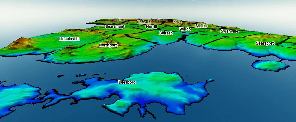
The first method for 3D labeling flattens the feature label into the displayed terrain or at the elevation of the vector feature. Comparable to the flat 2D label standard, the addition of the 3D label display increases visibility and readability of these flattened text features.
Using a background label stroke and a custom text color, flat 3D labels can be clearly seen.
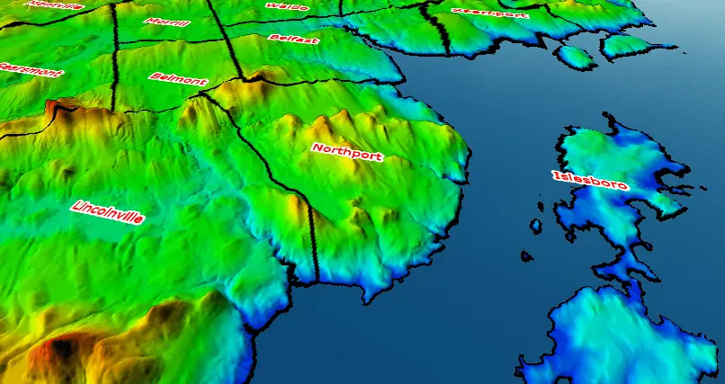
The second style for 3D labeling is a billboard style that renders the text features above the surface or feature, rotating them to always face the viewer. With options to use an outline for the billboard labels, this style clearly shows the location of the corresponding vector features looking over the terrain.
Rotating vertical text features always face the viewer and labels further from the camera fade into the background to emphasize the distance covered by the data.
Undo and Redo Functions
A frequently requested feature, undo and redo options have finally arrived in Global Mapper v23! Accessed from the Edit menu or with the keyboard shortcuts Ctrl+Z and Ctrl+Y, users can now easily undo many functions in the program, including but not limited to digitizing and layer creation.
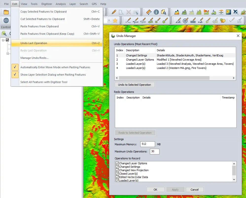
The Undo Manager dialog box shows the recent operations that can be undone and redone, and contains user settings to control which operations are tracked.
The Undo Manager includes lists of the recently executed operations that can be undone or redone. Use the keyboard shortcut, or select an item from the Undo Operations list and click to Undo Selected Operation to revert any data creation or modification to its previous state. Once undone, this procedure or action will be added to the Redo Operations list where it can be redone if necessary.
Expanded Spatial Operations Functionality
Building on an existing Global Mapper tool for vector feature analysis, Spatial Operations can now be applied to features of all geometry types. Points, lines, and areas can now be analyzed to find and create features based on their spatial relationships.

With expanded options, the Spatial Operations tool now allows users to choose the geometry types for the input and output features.
In the updated Spatial Operations dialog box, different predicates and operations will allow users to select the input layer geometry types and specify the output layer features as well. Depending on the operation or predicate chosen, certain combinations of input and output feature types will be accepted for the operation to run. Of course all of the improvements within this tool extend to the Spatial Operations Scripting option and Global Mapper Script workflows.
Vector Data Styling Updates
Continuing to improve the display of data in the map creation process, Global Mapper v23 expands the vector feature styling options with a new Classify option. This tool, found on the Point/Line/Area Styles tab of the Layer Options dialog box, classifies and styles vector features using numeric attribute values and statistical methods like Equal Interval, Quantile, and Natural Breaks (Jenks).
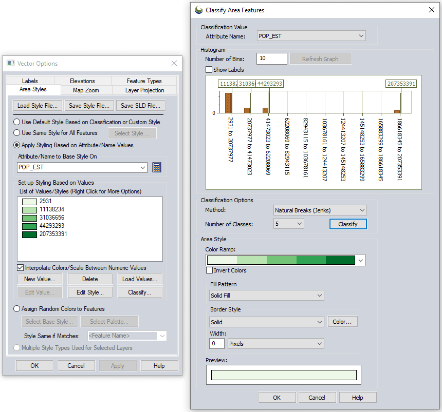
Through the Area Styles tab for this layer, a new dialog box offering numerous options for classifying features based on a range of numeric attributes is opened.
When setting up the classification and style for vector features a histogram of values is displayed and users can select and preview the number of classes and the classification method. Using either built-in or customized color ramps, this powerful new data visualization option provides users with complete control over the style of their choropleth maps.
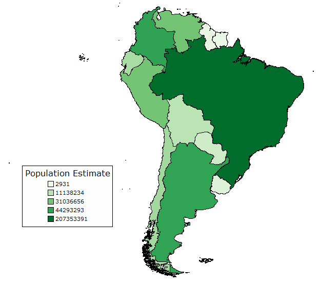
Using five classes and Natural Breaks, a choropleth map shows the population of South American countries.
With a wide-ranging set of professional tools, Global Mapper continues to evolve with new features and updates in every version.
Download a 14-day free trial of the software to explore these new tools in Global Mapper v23.


