

Powered by HYPACK-HYSWEEP mapping software, the NEXUS 800 operator can plan, acquire, and process the LiDAR and Photogrammetry data onboard a high powered Windows PC and high performance UAV allowing for rapid analysis, product creation and export to a variety of CAD and GIS formats.
The NEXUS 800:
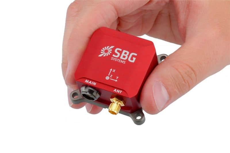
• Provides a full GNSS aided inertial navigation system with the Ellipse-D INS
• Visualizes LiDAR return with a 360 degree field of view
• Acquires LiDAR and Photogrammetric data using the powerful and user-friendly HYPACK-HYSWEEP software
• Displays Real-Time photogrammetry and Point Cloud viewing
• Provides Point Cloud and georeferenced photogrammetry correlation via post processing
• Includes an On-board Windows® PC for rapid data processing and product creation
• Allows volume computations and data analyses
• Includes a comprehensive full flight system, training and support