


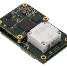
Quanta Plus
Quanta Plus combines a tactical MEMS IMU with a high-performance GNSS receiver to get reliable position and attitude in harshest GNSS environments and in surveying applications, where size and weight are critical. Its miniature OEM form factor, and stellar performances makes it the perfect tool for mapping applications where size and weight are a concern but also demand accurate and reliable measurement, such as UAV surveying near buildings, or backpack based mobile mapping.
Performance:
- Roll / pitch 0.015°, Heading 0.04° (RTK)
- Roll / pitch 0.01°, Heading 0.03° (PPK)
- RTK / PPK position performance: 1cm
- High resilience to harsh GNSS environments
Features:
- Best SWaP-C and stellar performance in harsh environments
- Built-in motion profiles that optimize the INS for each application
- Ethernet and PTP (or PPS) for easy integration with external sensors such as LiDAR
- Complete suite of integration tools for OEM (REST configuration API, compatibility with binary and ASCII protocols…)
- Enhanced performance with Qinertia PPK Software


