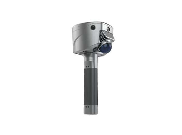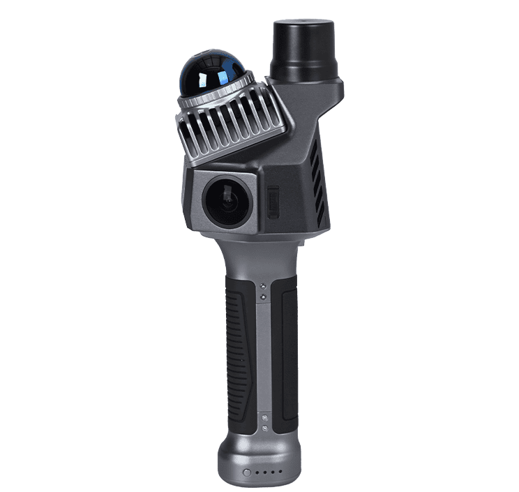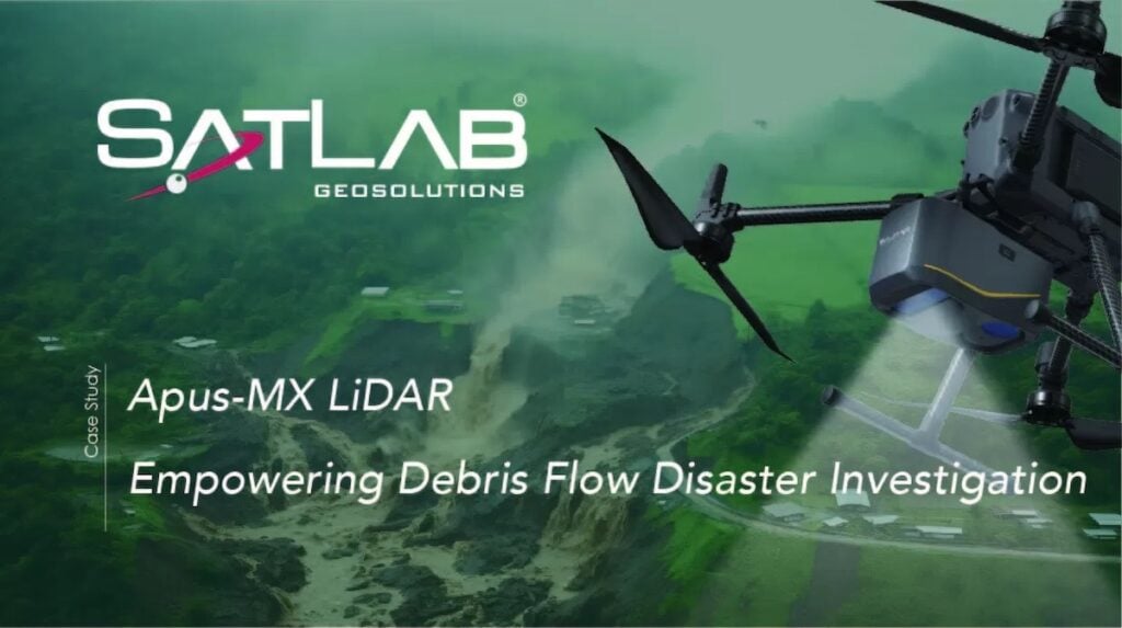
SatLab Geosolutions’ Apus-MX UAV LiDAR system, combined with Sat-LiDAR processing software, was deployed to support a debris flow disaster investigation in Chengdu, Sichuan Province, China.

Survey Area
Designed for efficient, high-accuracy data collection in difficult terrain, the system was used to gather critical information for risk evaluation and early warning measures following severe seasonal rainfall.
During the region’s flood season, multiple debris flow events affected mountainous areas due to intense rainfall, prolonged precipitation, and melting snow.
In response to directives from local authorities, a technical survey was launched to assess geomorphology, vegetation cover, surface deformation, and hydrological characteristics in two designated zones.
Area 1 spanned 0.5 km² with elevations ranging from 1,400 to 2,300 meters, while Area 2 covered 0.35 km² with elevations between 1,150 and 1,450 meters. Both sites were densely forested with thick undergrowth and complex vegetation layers.
Deployment Strategy & Technical Execution
Traditional survey methods were considered risky and unreliable due to the steep, forested slopes, unpredictable weather, and limited access. Furthermore, flight operations faced a nearly 1,000-meter elevation difference from available takeoff points to the highest parts of the terrain.

SatLab Apus-MX Mounted on the DJI M350
To overcome these constraints, a DJI Matrice 350 RTK drone integrated with the Apus-MX LiDAR was selected for its capability to conduct high-altitude flights and capture detailed data in remote and obstructed environments. A total of three ground-proximity flight missions were executed to ensure full area coverage.
The system operated with the support of RTK positioning and a CORS network for georeferencing. Sat-LiDAR software processed the collected point cloud data, enabling automatic generation of high-resolution outputs such as DEMs, DSMs, contour lines, and terrain classifications.
It also supported multi-phase volume calculations using a TIN grid, and included advanced tools for data accuracy inspection, strip adjustment, noise filtering, classification, and point cloud tiling.
Data Output & Results
The final results delivered an average point cloud density of 127 points per square meter, with ground points remaining dense and continuous even beneath thick vegetation. Accuracy was better than 2 cm, fully meeting the project’s technical requirements. The Apus-MX LiDAR system demonstrated a measurement range of up to 1200 meters at 60% reflectivity, with a laser pulse rate of 550,000 shots per second.
The Apus-MX LiDAR system—fully compatible with the DJI platform—provided safe, efficient, and non-contact data acquisition under difficult environmental conditions.
With Sat-LiDAR software delivering one-stop data processing and analysis, the solution enabled precise assessment of topography, deformation, vegetation, and hydrology in debris flow-prone areas, supporting effective disaster monitoring and mitigation planning.