Showcase your capabilities
If you design, build or supply Multispectral Cameras, create a profile to showcase your capabilities and connect with visitors who have an active requirement for your solutions.


Multispectral cameras for drones and Unmanned Aerial Vehicles (UAVs) capture image data across discrete spectral bands to support remote sensing, inspection, mapping, and ISR operations. Designed for integration with multirotor and fixed-wing UAV platforms, a multispectral drone camera enables vegetation analysis, material classification, moisture detection, and concealed object identification beyond standard RGB imaging capabilities.
This page showcases leading multispectral camera manufacturers, offering RGB, red edge, NIR, and SWIR sensing.
Read the Technology Overview
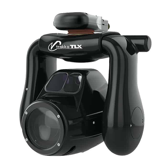
Multi-Sensor Imaging Gimbals, Searchlights and VMS Software for Air, Land & Maritime Platforms
High-Performance Remote Sensing Solutions for Delivering Accurate Aerial Insights

Advanced Imaging & Sensor Autonomy for Time-Critical Airborne Intelligence Missions
If you design, build or supply Multispectral Cameras, create a profile to showcase your capabilities and connect with visitors who have an active requirement for your solutions.

Multispectral drone cameras have altered remote sensing protocols across agricultural, industrial, and defense sectors by capturing data beyond the limitations of human vision. By capturing image data across multiple discrete wavelengths, a multispectral camera allows operators to identify vegetation stress, moisture content, material composition, and concealed objects that remain undetected by standard RGB cameras.
Optimized for Size, Weight, and Power (SWaP) constraints, a high-performance multispectral camera for drone deployment integrates into small multirotor platforms, fixed-wing aircraft, and tactical unmanned systems to deliver repeatable, data-driven analytics.
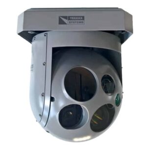
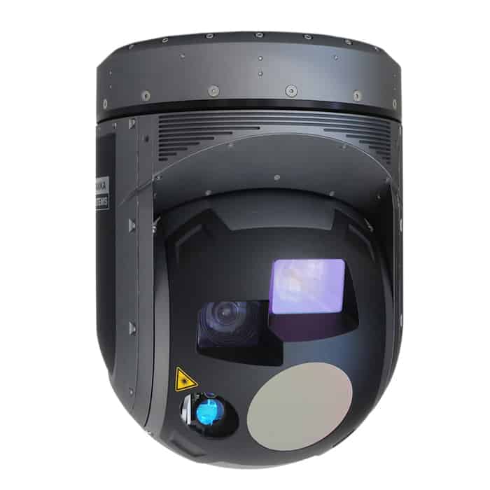
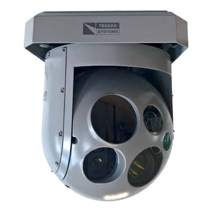
TrakkaCam SWE-400 QUAD multispectral camera by Trakka Systems
A multispectral imaging system operates by splitting reflected or emitted light into distinct spectral bands. Unlike hyperspectral systems, which record continuous narrow bands, dedicated configurations for multispectral imaging capture focused, non-continuous sections of the electromagnetic spectrum.
The selection of specific electromagnetic wavelengths allows targeting data acquisition to serve distinct engineering and environmental analysis objectives.
Deploying the correct combination of these bands ensures that data capture matches the physical properties of the surveyed target area.
Every material reflects, transmits, and absorbs light uniquely. This variance forms a distinct spectral signature. By processing data across multiple bands, software algorithms classify materials, diagnose system defects, or detect hidden assets. These characteristics allow operators to identify anomalies with greater accuracy than visible imaging alone.
To achieve scientific and defense-grade repeatability, raw data must undergo radiometric calibration to convert raw pixel tallies into true reflectance values. A professional drone multispectral camera features standardized hardware mechanisms to isolate external illumination variables:
This hardware combination ensures that data captured across different days, times, and cloud conditions remains directly comparable for long-term trend analysis.
Spatial resolution is governed by Ground Sampling Distance, which is the real-world distance represented by the center point of two consecutive pixels. Lower GSD values provide higher spatial resolution and improved target discrimination. Spatial resolution is influenced by flight altitude, focal length, and sensor resolution. A standard UAV multispectral camera provides higher resolution than satellite platforms due to low-altitude operation and flexible mission planning.
Precision agriculture is a primary market for a multispectral drone sensor. It allows for the calculation of advanced vegetation indices like the Normalised Difference Vegetation Index (NDVI) and the Normalized Difference Red Edge index (NDRE) to highlight spatial variations in crop vigor, water stress, and nitrogen levels.
Integrating a dedicated multispectral imaging sensor allows environmental tracking teams to monitor forestry analysis, wildfire recovery assessment, wetland mapping, habitat monitoring, and invasive species detection.
Industrial inspectability requires finding hidden flaws before they cause systemic failure. Budgets are optimized when operators deploy specialized multispectral cameras for drones to inspect powerlines, pipelines, solar farms, railways, and industrial facilities. Spectral imaging reveals corrosion, moisture intrusion, vegetation encroachment, and material degradation that is invisible in RGB imagery. Solar inspection is a highly relevant application, with multispectral and thermal datasets helping operators identify damaged photovoltaic cells and electrical inefficiencies.
Defense organizations may use a dedicated multispectral UAV camera for intelligence, surveillance, and reconnaissance operations. Spectral imaging can reveal disturbed earth, concealed infrastructure, camouflage materials, and hidden vehicles. Modern ISR architectures combine EO, IR, and multispectral sensing within unified payload systems to improve situational awareness and perform multi-spectral threat detection.
Research organizations often use multispectral drone cameras to conduct geological mapping, hydrology studies, archaeological surveys, and ecosystem analysis. The technology enables remote sensing over difficult terrain at low operational cost. Geological applications include mineral identification, erosion analysis, and soil composition mapping, while archaeological surveys can reveal buried structures and historical landscape features.
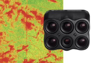
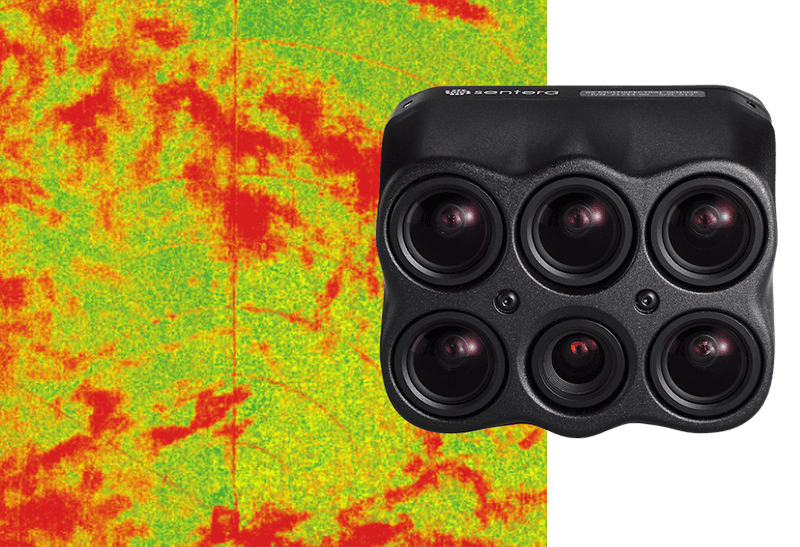
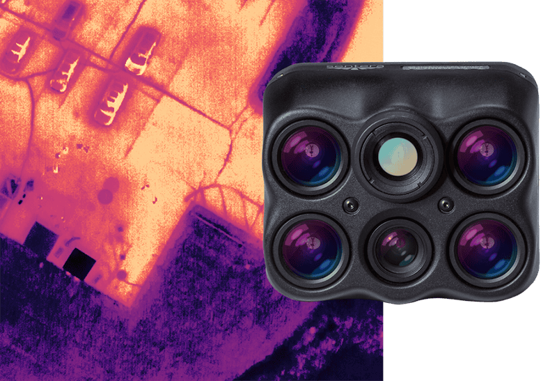
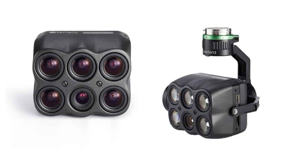
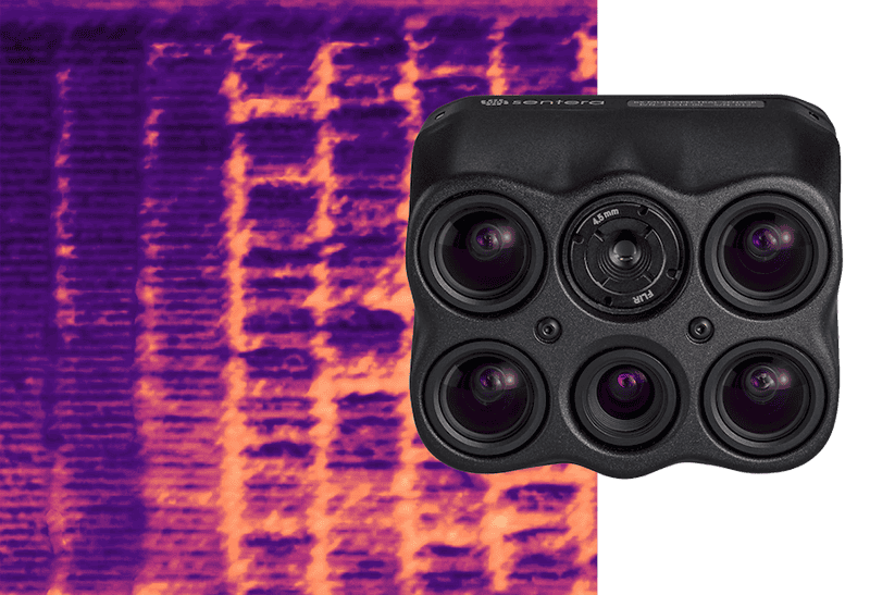
6X Multispectral imaging sensor by Sentera Sensors & Drones
Climate researchers typically use multispectral drone sensors to monitor coastal erosion, glacier retreat, flooding, vegetation health, and carbon distribution. Repeated UAV surveys allow scientists to track environmental change with spatial accuracy. The combination of UAV multispectral imaging and satellite remote sensing is used for climate resilience, conservation planning, and disaster response operations.
Modern UAV multispectral cameras rely on Complementary Metal-Oxide-Semiconductor (CMOS) architectures due to their readout speeds and minimized power draw. For SWIR sensing, integration teams utilize specialized Indium Gallium Arsenide (InGaAs) focal plane arrays. Hardware selection depends on sensitivity, noise performance, frame rate, spectral response, and SWaP requirements.
Multispectral optics must maintain image quality across multiple wavelengths while minimizing distortion and chromatic aberration. Systems often use coated optics and low-dispersion materials for improved spectral accuracy. Optical design directly influences field of view, spatial resolution, and light collection efficiency.
System designers separate incoming light into discrete wavelength bands using specialized optical routing methods.
Choosing between these filtering methods depends on whether the target application favors physical payload minimalism or absolute radiometric purism.
Multispectral imaging produces large datasets that require high-speed onboard storage and reliable data interfaces. Industrial SSDs and removable solid-state media are used. Payloads utilize Gigabit Ethernet, USB 3.0, and PCIe interfaces for rapid image transfer and onboard processing integration.
Embedded GNSS receivers geotag captured imagery for mapping, GIS integration, and orthomosaic generation. Many systems incorporate RTK or PPK positioning for centimeter-level accuracy. Precise geolocation is critical for engineering surveys, precision agriculture, and long-term environmental monitoring.
IMUs provide orientation and motion data used for image stabilization and accurate georeferencing. Tight GNSS and IMU integration improves mapping consistency and payload synchronization. Higher-end payloads use tactical-grade inertial systems to improve performance in GNSS-degraded environments.
Integrating a multispectral payload into unmanned platforms relies on a specific set of standard data connections.
These physical and electrical protocols ensure deterministic control over command logging, data transfer, and flight telemetry alignment.
Autopilot synchronization ensures consistent image overlap and precise timing during mapping and survey missions. Integration between payloads and flight controllers improves mission repeatability and autonomous data collection performance.
When evaluating a specific multispectral UAV payload for deployment, technical specifiers utilize a rigorous set of criteria to cross-reference capabilities with operational requirements.
| Parameter | Description |
|---|---|
| Spectral Resolution | Defines how precisely the sensor can distinguish between nearby wavelengths. Higher spectral resolution improves material discrimination and analytical capability. |
| Spatial Resolution | Determines the smallest detectable feature within the imagery to improve target identification and inspection detail. |
| Frame Rate and Capture Speed | High frame rates improve image overlap and support high-speed UAV operations, multispectral video, and persistent surveillance applications. |
| Dynamic Range | Evaluated in decibels, this defines the camera ability to capture detail in both shadows and highly reflective highlights within a single scene. |
| Radiometric Sensitivity | Determines the camera ability to detect differences in reflected energy across spectral bands. |
| Accuracy and Repeatability | Consistent and repeatable measurements are required for long-term monitoring, precision agriculture, and scientific analysis. |
| Calibration Stability | Stable calibration performance ensures reliable spectral measurements across changing environmental conditions and long-duration deployments. |
| Data Throughput and Storage Capacity | High-resolution multispectral imaging generates datasets that require high-bandwidth storage and processing architectures. |
| Latency Considerations for Real-Time Applications | Low-latency processing is used for ISR, tactical reconnaissance, and time-sensitive inspection workflows. |
Reviewing this performance checklist allows procurement teams to secure appropriate payload hardware matching their analytical tolerances.
Hyperspectral systems capture hundreds of narrow, continuous spectral bands, while multispectral cameras capture a smaller number of broader, discrete bands. Multispectral payloads offer lower SWaP requirements, lower cost, simpler data processing, and direct integration for UAV platforms.
Thermal cameras detect emitted heat energy, while multispectral systems primarily analyze reflected light. The technologies are complementary and are combined in industrial and defense payload architectures to capture both material and thermodynamic changes.
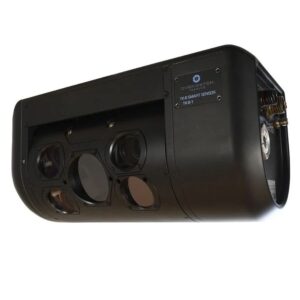
TK-8 multispectral imaging system by Overwatch Imaging
LiDAR generates three-dimensional spatial measurements, while multispectral systems provide spectral and material information. Many UAVs combine LiDAR and multispectral sensing to create environmental datasets that feature both structural and spectral integrity.
Several technical breakthroughs are currently redefining how industrial multispectral drone sensors are engineered and deployed on unmanned platforms:
These developments will continue to lower operational friction while accelerating data ingestion times across complex deployment environments.

 Searching Companies & Products


 Subscribe to the Weekly eBrief
The latest engineering and technical developments straight to your inbox - join thousands of engineers who receive it.
Subscribe to the Weekly eBrief
The latest engineering and technical developments straight to your inbox - join thousands of engineers who receive it.