Sentera Sensors & Drones

verified This business has been claimed by Sentera Sensors & Drones and verified by UST.
Verified companies work with us to ensure we display the most up-to-date and comprehensive product information, articles and other material to help you choose the right solution for your requirements.
High-Performance Remote Sensing Solutions for Delivering Accurate Aerial Insights United States of America
Visit Website
Saved
Save
Contact
Sentera Sensors & Drones

High-Performance Remote Sensing Solutions for Delivering Accurate Aerial Insights

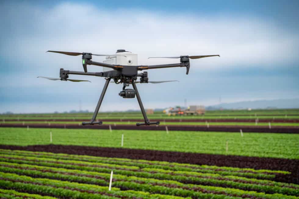
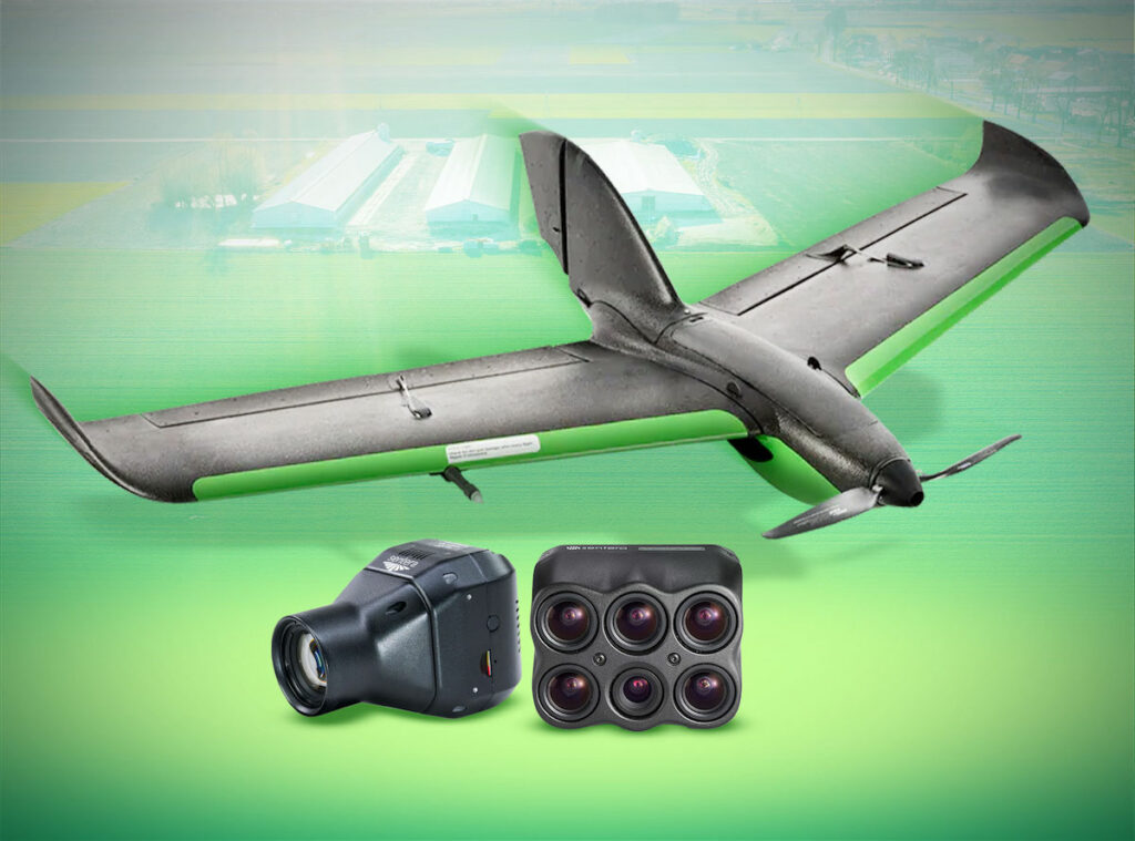
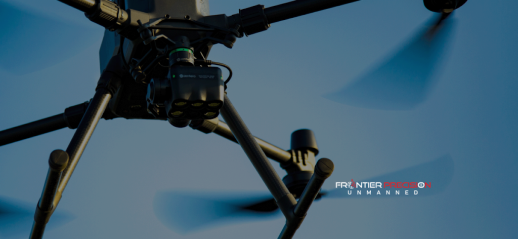
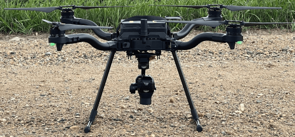
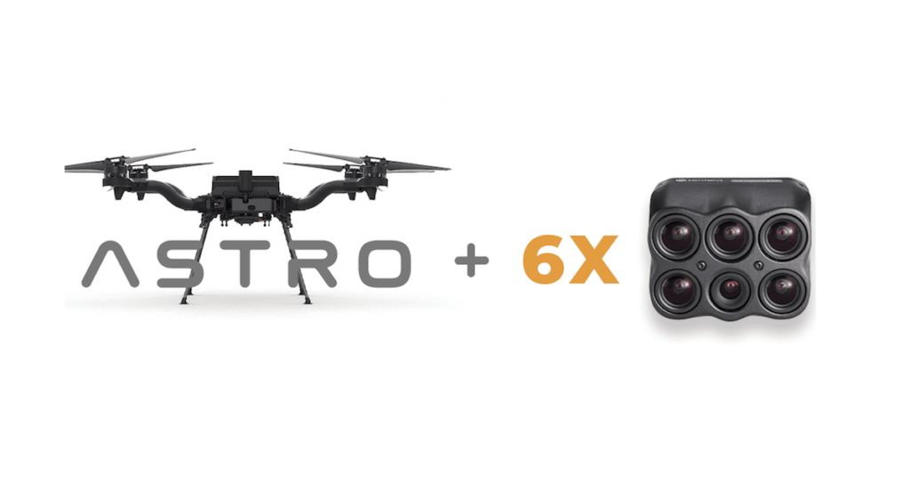
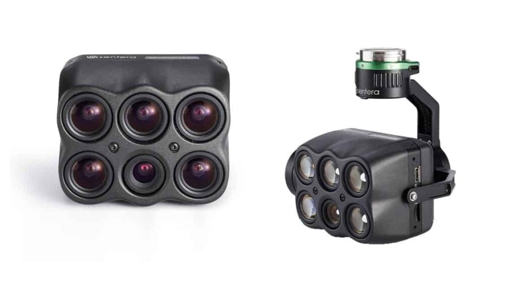
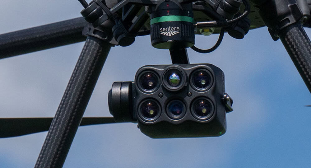
Sentera Sensors & Drones is at the forefront of remote sensing technology, offering a comprehensive range of advanced sensors designed for precision, reliability, and adaptability. Their products deliver high-resolution imagery and data across diverse environments, empowering professionals in agriculture, land management, infrastructure, and research to make more informed decisions.

Backed by decades of industry expertise, Sentera’s solutions are engineered to integrate seamlessly into existing systems and workflows, enhancing productivity while maintaining the highest standards of data accuracy and repeatability.

Sentera sensors for aerial insights

Sentera Sensor Solutions

6X Series Sensors

The ultimate solution for high-res RGB and accurate radiometric multispectral and thermal imagery

Sentera 6X multispectral UAV sensors

The Sentera 6X Series of multispectral UAV sensors provides six imagers in a compact and ultra-lightweight package, offering class-leading performance and science-grade multispectral data acquisition.

These sensors capture synchronized radiometric multispectral, thermal and high-resolution RGB imagery, suitable for advanced analytics, all in one single sensor and one flight. Leveraging a gimbal for stabilization, high-dynamic range, low-noise sensors with premium-quality optics, and an optimized reflectance calibration process.

The series features three different models, providing high-precision solutions for a wide range of data acquisition requirements. All models are provided with Sentera’s Calibrated Reflectance Panel and Incident Light Sensor. These allow the system to be radiometrically calibrated to account for lighting variations, thus ensuring superior imaging accuracy.

The 6X Series sensors maintain performance across diverse environmental conditions and across various use cases.

Sentera 6X Thermal Sensor

Sentera 6X Thermal

Synchronized thermal, multispectral, and high-resolution RGB imagery in one flight

High-resolution multispectral, RGB, and a FLIR Radiometric Boson 320 thermal imager for morecomprehensive data collection, ideal for thermal mapping and water stress detection.

  • Four 3.2MP global shutter multispectral imagers (Red, Green, Near Infrared, Red Edge).
  • One 20MP RGB imager.
  • One FLIR Boson 320 radiometric thermal imager.
  • NDAA Compliant
  • Ideal for thermal mapping, vegetation health, residue cover, moisture, stand count, thermalinspection, water stress, & carbon monitoring

Sentera 6X Thermal Pro Sensor

Sentera 6X Thermal Pro

Synchronized multispectral, high-resolution RGB, and advanced thermal data in a single flight

Ideal for research, land management, and infrastructure inspections, it empowers professionals tomake informed decisions with precise, detailed data.

  • Four 3.2MP global shutter multispectral imagers (Red, Green, Near Infrared, Red Edge)
  • One 20MP RGB imager
  • One FLIR Boson 640 radiometric thermal imager
  • NDAA Compliant
  • Ideal for thermal mapping, vegetation health, evaporation analysis, moisture, stand count, thermalinspection, water stress, & carbon monitoring

Sentera 6X Multispectral Sensor

Sentera 6X Multispectral

High-res RGB and accurate radiometric multispectral imagery

Ideal for season-long vegetation analysis utilizing science-grade, accurate radiometric multispectral imagery and high-resolution RGB.

  • Five 3.2MP global shutter multispectral imagers (Red, Green, Near Infrared, Red Edge, Blue)
  • One 20MP RGB imager
  • NDAA compliant & Blue UAS approved
  • NDAA Compliant
  • Ideal for mapping, phenotyping, vegetation health, stand count, weed pressure, senescence, biomass, uniformity

Calibrated reflectance panel for multispectral drone data accuracy

Sentera Calibrated Reflectance Panel

Sentera’s Calibrated Reflectance Panel is designed to support radiometric calibration for multispectral drone-based imaging workflows. Providing a stable and uniform reflectance surface across both visible and near-infrared spectral ranges, it enables users to characterize data capture conditions and normalize the reflectance values of multispectral datasets. This ensures more dependable analysis outputs for mapping, monitoring, and remote sensing operations.

Purpose-built for compatibility with Sentera’s 6X Series Sensors, the reflectance panel also integrates seamlessly with the DJI Mavic 3Multispectral and a wide range of third-party imaging systems.

Why Capture Rate Matters

Unlock the Full Potential of Your Drone Missions with the Sentera 6X Sensor Series

Discover how the 6X Sensor Series transforms aerial operations by maximizing speed and coverage with an industry-leading capture rate. Sentera’s white paper, Why Increasing Capture Rate Matters, dives deep into how faster capture rates eliminate pre-flight complexities and expand mapping potential.

65R Sensor

Global Shutter High Resolution Aerial Imagery

The Sentera 65R Sensor offers 65-megapixel global shutter RGB imagery optimized for drone operations. Its compact, lightweight design extends flight times, enhancing efficiency. With a resolution of 9344 x 7000 pixels, 3 FPS capture rate, lens variants, and live video, it ensures exceptional detail.

Sentera 65R Ultra-high-resolution aerial imaging sensor

Sentera 65R Survey Sensor for Ultra-High Resolution Aerial Imaging

The 65R, offers plug-and-play compatibility with popular drone platforms, making it ideal for surveying, mapping, inspection, and analytics. It empowers professionals to make informed decisions with high-resolution data, significantly reducing the number of images needed for comprehensive coverage.

Software Solutions

Sentera’s cutting-edge drone payloads can be complemented by advanced software packages to form end-to-end solutions for precision agriculture and agronomics professionals.

Sentera software for precision agriculture

FieldAgent™ – a complete crop analytics and visualization platform that turns drone imagery into actionable insights, resulting in improved yields and research outcomes

SMARTSCRIPT™ Weeds – a targeted spray solution that quickly maps and identifies weeds and provides customized herbicide prescriptions for optimized control

Custom Sensor Development

9 Band Sentinel 2B Replica CameraSentera provides custom sensor development to suit unique client requirements, focusing on precision agriculture applications. Bespoke solutions can be created for virtually any remote sensing needs and to fit any drone platform.

Examples of custom sensors created by Sentera include:

  • A gimballed sensor package that collects data that accurately replicates the nine spectral bands utilized by the Sentinel 2B satellite
  • A low-SWaP quad-band multispectral camera with 5MP resolution for DJI M300 and M600 drones

Contact Sentera today to discuss your requirements for custom UAV sensor development.

Sentera Partner Program

The Sentera Partner Program provides access to the latest drone and sensor technologies, enabling you to grow your business and deliver unmatched results to your clients. In addition to keeping you at the leading edge of innovation, Sentera also provides the support you need to get the most out of the company’s state-of-the-art solutions.

Benefits of joining the Sentera Partner Program include:

  • Competitive pricing on Sentera products and services
  • Early access to new products & promotions
  • Partner portal with comprehensive resource library

To find out more about partnering with Sentera, get in touch today.

Products

6X Thermal

Synchronized Thermal, Multispectral, and High-Resolution RGB Imagery in One Flight

6X Thermal Pro

Synchronized multispectral, high-resolution RGB, and advanced thermal data in a single flight

6X Multispectral

The ultimate solution for high-res RGB and accurate radiometric multispectral imagery

65R

Global Shutter High-Resolution Sensor Payload for Mapping, Modeling, & Surveying

Articles

Latest
Cutting-Edge UAV Remote Sensing Solutions for High-Accuracy Aerial Insights

Sentera's products deliver high-resolution imagery and data and are engineered to integrate seamlessly into existing systems and workflows

May 26, 2026
Runway Pavement Assessment Using the Sentera 65R Camera

The Sentera 65R camera, integrated with the IF800 Tomcat multirotor UAS and gNext software, enables high-resolution aerial imagery for automated analysis of pavement conditions in runway assessment

Feb 05, 2026
Advanced Aerial Imaging Capabilities Boosted by New Agriculture Technology Merger

John Deere’s acquisition of Sentera enhances drone-enabled precision agriculture, integrating advanced aerial imaging and analytics to improve farm efficiency, sustainability, and data-driven decision-making

May 29, 2025
Developer of High-Precision Agricultural Sensors Joins the Thermal by FLIR Program

Sentera’s 6X Thermal Series, now part of the Thermal by FLIR program, delivers high-precision thermal imaging solutions for mapping, analysis, and diverse industry applications using unmanned aerial systems

Apr 02, 2025
Sentera Sensor Supports Multispectral Crop Monitoring with UAV Integration

Sentera features the use of its 6X Multispectral sensor, integrated with UAV platforms, for early-stage crop monitoring and actionable precision agriculture insights

Dec 10, 2024
Agricultural Drone Solutions Advanced with New Collaboration

Drone Nerds has partnered with Sentera to expand its range of agricultural and industrial drone solutions, adding Sentera's PHX fixed-wing drone and multispectral sensors to its offerings

May 24, 2024
Sentera Partners with Frontier Precision to Expand Drone Sensor Distribution

Sentera has formed a strategic partnership with Frontier Precision, appointing the company as an authorized reseller of its drone sensing solutions to support wider distribution across global industries

May 10, 2024
Sentera Integrates Cameras onto Inspired Flight’s Drone Platform

Sentera's 6X Multispectral and 65R ultra-high-resolution RGB sensors are now compatible with Inspired Flight Technologies' IF800 Tomcat and IF1200 drone platforms

Mar 15, 2024
Sentera Expands Aerial Sensor Versatility Through Gremsy Interconnect Compatibility

New integration for 6X & 65R sensors streamlines high-resolution data collection across diverse drone platforms

Dec 15, 2023
Sentera Integrates 65R Ultra-High-Resolution Sensor with Astro UAV Platform

Sentera expands integration with Freefly Systems by adding the 65R sensor to the Astro platform, enabling high-resolution imaging, rapid sensor interchange, and support for mapping, agriculture, and infrastructure applications

Sep 08, 2023
Sentera Expands High-Precision Analytics Through New Hardware Compatibility

The 6X multispectral sensor now integrates with the Astro platform to deliver science-grade data and plant-level measurements for agricultural researchers

Apr 21, 2023
Next-Generation Multispectral Sensor Features Real-Time Processing

Sentera has announced the launch of the 6X, a new multispectral sensor designed for unmanned aerial system (UAS) precision agriculture,...

Nov 19, 2019

Webinars

Watch anytime
Capturing the Sharpest Aerial Imagery with the 65R
Sentera
Nov 30, 2022
Regional Offices & Locations
Sentera Sensors & Drones United States of America 767 N. Eustis St., Ste 120, St. Paul, MN 55114 +1 612-204-2000 Contact Website
Advancing Unmanned Systems Through Strategic Collaboration UST works with major OEMs to foster collaboration and increase engagement with SMEs, to accelerate innovation and drive unmanned systems capabilities forward.