Showcase your capabilities
If you design, build or supply Inspection Software, create a profile to showcase your capabilities and connect with visitors who have an active requirement for your solutions.


Find developers of Drone Inspection Software including artificially intelligent AI software for aerial inspection of power lines and infrastructure using unmanned aerial vehicles; UAV, UAS
Read the Technology Overview
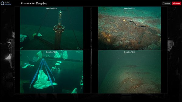
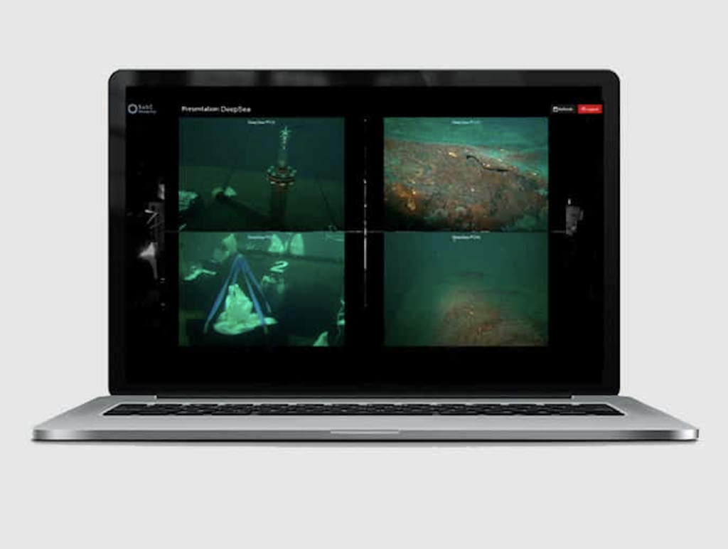
Robotics and Subsea Technologies for Defense, Commercial & Science Applications

Onboard Video Processing Software and Hardware for Unmanned Systems
AI-Powered Autonomous Drone Solutions for Public Safety, Defense, and Industrial Inspection
If you design, build or supply Inspection Software, create a profile to showcase your capabilities and connect with visitors who have an active requirement for your solutions.

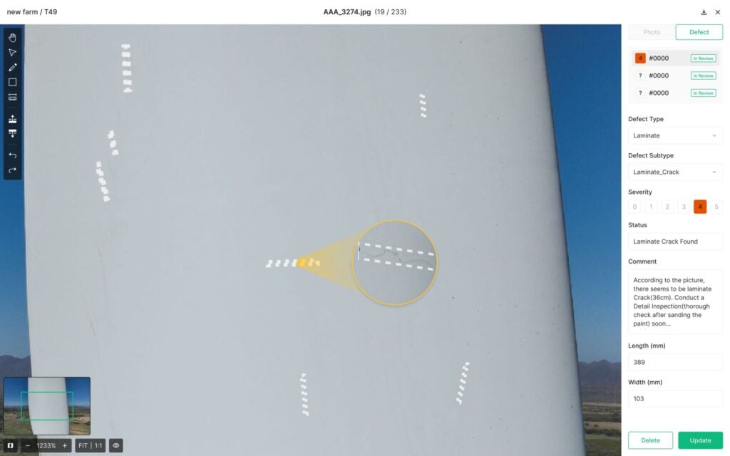
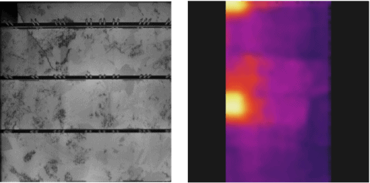
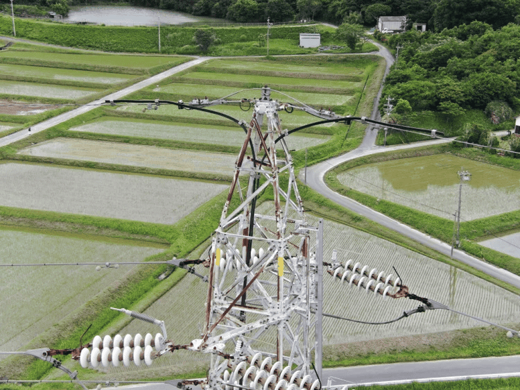
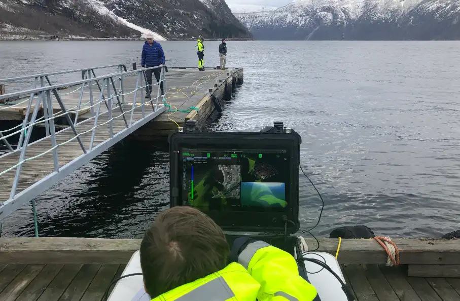
UAVs (unmanned aerial vehicles) and drones equipped with optical and thermal cameras are used to inspect a wide variety of assets, including buildings, roofs, roads, railways, power lines, solar farms and wind turbines. These inspections produce large volumes of data, particularly images and videos.
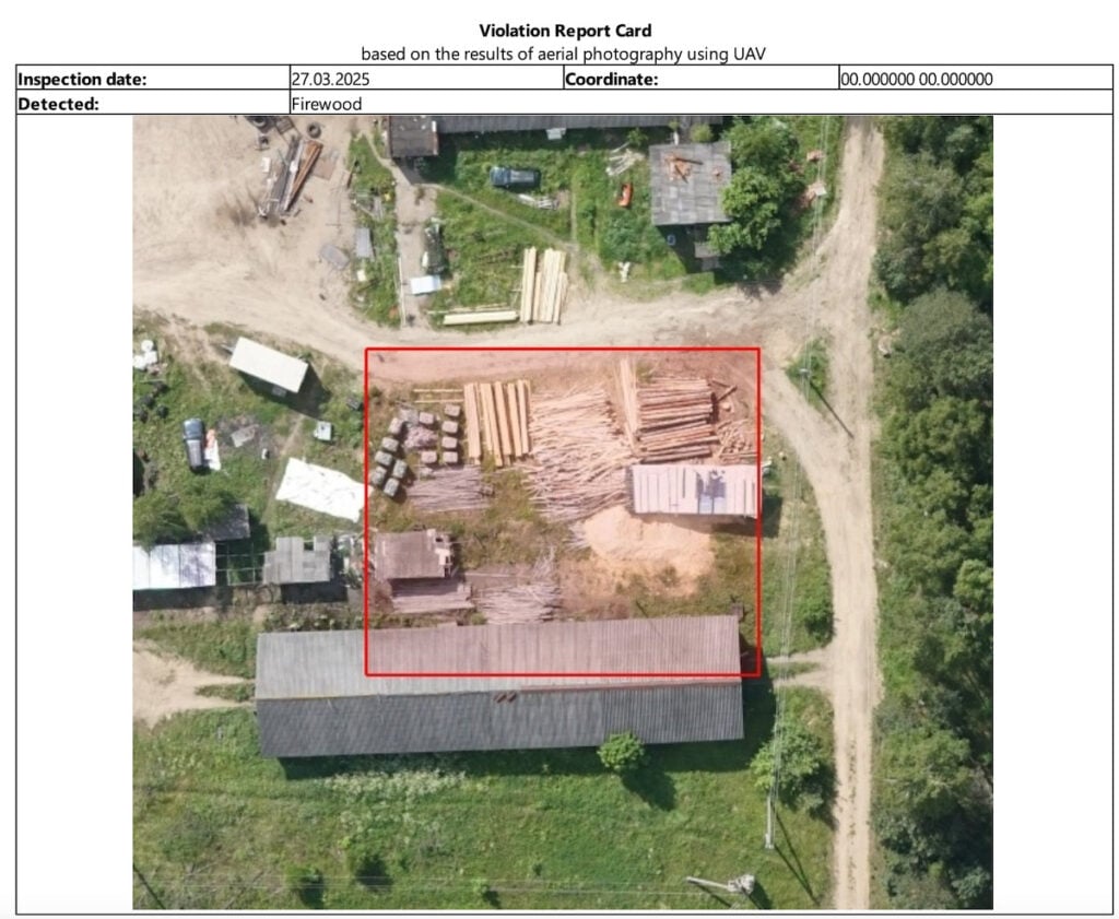
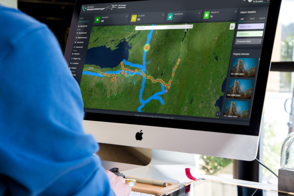
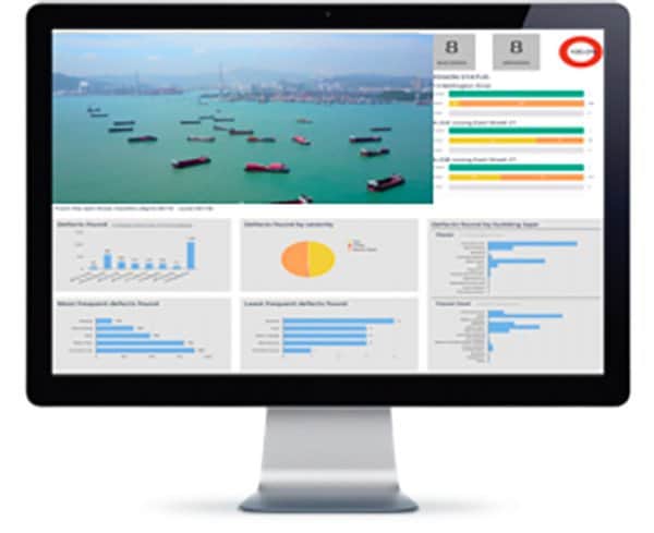
Drone inspection software provides a solution for, capturing, managing and organizing this data. It may provide features such as geotagging or the ability to annotate items and classify them according to particular criteria. The software may also be able to generate reports according to customizable templates, and this process may be partially or completely automated. Integration with other software, such as asset management or GIS (geographic information systems) packages, may be possible.
AI-Powered Analytics Software by H3 Dynamics
Artificial intelligence (AI) capabilities may be built into the software that provide automated detection and grading of faults and potential issues, such as cracks in roads or turbine blades. This process can save a significant amount of time compared to manual inspection of images and video by a human operator, thus making inspections more cost-effective and efficient.
UAV inspection software may be installed on local machines, or be cloud-based for remote access in the field by laptops, mobile phones and tablets. Some software developers may offer the option of cloud access to their facilities, or installation on local servers to create a completely in-house capability. The software may be provided with a subscription package, with scalable options based on number of pictures, videos, or inspected assets.
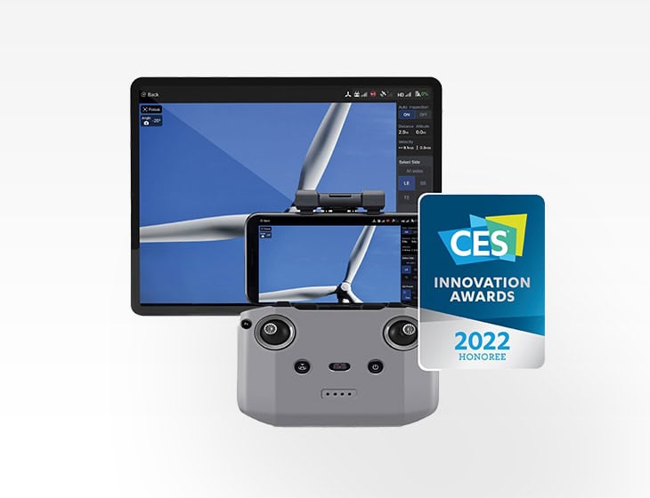
In addition to handling data, aerial inspection software may also provide the ability to control the drones themselves. This may include mission planning and selecting routes and waypoints on a map interface. The software may provide real-time tracking for inspection drone fleets, as well as real-time HD video streaming from the onboard cameras.

 Searching Companies & Products


 Subscribe to the Weekly eBrief
The latest engineering and technical developments straight to your inbox - join thousands of engineers who receive it.
Subscribe to the Weekly eBrief
The latest engineering and technical developments straight to your inbox - join thousands of engineers who receive it.