


Drone LiDAR
Discover cutting-edge solutions from 4 leading global suppliersWarren Community College and NJ TRANSIT have worked together to efficiently and accurately map a train tunnel using airborne LiDAR packages specifically designed for unmanned aircraft systems.
In the following article, the team at Warren Community College detail the successful collaboration and the project, which employed the Elios 3 unmanned system to create a LiDAR point cloud of the Roseville Tunnel.
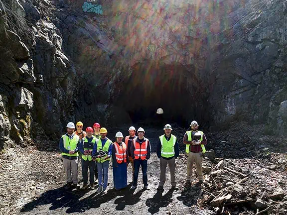
The full crew consisting of WarrenUAS students and staff and personnel from NJ Transit stand at the mouth of the tunnel.
NJ TRANSIT needed to create a visual record of a 100-year-old stone train tunnel in Byram Township (Sussex County). Prior to commencing reconstructive work that would fortify the structure with concrete and change the look of the original design, data collection was required so that an existing train line could be revived and expanded. That was easier said than done for a variety of reasons. Previously NJ TRANSIT had worked with Warren Community College and its drone program on another project involving the roof of Newark’s Penn Station.
The Penn Station project worked out so well that when NJ TRANSIT needed help on the tunnel project, it again turned to WarrenUAS.
“Before the Roseville rail tunnel project, we first worked on another challenge with Warren – the precise mapping of the roof of Newark Penn Station,” explained Andy Schwartz, Sr. Director – Radio, Security, & UAV Systems for NJ TRANSIT.
“This was a great project that showcased Warren’s ability to conduct flight operations in a dense urban environment while using precision location technology called Aeropoints to create an accurate orthomosaic map of the roof of the building. The map was used by NJ TRANSIT engineers as part of a renovation project that included the repair/replacement of skylights. The map, given the use of Aeropoints, was also accurately imported into NJ TRANSIT’s GIS imagery database. Given the success of that project and learning that Warren possessed a special drone with LiDAR for scanning confined spaces, I thought that the Roseville Tunnel project would be an excellent place to try the Elios 3 system to create a LiDAR point cloud of the tunnel interior and the two portals.”
And so, earlier this year a team from Warren Community College consisting of staff and students, used a specialized drone to map the inside of the tunnel with a LiDAR (Light Detection and Ranging) scanner. The highly accurate LiDAR uses laser pulses bouncing off the surface of the structure to create millions of points in 3-dimensional space that will allow the team to render an extremely accurate and measurable 3D reproduction of the tunnel.
“The scope of work involved was challenging,” said Peter Miller, Unmanned Systems Specialist and Flight Operations Manager for the College. “With our high-tech equipment though we were up to that challenge.”
NJ TRANSIT first became aware of Warren – and its abilities – through a common UAS vendor, Censys Technologies. As both organizations were working to add the Sentaero to their fleets, Schwartz met Dr. Will Austin, Chief Pilot at Warren as they began to work through similar procurement processes and training endeavors.
“I reached out to Dr. Austin and learned about the amazing UAS program that they had established at Warren,” said Schwartz. “Given we both were acquiring the same aircraft, we agreed to work/train together, when possible, to benefit both organizations. Warren had the technical/academic expertise in UAS operations – along with a deep tool bag of UAS solutions – and NJ TRANSIT had the real-world environment that could benefit from the application of UAS technology. It was during a few visits to the College that we had discussions about real-world projects that would be of mutual benefit to both Warren and NJ TRANSIT.”
The tunnel, which is located off of Roseville Road in Byram Township, is part of an 8-mile extension of NJ TRANSIT’s Morristown line. The Roseville Tunnel is between the existing NJ TRANSIT line at Port Morris and the planned site of the Andover Station. The previously abandoned tunnel and rail line, known as the “Lackawanna Cutoff,” has been inactive for almost 50 years.
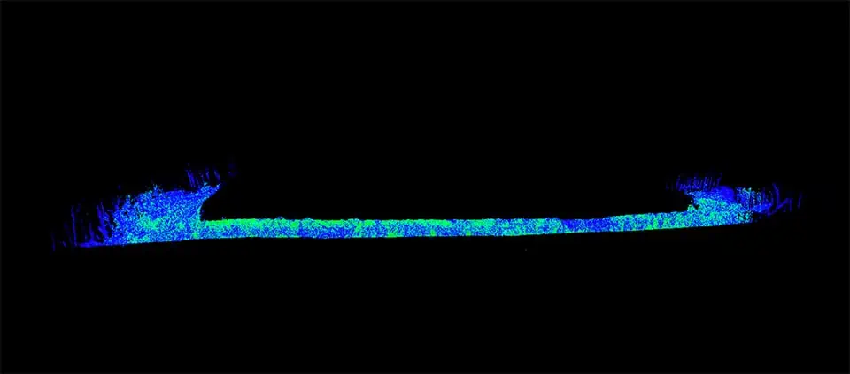
The full point Cloud, when viewed from the side, illustrates the proportion and vast length of the tunnel that was scanned.
“Mapping the NJ TRANSIT tunnel was an interesting mission,” said Amanda Moberg, Senior Lab Associate at Warren. “Adam Kyle (Warren instructor) and I took the College’s Capstone class out to the tunnel and used the Flyability Elios 3 drone to capture a LiDAR point cloud map of the tunnel.” Moberg noted that a normal camera was not a viable option due to insufficient light inside the tunnel.
“Once the map was processed,” said Moberg, “the point cloud showed the interior texture of the tunnel walls, including the difference between the raw stone portions and a section that had been reinforced with concrete. One of the Capstone students who was with us that day, Jacob Heimo, and who is one of two WarrenUAS students completing an internship with NJ TRANSIT, is currently working on extracting measurements from that point cloud map for use on the tunnel construction project.”
“It’s been quite the transition from being a student to working on the inside (of this project),” said Heimo, who reeled off a host of technical aspects of the project that he has been involved with. “It’s like watching science fiction coming to fruition. Working with NJ TRANSIT has been an exceptional opportunity for me.”
Saad Abdelhady was another Capstone class student who worked on the tunnel project. The significance of being a part of such an important part of the project is not lost on him; “By getting to use some of our advanced systems in real world applications, it really showed how powerful and how fast technologies are advancing,” he said. “Learning and using the systems to understand how we can help others benefit and the wide variety of uses in the field” were all part of the process.
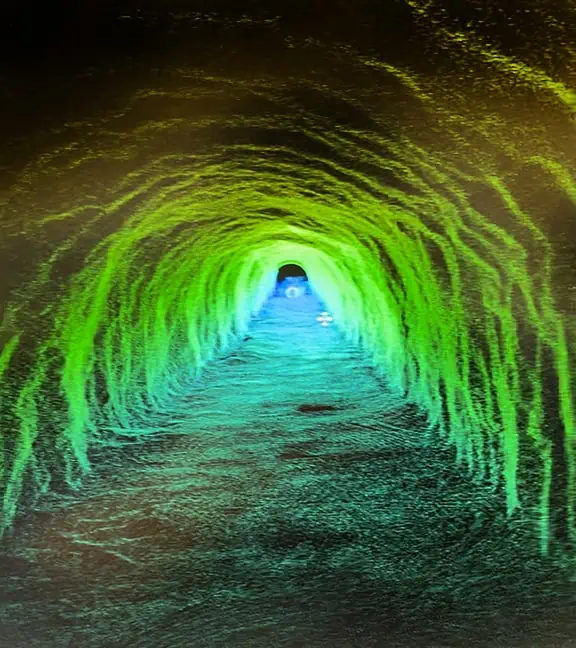
The point cloud made from the LiDAR scan looking down the mouth of the tunnel.
Once the construction on the tunnel is completed, a second mapping mission could later be conducted to compare the pre-construction map with the one made post-construction. The post-construction map could then be compared with subsequent scans to detect damage or other changes to the tunnel as time progresses.
At another point in time, a project such as this would have been cumbersome – and much more expensive, to say the least.
“In the area of precision mapping, before the advent of unmanned systems, a helicopter and/or light aircraft would have to be used in conjunction with surveyed ground control points,” related Schwartz. “Highly specialized equipment and personnel would be needed to conduct such operations at significant cost. In the case of a confined space or the interior of a structure or tunnel, while LiDAR (Light Detection and Ranging) has existed for many years, only recently has it become affordable – and flyable on unmanned aircraft systems. LiDAR can generate highly accurate point clouds used for 3-dimensional modeling and making precise measurements. These models, and the measurements available from them, allow engineers and designers to work much more efficiently and gives them real-world, ‘as-built’ information from which designs can be based.”
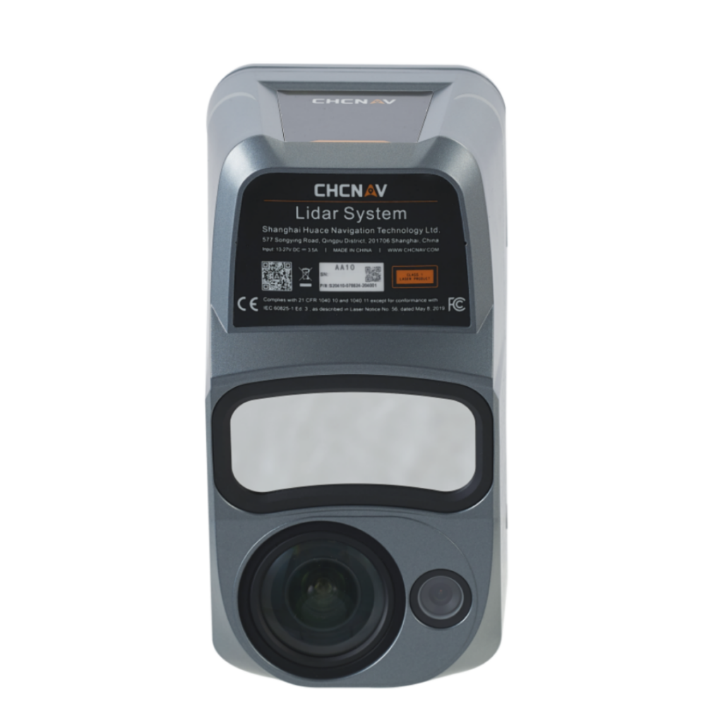
Schwartz added, “In the past, LiDAR was only something that could be deployed from the ground. It was extremely costly and difficult to manage. Prior to LiDAR, engineers and surveyors would have to physically enter the environment which could be very time-consuming and, potentially, dangerous. Today this can be done, quickly, efficiently, accurately, and safely using airborne LiDAR packages specifically designed to be flown by unmanned aircraft systems. Warren has, in their toolkit of advanced UAS solutions, a LiDAR-equipped UAS specifically designed to scan the interior of structures such as buildings, tunnels, and other confined spaces. It was this unit that was used to create the LiDAR point cloud of the Roseville Tunnel.”
Schwartz expects that the two entities will continue to work on other projects down the line.
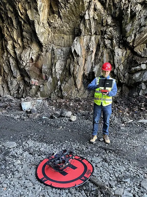
Jacob Heimo, WarrenUAS student, and now summer intern at NJ Transit, prepares the Elios 3 system for launch.
“The relationship has been great and continues to work great,” Schwartz said. “In addition to collaborating with the Warren folks on real-world projects, we have also taken on two students as part of NJ TRANSIT’s summer intern program that’s made available to qualifying college students. Our two interns from Warren, Jacob Heimo and Thomas Knibbs, have been working through the summer break and have brought their significant knowledge and technical abilities to NJ TRANSIT. Their contributions have definitely furthered the maturity and growth of our program. They have brought their capabilities in data post-processing, 3D modeling, and safety management systems to help NJ TRANSIT establish more formality in our operations and the ability to deliver more complex and usable data to our internal customers from our drone operations.”
The feeling has been mutual, “Working at NJ TRANSIT has provided me with the opportunity to get hands-on experience with projects that not only utilize the latest technology, but have tangible effects,” said Knibbs.
“The relationship with NJ TRANSIT has been so beneficial to our program and our students. Andy and the team at NJ TRANSIT have joined us on this learning journey, and their willingness to embrace the technology and for us to master it collaboratively is exactly why working in the emergent drone industry is so exciting and rewarding,” added Dr. Austin.
Schwartz summed, “We will continue to collaborate with Dr. Austin and his staff in the areas of equipment, training, and flight operations and see a bright future for both organizations through our continued collaboration. With NJ TRANSIT’s real-world environment and our intern program, it’s a great partnership.”


