


Drone LiDAR
Discover cutting-edge solutions from 4 leading global suppliers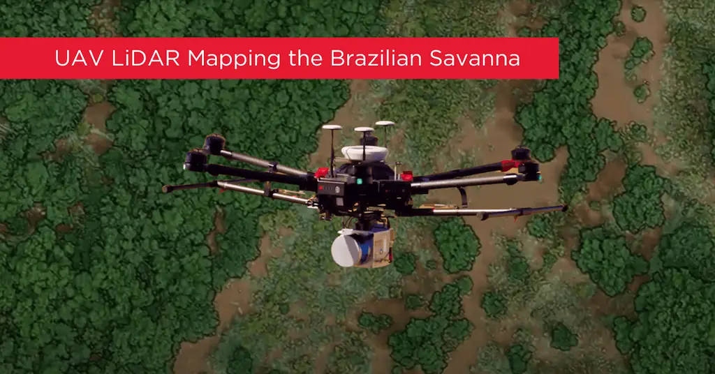
An international team of Brazilian and U.S. scientists used two UAVs, equipped with a Phoenix LiDAR system, to monitor and analyze degraded parts of the Brazilian Savanna that had previously been surveyed with aircraft and LiDAR. Read more >>

Their goal was to protect the most biologically diverse savanna in the world from further human impacts, restore native species, and increase CO2 absorption to mitigate the effects of climate change.
The researchers aimed to achieve all this while also balancing the protection and restoration of natural resources with food production.
UAVs are already used extensively in Brazil for a number of other uses. This team gathered both physical and biological information about the vegetationcover using Phoenix LiDAR and also visual (RGB) sensors. Counting trees is a critical metric that enables them to estimate planted seedling survival rates, species density, plant spacing, etc.
This team’s objective was to demonstrate how both Phoenix LiDAR and RGB sensors helped them monitor the vegetation structure (including tree numbers and height) in the Cerrado savanna.

Remotely Piloted Aircraft Systems (RPAS) fitted with Phoenix LiDAR systems and also RGB visual cameras, performed better surveys for less cost, time, and effort.
Phoenix LiDAR did a better job counting and measuring the trees in the ten survey plots, compared to the same survey done with an RGB camera.
The researchers collected data for ten plots over three surveys total; comparison monitoring data was collected by aircraft-based LiDAR in 2015, and the two 2017 UAV surveys were one month apart.
One 2017 survey used the University of Florida’s GatorEye system (a Velodyne VLP-16 dual-return laser scanner head, capable of 600,000 returns per second, with Phoenix live and post-processing software, mounted on the DJI Matrice 600 Pro hexacopter multi-rotorUAV, with L1/L2 dual-frequency GNSS (PPK mode – Post Processing Kinematic), and the other using a SODA RGB 24 MP camera mounted on a fixed-wing Sensefly UAV.

A Phoenix LiDAR system, including Phoenix live and post-processing software, was mounted on a DJI drone.
This study compared the UAV LiDAR to UAV RGB data, and compared both to the previous 2015 LiDAR data, discussing Phoenix LiDAR’s superior accuracy over RGB’s, and acknowledging additional benefits of the RGB sensor.
This research demonstrates that this kind of research can be done by UAV, and can provide higher-resolution data than the aircraft surveys while reducing cost, time, and effort.


