


Discover World-Leading Unmanned and Autonomous Technologies
Discover cutting-edge solutions from leading global suppliers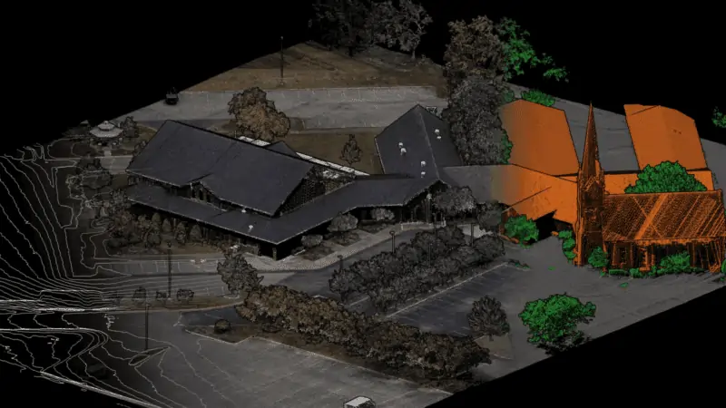
Phoenix LiDAR’s new SpatialExplorer 7 is an expandable desktop software suite that provides a complete workflow, from LiDAR data acquisition to final product creation.
The expandable SpatialExplorer suite is built to ensure that data acquisition is a success, from mission guidance to real time point clouds and easy field QC.
The company’s LiDARSnap and CameraSnap provide industry leading results for datasets from airborne, mobile, or other platforms. Analytic tools then transform the highly accurate data into actionable products and automatically generated quality reports.
SpatialExplorer 7 gives users the tools they need at each stage of LiDAR production:
Acquisition
- Configure all system sensor and store custom profiles to ensure the correct settings during each acquisition
- Live sensor control during acquisition allows the operator to respond as necessary
- A real-time point cloud and detailed navigation feedback provide instantaneous data quality control in the field
Post Processing
- Cloud and local GNSS/INS trajectory processing options
- Calibrate point clouds with industry leading trajectory optimization and boresight computation methods through Phoenix’s latest LiDARSnap
- CameraSnap sensor calibration and image bundle adjustment creates seamless RGB projection
- The ability to process data from airborne, mobile or other types of acquisitions using a single software
- Custom data analysis through automated filtering routines, manual classification tools, change detection, clearance analysis, and more
- Fully automated project and processing reports for internal QC and delivery to end users
MissionGuidance
- Navigation guidance for pilots and mobile vehicle operators to stay exactly on the planned course
- Collection management for operators to ensure accurate and complete data acquisition
SpatialExplorer 7 has additional functionality with the SpatialPro add-on and/or MissionGuidance add-on.


