


Drone LiDAR
Discover cutting-edge solutions from 4 leading global suppliers
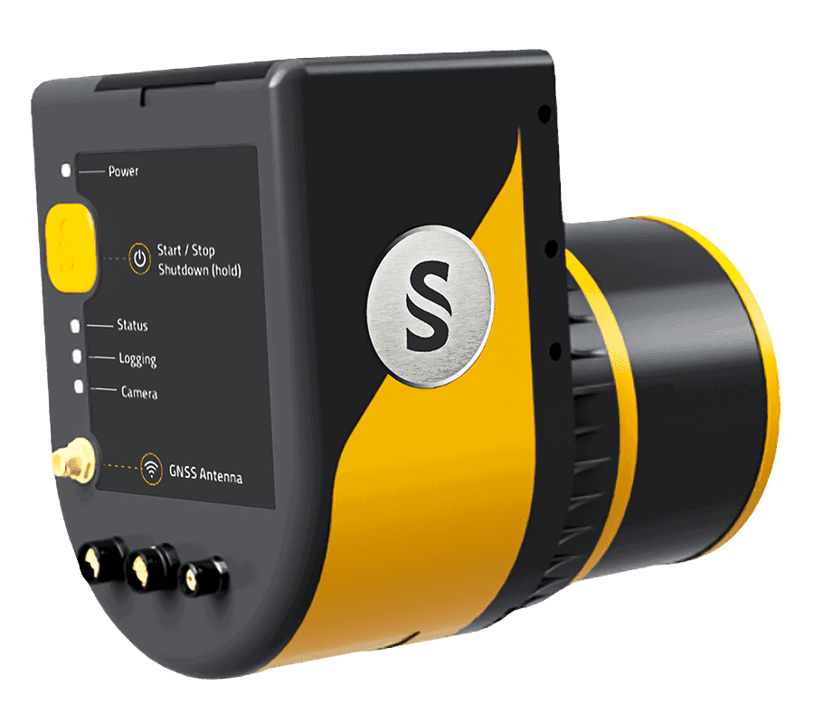
Phoenix LiDAR asserts that unmanned aerial vehicles (UAVs) have moved into far wider usage since current technological advances began to both support and require UAV technology. Read more >>
Individual tree detection, for instance, is an important facet of the forest management industry that has benefitted from the change between traditional data collection and monitoring methods and UAV data collection. This key change, however, is daunting due to the vast amounts of information available.
The team of international researchers have released a tutorial white paper to help non-researchers understand the positives of using UAVs and LiDAR for research usually carried out using airplanes.
The researchers explain how to do Individual Tree Detection (ITD) using LiDAR maps and images from UAVs equipped with Phoenix Scout LiDAR cameras, and also using open source software to process the data. The software creates a canopy height model (CHM) as well as performing ITD.
Since this tutorial is designed for beginners to remote sensing, i.e., using drones to capture data, the forested areas involved are relatively easy to study due to open canopies, and the methods are simplified.
Doing this work efficiently is crucial for understanding how forests respond to climate change. Traditional methods still provide the data, but at a higher labor, time, and financial cost, particularly if there is a larger expanse of forest to analyse. UAVs can gather the data at significant savings.
The tutorial, which uses R studio software and the R programming language, covers the following:
- Loading the data
- Clipping the area of interest
- Classifying ground points
- Creating a DTM
- Height normalization of the point cloud
- Creating a CHM
- “Smoothening” the CHM
- Detecting the treetops
- Assessing accuracy
The aim of this tutorial is to help beginners or laypeople understand how UAVs can help researchers work.


