

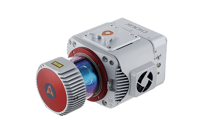
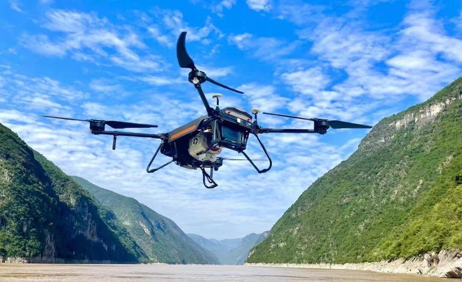
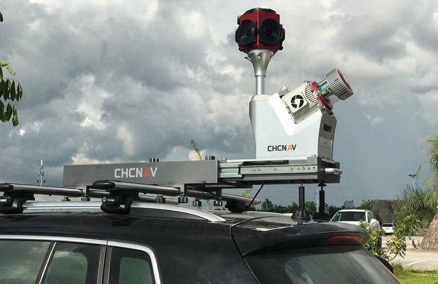
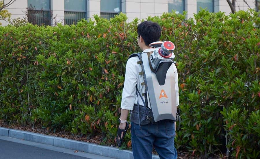
AlphaUni900/1300 Mobile Mapping System
AlphaUni 900/1300 belongs to Alpha Mobile Mapping family, are high-end multi-platform LiDAR systems, which designed and improved by CHCNAV through many years of exploration and data capture experience.
AlphaUni 900/1300 offers fully integrated system with high-precision, long-range laser scanners with unique Waveform-LiDAR technology from Riegl and high-accuracy inertial navigation system, ready for demanding surveying missions in the air and on the ground, requiring the highest quality of data.
Specifications:
| 900 | 1300 | |
| Size | 31.6 x 20.9 x 15.6 cm 12.2" x 7.87" x 5.9" |
31.6 x 20.9 x 15.6 cm 12.2" x 7.87" x 5.9" |
| Weight | 4.5 kg | 4.5 kg |
| Power Consumption | 65W | 65W |
| Absolute Accuracy | < 0.050 m RMS | < 0.050 m RMS |
| LiDAR point density for UAVs (@ 4 m/s) | 120 pts/sqm @ 100 m AGL | 190 pts/sqm @ 100 m AGL |
| Max LiDAR range, reflectivity > 60% | 920 m | 1350 m |
| LiDAR accuracy | 10 mm | 15 mm |
| LiDAR precision | 5 mm | 10 mm |
| Scan speed | Up to 200 scans/sec | Up to 200 scans/sec |


