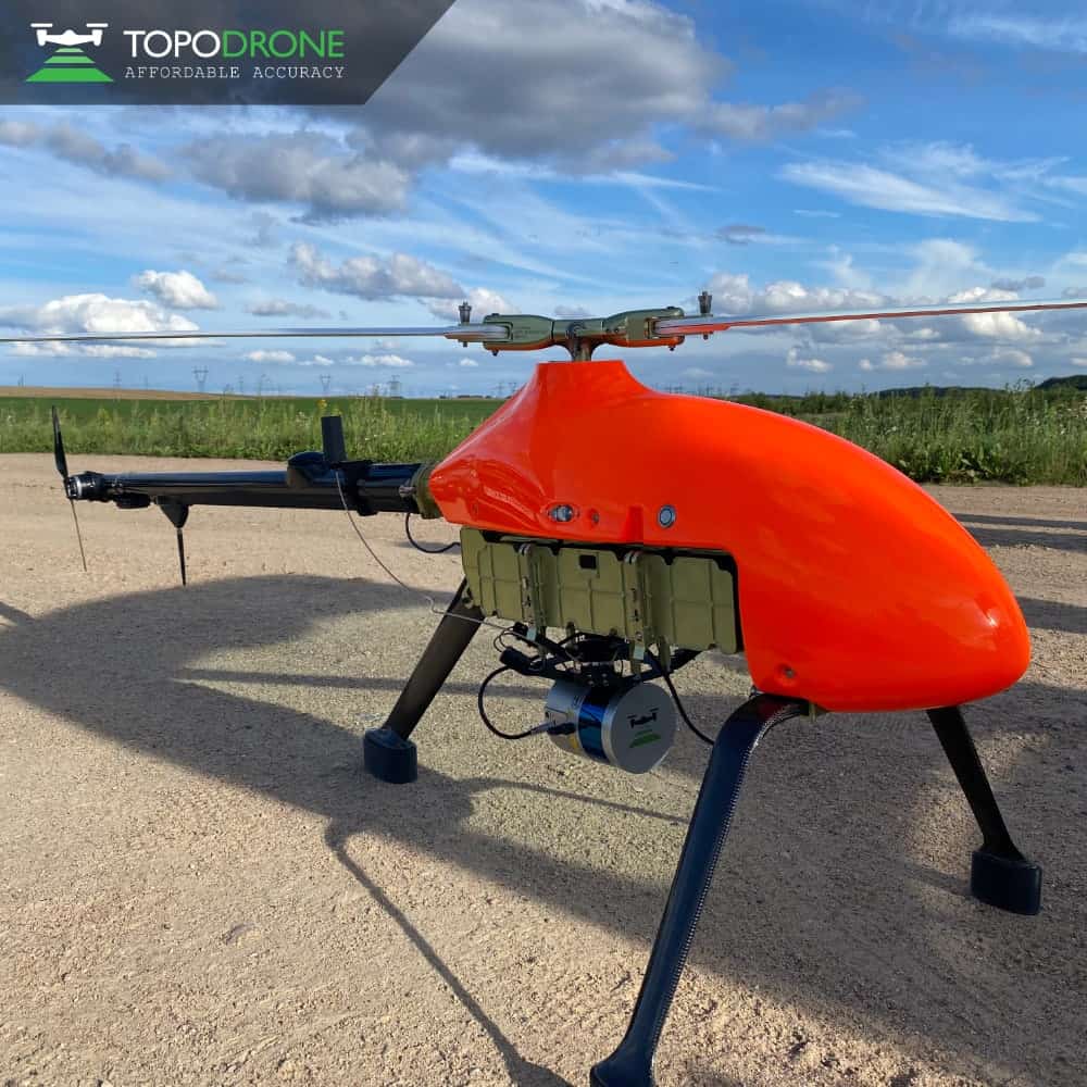
TOPODRONE has announced the new LiDAR PRIME + aOrion Heli-E system, which incorporates Velodyne Lidar's long-range Alpha Prime sensor for high-precision, large area aerial mapping
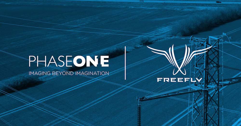
Freefly's Alta X UAV and the Phase One P3 camera plug and play solution will enable customers to integrate real-time, best-in-class inspection data into their preferred applications and workflows
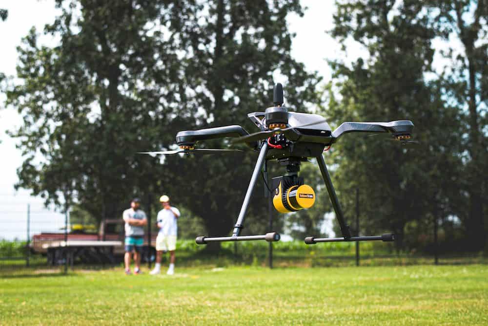
This enables drone users with a Gremsy standard T3V3 female quick release to lift and power the YellowScan Mapper, Mapper+ or Surveyor Ultra systems without needing prior integration work
The program is designed to provide the resources needed to develop business opportunities, including marketing, internal training and maintenance, technical support, quantity discount, and more
Kongsberg Geospatial develop high-performance geospatial solutions to enable next generation civilian and military BVLOS drone missions, unmanned traffic management and airspace awareness
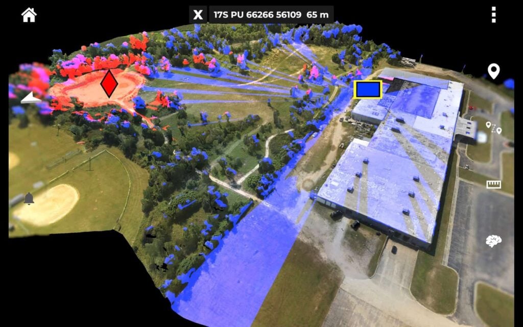
Farsight gives military teams virtually real-time access to detailed 3D maps of a target area overlaid with Geographic Intelligence concerning rapidly developing situations on-the-ground
This technology is useful for land surveying, power line inspection, topographic surveys, forestry and wildfire mitigation, precision agriculture, and mining
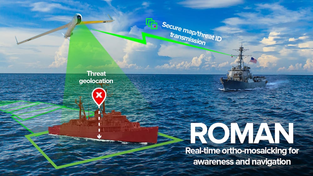
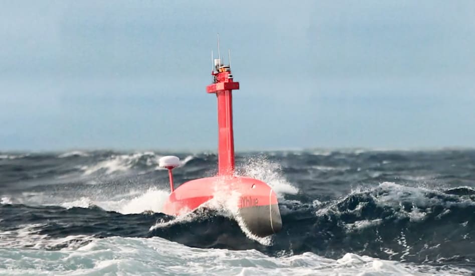
Charles River Analytics is creating ROMAN (Real-Time Ortho-Mosaicking for Awareness and Navigation), a set of software components for creating real-time sea surface maps and detecting maritime objects
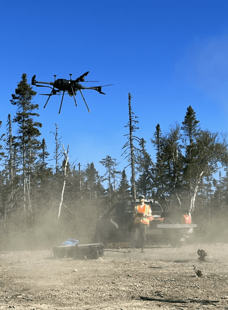
Overhead Intelligence has commenced its Extended Visual Line Of Sight plus Beyond Visual Line Of Sight mission for UAV magnetometer surveys across the entire province of Newfoundland and Labrador
The company will visit Mongolia, South Korea, Japan, Myanmar, Laos, Thailand, Vietnam, Cambodia, Malaysia, Philippines, Indonesia, Australia, and New Zealand from July to September 2022
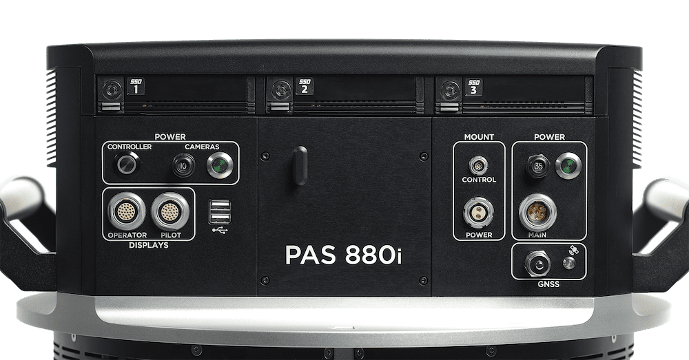
The addition of a near-infrared sensor to the PAS 880 and PAS 280 solutions expands their utility in applications related to agricultural monitoring, environmental preservation, and land use/land cover programs
Powered by a new SLAM engine that lets it create 3D models as it flies, the Elios 3 drone is accompanied by a new version of Flyability’s software for inspectors, Inspector 4.0
Schneider-Digital’s 3D PluraView monitor series is established as the de-facto standard in the military sector and is by far the market leader for military 3D-stereo desktop displays.
INTERGEO will welcome back visitors 18-20 October 2022 at Messe Essen for face-to-face meetings and exchanges with international companies, innovative start-ups and the leading minds in the industry
Visitors will be able to learn from top-tier speakers from the geospatial industry, to address the profession’s biggest issues – from sustainability, inclusivity and mental health to GIS, digital twins and augmented reality
Unveiled this week at AUVSI Xponential, the updates to Auterion OS serve enterprises with diverse use cases that need component and payload flexibility, alongside a centralized, streamlined software experience
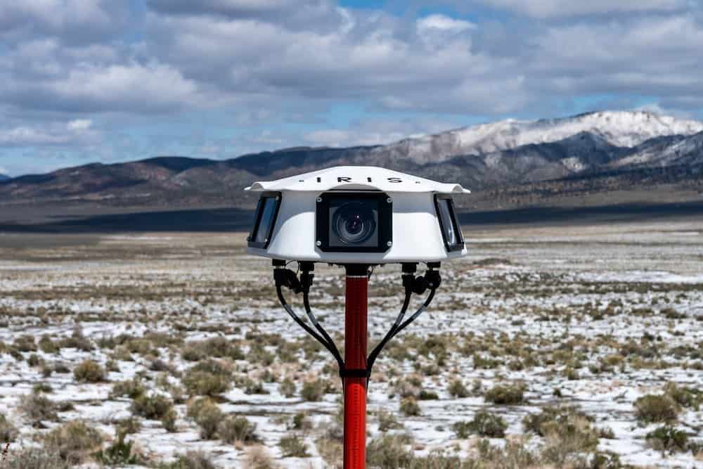
Iris Automation’s Casia G provides a full optical, 360° degree field of regard designed to detect, alert and enable operators to avoid both co-operative and non-cooperative aircraft for safe BVLOS flight
Advancing Unmanned Systems Through Strategic Collaboration
UST works with major OEMs to foster collaboration and increase engagement with SMEs, to accelerate innovation and drive unmanned systems capabilities forward.