


Sense Aeronautics’ Aerial Object Detection (AOD) solution delivers real-time detection, classification, tracking, and geolocation of airborne targets using infrared and electro-optical video feeds. Designed for deployment on drones, ground control stations, or in the cloud, it enhances low-altitude airspace safety by identifying both cooperative and non-cooperative flying objects that traditional transponder-based systems often miss. By processing live imagery from a wide range of video sources, AOD delivers immediate alerts that improve situational awareness and support faster, safer decision-making during missions.
Engineered for reliability in dynamic conditions, AOD operates effectively day and night, maintaining detection accuracy across diverse environments. Its flexible architecture supports onboard, ground, and cloud configurations, ensuring adaptability for multiple platforms and mission types. The software’s efficient processing focuses only on relevant aerial activity, optimizing bandwidth, storage, and operator attention while sustaining high detection performance in real time.
Specifications:
| Input Sources | IP and USB cameras, video files (MPEG-4, H.264), video streams (RTP, RTSP, RTMP, WebRTC, HLS) |
| Output Formats | Dolby, RTMP, RTSP, WebRTC, HLS |
| Training Data | 200,000 annotated samples |
| Latency | < 1 second (cloud deployment) |
| Detection Probability | > 90% |
| Detection Range | 500 m (small drone); 3,000 m (light aircraft) |
| Deployment | Onboard (Edge), Ground Control Station, or Cloud |
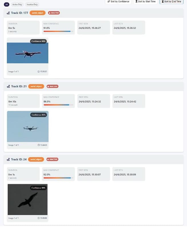
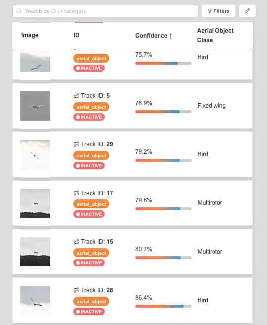
AOD features integrated mission insight reporting tools that consolidate aerial detection and tracking data into structured, interactive summaries. For every tracked airborne object, the system records precise geolocation information along with the first and last observed appearance, enabling clear reconstruction of airspace activity over a selected timeframe or an entire mission. Each detection is automatically paired with an optimized image crop, providing a concise visual reference to support rapid verification and post-event assessment.
Accessible during operations or for offline review, these reports reduce reliance on continuous live video monitoring by presenting relevant detection data in a clear, organized format. Reports can be exported as PDF files to support operational documentation, after-action review, and information sharing across command and coordination teams.


