Sonardyne underwater positioning technology is supporting coordinated AUV operations during the BAS-led GIANT mission to study Greenland’s tidewater glaciers
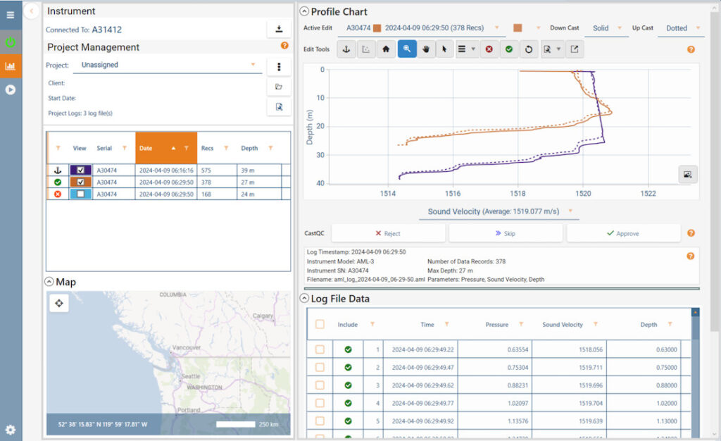
AML Oceanographic has introduced CastQC in Sailfish 1.5.1 to support hydrographic survey workflows with dynamic cast validation, profile comparison, interactive editing, and export on approval
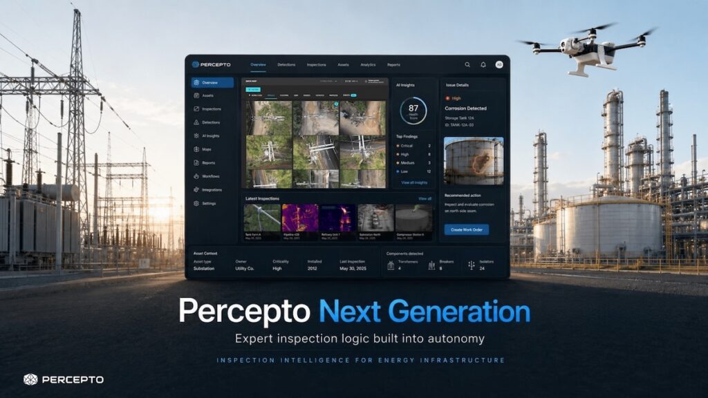
Percepto has introduced a next-generation inspection intelligence platform that combines Percepto Air drones, onboard autonomy, contextual AI, asset intelligence, and managed remote operations to support scalable energy infrastructure inspections
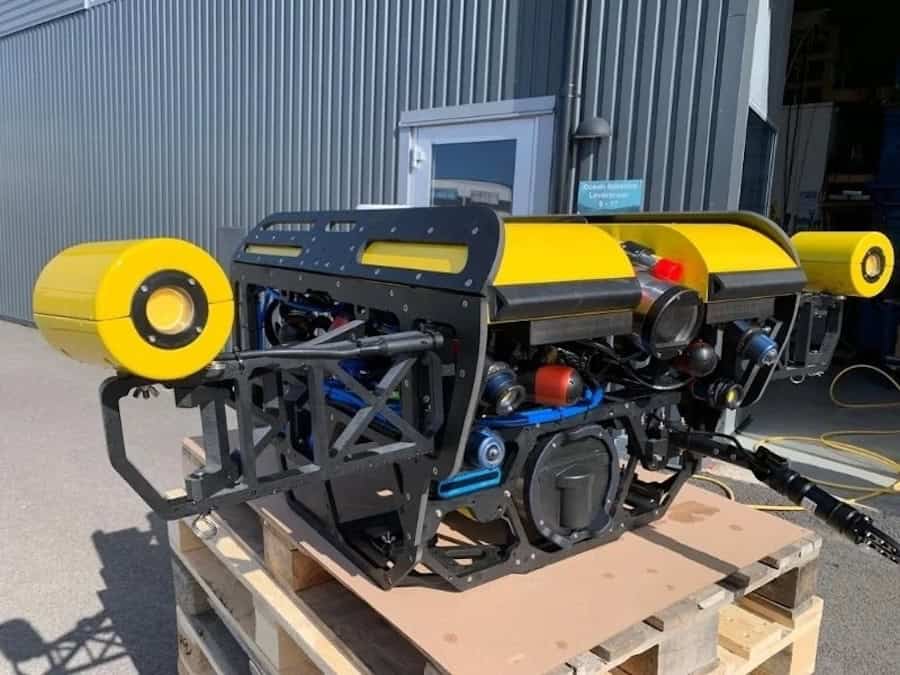
SubC Imaging and Ocean Robotics International have partnered to integrate SubC’s cameras, lights, lasers, recording systems, and software into compact and observation-class ROV platforms for underwater inspection, research, and monitoring applications
The launch of CHC Navigation's new premium airborne LiDAR system delivers ultra long range laser scanning and high precision orientation architecture to optimize wide area geospatial mapping across complex and changing terrain
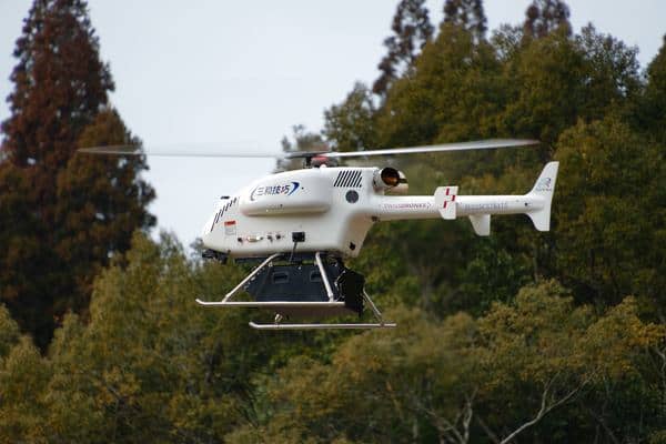
SwissDrones’ SDO 50 unmanned helicopter is advancing operations in Japan through maiden flights, cargo demonstrations, and disaster-response exercises alongside Sanwa Giko and regional partners
OMS Group has acquired a second Exail DriX O-16 USV to expand its autonomous seabed survey capabilities, supporting global subsea cable installation and monitoring activities amid growing subsea infrastructure demand
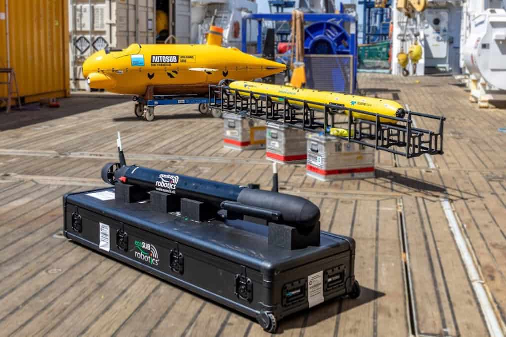
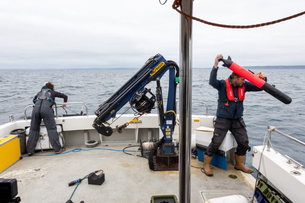
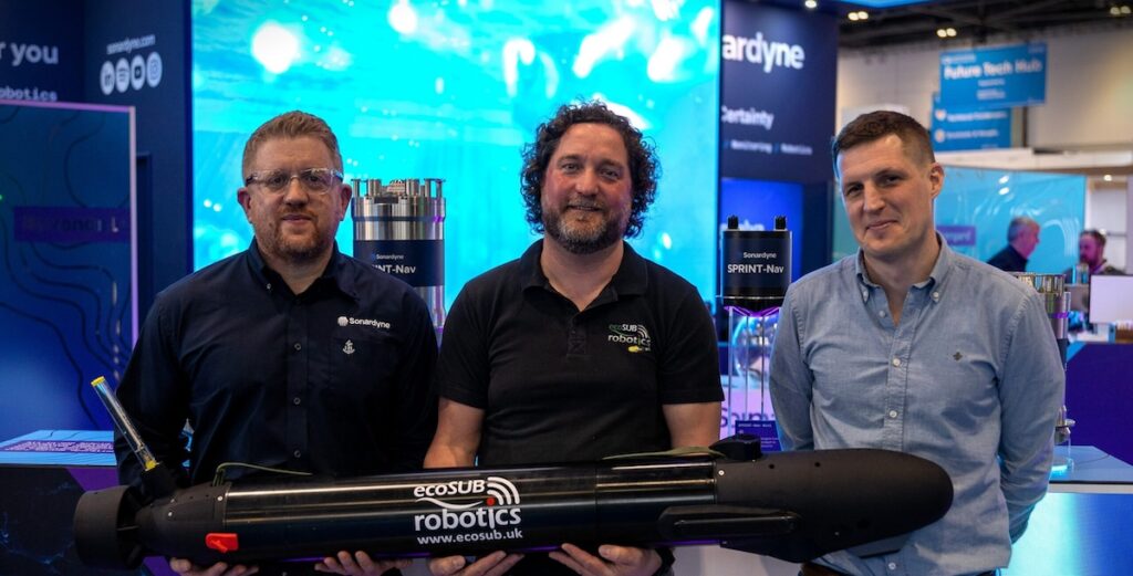
Njord Survey has selected Sonardyne SPRINT-Nav U for integration into ecoSUB AUVs to support more scalable and efficient subsea survey operations through high-accuracy navigation
Greensea IQ has demonstrated autonomous UXO detection using the Bayonet 350 AUGV, towing a sensor sled and collecting high-resolution geophysical data in complex nearshore environments
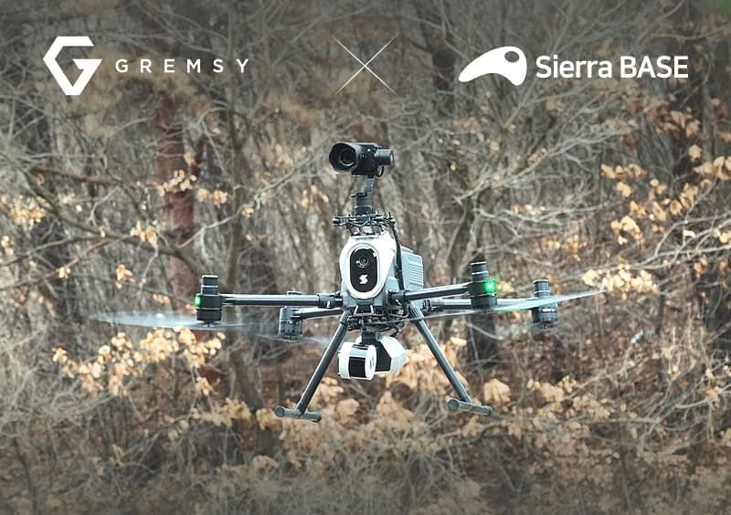
AI-native camera module manufacturer Gremsy and drone specialist Sierra BASE have successfully demonstrated a specialized aerial platform designed to modernize structural monitoring and infrastructure safety across South Korea
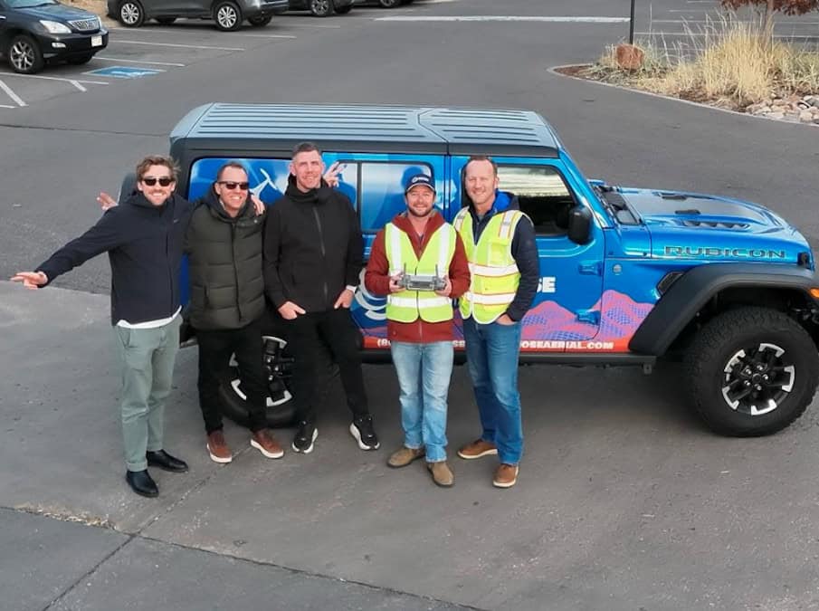
Blue Nose Aerial Imaging has collaborated with Inotek to strengthen U.S. drone inspection services by combining nationwide aerial data capture with engineering-led analysis to deliver insights into building condition, defects, energy loss, and risk
SubC Imaging has partnered with Ocean Modules to bring its subsea cameras, LED lighting, and laser technology to Ocean Modules’ ROV systems, providing integrated imaging solutions for inspection and maritime operations
ZenaTech has released the IQ Quad, an autonomous VTOL AI drone equipped with multi-sensor payload support, obstacle avoidance, and autonomous recharging to deliver survey-grade geospatial data for mapping and land analysis
Woods Hole Group and Chance Maritime executed a fully autonomous 38-day offshore survey using a diesel-powered USV, operating continuously for over 4,000 nautical miles without refuelling or intervention
Teledyne Marine’s HydroPACT 440 MK2 delivers a future-proof upgrade to its industry-standard subsea pipe and cable tracking system, combining new hardware, modernised software, and long-term continuity
Deployed by University of Tasmania researchers, a custom Boxfish ROV completed a 50-transect Beagle Marine Park survey, with footage premiering on YouTube on Wednesday, 19 November at 7 pm AEDT
SubC Imaging has integrated its DVR+ Overlay system with imaging specialist Orphie’s IP cameras, providing underwater inspection teams with a simplified way to capture, record, and stream enhanced subsea video
Cellen’s hydrogen-powered H2-6 drone now integrates the AerialOGI Neutrino sensor, delivering long-endurance, high-precision aerial gas detection and environmental monitoring
Cellen and Enthusiast Hydrogen partner to map natural hydrogen in the U.S., combining hydrogen-powered drones with advanced LDLARS sensor technology for long-endurance aerial surveys
At Oceans 2025 Chicago, D-2 Inc. is presenting its Titanium Ocean CTD and new AUV CTD at Booth 311, featuring a pump-free hybrid cell and low-power operation
Voyis launches Voyis Support, a professional service delivering expert guidance, advanced methodologies, and reliable results for underwater surveys and photogrammetry projects
Voliro has secured the intellectual property of Sixpec’s Pulsed Eddy Current (PEC) sensor technology to enhance its drone-based inspection capabilities and advance non-destructive testing for Corrosion Under Insulation (CUI) in industrial applications
SubC Imaging’s live streaming technology was used by Woodside for the first remote subsea inspection in the US Gulf of Mexico, with secure, high-resolution video transmitted from offshore to onshore teams to support safe and efficient inspections
Advancing Unmanned Systems Through Strategic Collaboration
UST works with major OEMs to foster collaboration and increase engagement with SMEs, to accelerate innovation and drive unmanned systems capabilities forward.