


Mapping Drones
Discover cutting-edge solutions from 16 leading global suppliers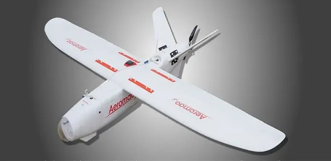
Air Sciences has announced that, in conjunction with environmental consulting company GeosUAS Inc, it has used the Aeromapper Talon UAV (unmanned aerial vehicle) for high-resolution terrain mapping of a windy, dry lake bed in Southern California. Air Sciences was testing the Aeromapper UAV for its ability to acquire 3 cm resolution DEMs and orthophotos for areas of around 8 square km at regular intervals.
The Aeromapper Talon is a turnkey sUAS manufactured by Canadian company Aeromao Inc. and designed for tasks such as mapping, surveying, precision agriculture, monitoring and surveillance. It is a multipurpose fixed wing drone with a multitude of payload options, including high resolution RGB cameras with PPk, thermal sensors, multispectral cameras and various combinations of these.
During the tests, the Talon flew several successful flights of up to 1.5 hrs. The plane flew and landed successfully when ground level winds were about 15 mph and gusting to 20 mph. Once the images were processed with Pix4D Mapper, the resultant terrain and orthophotos were of high quality, equivalent to data obtained from an industry-grade quadcopter.


