


Discover World-Leading Unmanned and Autonomous Technologies
Discover cutting-edge solutions from leading global suppliers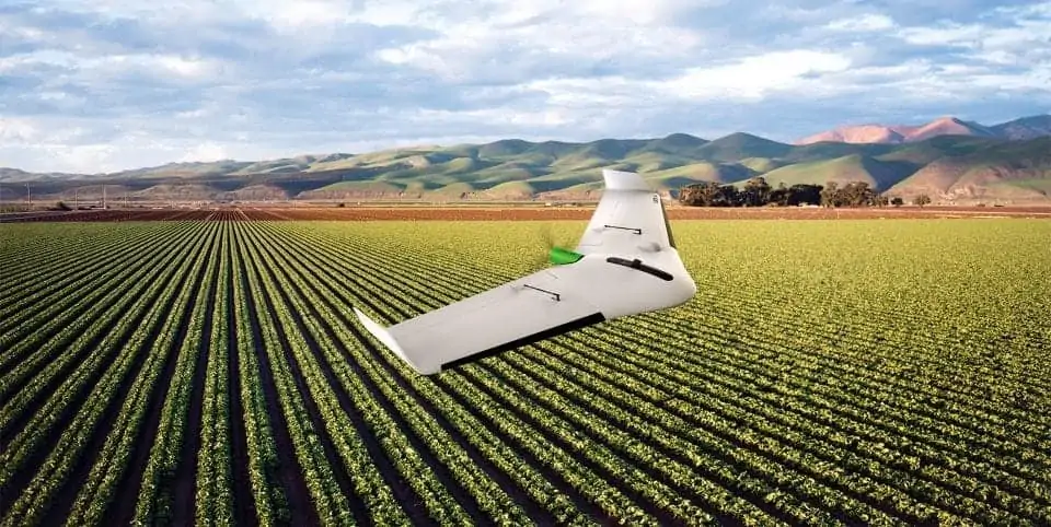
Delair has announced the launch of a new drone platform specifically optimized for the agriculture industry, the Delair UX11 Ag. Built on the foundation of the successful Delair UX11 fixed-wing UAV (unmanned aerial vehicle), the new version combines the productivity benefits of long-range/BVLOS flight operations with highly accurate survey-grade mapping and plant data collection capabilities – to enable a new level of precision agriculture.
Find suppliers of Fixed Wing UAS >
The UX11 Ag’s enhanced centimeter-level geolocation, along with its efficient operational characteristics, make it an effective solution for large area farming and forestry. The drone includes sensing technologies and a multispectral camera for plant-level measuring, including bird level, biomass and chlorophyll. It supports a productivity-oriented workflow for long-range, multi-field and multi-flight operations. The precise automatic geolocation – PPK as you go – enables a perfect overlay of maps for temporal analysis or machine guidance. The drone enables real time review of data, providing even more efficiency for analyzing while in the field.
The Delair UX11-Ag is well suited for a range of large-scale agriculture activities, including inventory control to optimize operations management and crop planning, increased traceability for sustainability, health monitoring of crops and extraction of key production metrics, and crop response assessment in field trials and research. The system has been designed specifically for the diverse and often challenging environmental conditions of large-scale farming environments.
“The Delair UX11-Ag directly addresses an opportunity in the fast-growing agriculture and forestry segment with a solution that uniquely meets the productivity and ease-of-use requirements of these operations. It fills the void that exists between traditional small-scale solutions such as flight-time-limited quadcopters, and the limited resolution and agility through satellites,” said Michaël de Lagarde, co-founder and CEO of Delair. “We have built on a proven foundation of our UX11 model and created a platform that is both cost effective and high performing to deliver very precise and actionable insights for agricultural stakeholders of all kinds of crops.”
The Delair UX11 Ag reduces the amount of time and money required to provide detailed surveys of large- scale agriculture operations. For example, thanks to its long-range capabilities, the Delair UAV can typically cover up to 900 hectares in a single day with only six flights at 150-meter altitude. Its precise geolocation capabilities and wide area imaging technology further decrease operational costs. In addition, its ease of use makes it faster to set up and deploy, and with a rugged “ag-proof” design specifically built for the harsh operational challenges found in agriculture use cases, it lowers overall maintenance.
The Delair UX11 Ag features a fully integrated high-grade multispectral camera to see the plant level of most crops and provide high-quality agriculture data. The sensor generates plant health indexes and RGB (color) images and is calibrated for precise, repeatable measurements.
The UX11 Ag is an easy-to-assemble and easy-to-carry system, weighing in at 1.4 kg. Its dimensions and takeoff capabilities make hand launching possible. The UAV features BTOL (bird-like take-off and landing) for steep-climb take offs and descents in confined areas, reducing down time between flights and extending its use to challenging environments such as dense vegetation in plantations or forests.
Two communications options are available with the UX11 Ag: the Delair Link for 2.4 GHz wireless communications, allowing connections anywhere and a range of up to 5 km; and an integrated secure cellular connection on partner 3G and 4G networks, which reduces potential interference issues and allows longer range control, including BVLOS operations.


