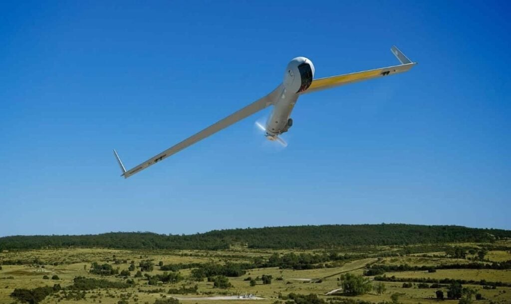
ScanEagle UAS Provides Data for Wildfire Suppression

By Mike Ball / 21 Aug 2018
Follow UST

Insitu ScanEagle UAS

Insitu has announced that it has been helping firefighters on wildfires in Oregon, providing information for fire suppression activities via its data collection, analysis and delivery capabilities. Comprised of aviation professionals, Insitu’s Mobile Response Team has been operating its ScanEagle Unmanned Aerial System (UAS) to supplement manned aviation firefighting teams battling wildland fires. ScanEagle is a licensed and approved UAS operating in full compliance with FAA regulations and with the full approval of local, state and federal fire authorities.

A UAS team working on a fire consists of a vendor flight crew, as well as federal personnel who work together to meet the incident goals and objectives. The UAS Manager (a federal employee) provides the required communication between air and ground resources to facilitate safe and effective missions, while the Data Specialist (also a federal employee) works directly with the vendor flight crew and incident GIS Specialist (GISS) to ensure timely development/delivery of requested data products.

The ScanEagle teams “fly the gaps,” meaning they fly the UAS at night and over dense smoke and inversion conditions, when manned aircraft typically are grounded due to hazardous conditions for pilots. The ScanEagle team to date has logged more than 200 hours of night flight time during nearly 30 flights over the Garner Complex and Taylor Creek fires in Oregon.

The payload onboard the ScanEagle includes infrared sensors and electro-optical cameras that gather and disseminate geospatial imagery, and provide incident perimeter maps and full motion video. The sensors and cameras spot heat signatures, fire movement and spot fires, and provide video feed of critical infrastructure, historical buildings and other structures that might be in danger, as well as identifying safe ingress and egress routes for firefighters.

“Above all, our main mission is to help combat these unrelenting fires and help keep the firefighters, the residents and the communities safe,” explained Andrew Duggan, vice president, Insitu Commercial. “One of the benefits of flying UAS over difficult and rugged terrain is mitigating the need for firefighters to physically walk it when locating and extinguishing hot spots,” he continued. “By flying UAS at night, fire incident commanders have the advantage of significant fire intelligence and heightened situational awareness for their early morning planning meetings in determining where to most effectively and safely dispatch their resources and personnel.”

All ScanEagle UAS flights have been coordinated with the Oregon Department of Forestry (ODF), the Federal Aviation Agency (FAA) and the Department of the Interior (DOI).

Watch a video of the UAS imagery below:

Posted by Mike Ball Mike Ball is our resident technical editor here at Unmanned Systems Technology. Combining his passion for teaching, advanced engineering and all things unmanned, Mike keeps a watchful eye over everything related to the unmanned technical sector. With over 10 years’ experience in the unmanned field and a degree in engineering, Mike’s been heading up our technical team here for the last 8 years. Connect & Contact

Latest Articles

Most Read Articles on UST This Week

Here’s our round-up of the five most read articles on UnmannedSystemsTechnology.com this week

Jan 18, 2025
New High-Precision VTOL UAV LiDAR Scanning Solution

Ventus-Tech Robotics' tailsitter VTOL UAV has been integrated with the Yellowscan Mapper+ OEM payload

Jan 17, 2025
Controller Software Enables Pre-Programmed Precision Composite Curing

UAVOS is developing the Controller Software for its Composite Curing Ovens, providing a pre-programmed mode to optimize curing technology precise and efficient processes

Jan 17, 2025
New Connectors & Terminals Released for Drone Applications

ETCO Incorporated has introduced a new range of connectors and terminals for drone operations, provided in a variety of materials and designs

Jan 17, 2025
Autonomous Inland Navigation to Display at XPONENTIAL Europe

Research institute DST will bring its autonomous inland navigation capabilities to XPONENTIAL Europe with ELLA, a pioneering autonomously cruising research vessel

Jan 17, 2025
Choosing the Right Ethernet Switch for GigE Vision Cameras

Explore BotBlox's Ethernet switches for GigE Vision cameras, comparing their suitability for high-performance streaming in drones and embedded platforms

Jan 17, 2025

Featured Content

“Surveillance as a Service” UAV Solution Launched

Volatus Aerospace’s “Surveillance as a Service" solution will use drone technology to provide secure, multi-modal surveillance for faster response times and actionable intelligence

Jan 16, 2025
Aurora & SkyGrid Advance Airspace Management Solutions for UAVs

Aurora Flight Sciences and SkyGrid are set to enhance Advanced Air Mobility (AAM) by collaborating on systems for integrating UAVs into the national airspace

Jan 14, 2025
New Safety System Unveiled for Anzu Raptor Drones

ParaZero has launched the SafeAir Raptor, a parachute safety system for Anzu Robotics’ Raptor and Raptor T drone models that complies with ASTM F3322-22 standards

Jan 08, 2025
How ANELLO’s Disruptive SiPhOG™ Technology is Shaping the Future of Precision Navigation

UST sits down with Dr. Mario Paniccia, CEO at ANELLO Photonics, to learn how Silicon Photonics Optical Gyroscope technology is empowering autonomous systems with cutting-edge navigation solutions

Jan 06, 2025
XPONENTIAL Europe Highlights Autonomous Robotics for Perimeter Security

XPONENTIAL Europe, held in Düsseldorf from 18-20 February 2025, will focus on uncrewed systems and highlight their use for protecting critical infrastructure

Jan 02, 2025
Software-Defined Networking Capability Selected for Attritable Autonomous Systems

Viasat will provide its NetAgility SDN system in support of the US DoD's Replicator initiative

Dec 24, 2024