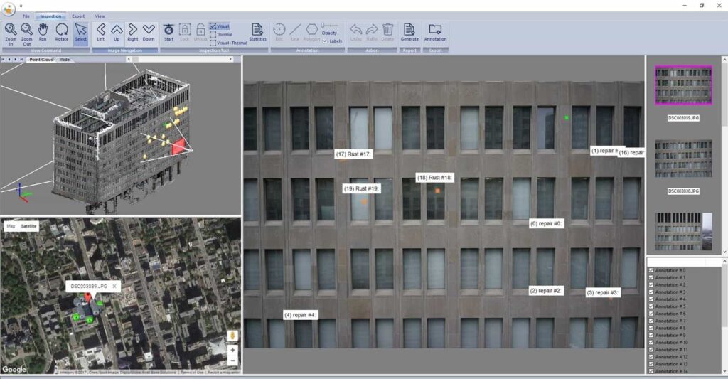
Industrial Skyworks has officially launched “Blue VU”, the company’s new drone inspection software for accurate and efficient inspections of buildings, and oil and gas infrastructure. The new Blue VU software will faciliate safe visual access of hard-to-reach locations, such as the roofs of buildings, flare stacks, and storage tanks and will automate the collation and organisation of thousands of images generated during a drone inspection flight.
Drone inspection solutions have enabled numerous businesses to review their drone data and perform inspections from their desktops. These solutions allow users to carry out drone inspections safely and identify problems early, without spending a lot of time or money.
Some of the key capabilities of the new Blue VU software include:
- Fast and intelligent organizing and sorting of thousands of UAV images
- Intelligent recommendation systems for searching UAV images with the best view to support efficient inspection activities
- Support for synchronized, multimodal exploration of UAV images using 3D point clouds, 3D building models, and 2D maps
- Efficient tracking and controlling of the inspection workflows
- Creates a customized database for structuring, recording, and digitizing anomalies (such as rust, hot spots, cracks, etc.) directly from the UAV images within the software
- Automatic generation of building inspection reports with inspection statistics and visual and vectorised inspection results
- Can export the inspection results into GIS and CAD formats.
Michael Cohen, CEO of Industrial Skyworks, commented: “With Blue VU, we’re able to offer our clients a complete solution, from drone technology to desktop data, that uniquely powers remote inspections, thereby lowering costs while increasing safety outcomes. Finally, remote building, and oil and gas inspections are possible.”


