Advanced Solutions and 3DR to Offer Drone Data Solution to AEC Professionals

By Mike Ball / 12 Apr 2017

Smart Sourcing for Unmanned Systems

Discover cutting-edge solutions from leading global suppliers
SUPPLIER SPOTLIGHT
Follow UST

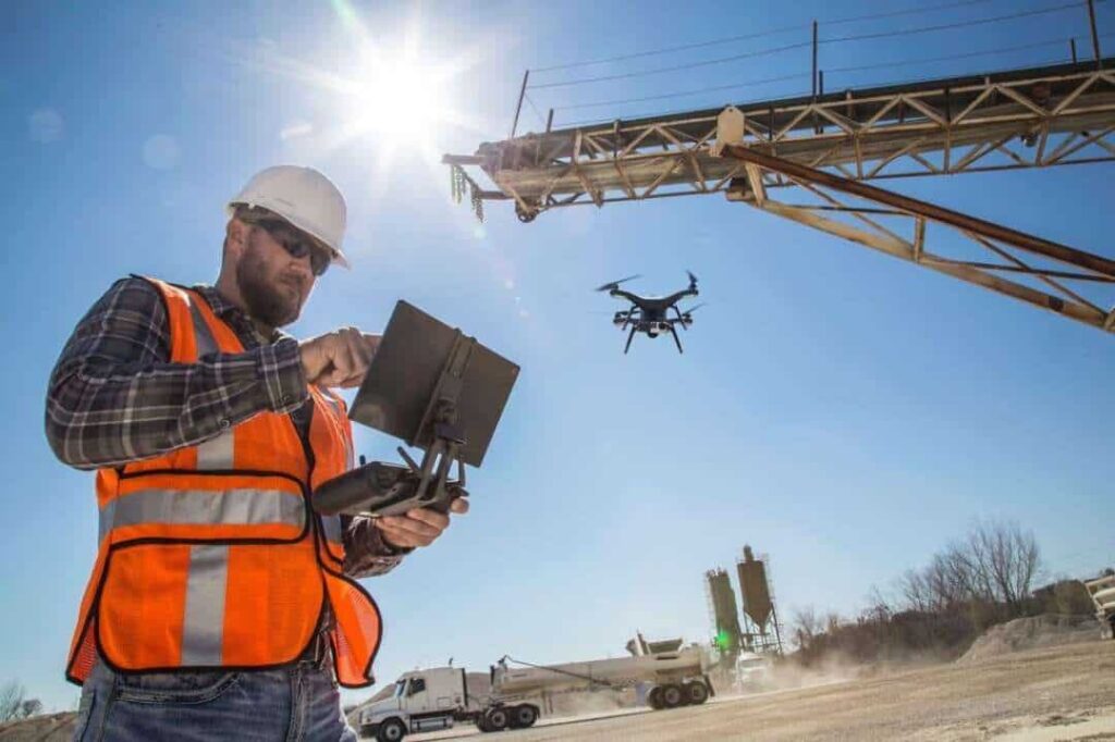
Construction worker with drone

Advanced Solutions has announced that it has entered into partnership with 3DR, the developer of Site Scan, a drone data platform for construction, which enables consumers to inspect, survey, and scan worksites safely and efficiently to deliver data for processing and analysis in the cloud.

Advanced Solutions Design Software has 30 years’ experience in the AEC (Architecture, Engineering & Construction) industry as an Autodesk Platinum Partner. This partnership affords clients the opportunity to accelerate their businesses and obtain real-time site information, and the new offering will complement Advanced Solutions’ current products and services. Advanced Solutions will leverage proven AEC industry experience to ensure customers receive high-quality training and consulting services to support Site Scan and streamlining of existing workflows.

“Reality capture is swiftly altering the way professionals in the building industry collect and utilize information from the field to assist in a more informed decision-making process,” said Michael Golway, CEO of Advanced Solutions, Inc. “We are enthusiastic how this new partnership with 3DR will enable our customers in the AEC industry to accelerate and benefit from their adoption of reality capture technologies.”

The workflow is managed entirely from an iPad enabled with the Site Scan Field app designed specifically for the business user. The process begins with Site Scan developing a flight plan for the survey, then the drone autonomously executes the flight and proceeds to capture imagery. Upon capture, Site Scan begins processing and importing data.

The survey captures images to create high-resolution georeferenced maps and digital elevation models, while Site Scan captures imagery to create 3D models. Once Site Scan captures the high-resolution images, these images are uploaded to the 3DR Cloud and finally to Autodesk ReCap. The resulting 2D orthographic view, 3D Mesh, and 3D Point Cloud are available for integration with many Autodesk technology solutions such as Autodesk Infraworks, Autodesk AutoCAD Civil 3D, Autodesk ReMake and more. Customers can calculate areas, volumes, and measure distances with Site Scan reality capture data for use in measuring stockpiles, gaining context for as-built conditions, as well as survey and mapping applications.

“Capturing site data today is costly, time-consuming, and often dangerous. Drones can easily go where it is inefficient or unsafe for field personnel, making it easier to measure our world accurately so we can better manage it,” said Chris Anderson, CEO of 3DR. “We are delighted to partner with Autodesk Platinum Partner, Advanced Solutions Design Software, to deliver Site Scan, a complete solution drone data solution that saves time and money in construction.”

Posted by Mike Ball Mike Ball is our resident technical editor here at Unmanned Systems Technology. Combining his passion for teaching, advanced engineering and all things unmanned, Mike keeps a watchful eye over everything related to the unmanned technical sector. With over 10 years’ experience in the unmanned field and a degree in engineering, Mike’s been heading up our technical team here for the last 8 years. Connect & Contact

Latest Articles

Orbital UAV Unveils Advanced Power Management System for Heavy Fuel Engines

Orbital UAV has launched its new Power Management System (PMS), delivering advanced electrical control, protection, and remote start capabilities for heavy fuel drone engines

May 14, 2025
Submersible ROVs Enhancing Underwater Security for Customs & Border Protection

Deep Trekker explores the expanding role of remotely operated vehicles (ROVs) in enhancing the capabilities of Customs and Border Protection (CBP) agencies around the world

May 14, 2025
Persistent Systems Enhances Army Sensor Networks with MANET Technology

Persistent Systems’ Wave Relay® MANET has been selected to enhance U.S. Army CBRNE operations by enabling real-time sensor data sharing and threat response

May 14, 2025
IoT Tech Expo North America to Spotlight AI, 5G & Automation

The IoT Tech Expo North America is returning to Santa Clara in June 2025, bringing together global experts to address trends in AI, 5G, and automation

May 14, 2025
Product Spotlight: Durable Lightweight Lithium-Ion Batteries for UAVs

American Lithium Energy (ALE)'s energy-dense lithium-ion battery cells combine high power output with built-in safety features, ideal for UAV and eVTOL applications in challenging environments

May 14, 2025
eVTOL Aircraft Enhanced by Embention Autopilot System

Embention will deliver flight control systems to eVTOL developer Erium Aerospace, advancing safe, autonomous, and sustainable urban air mobility

May 14, 2025

Featured Content

Product Spotlight: Durable Lightweight Lithium-Ion Batteries for UAVs

American Lithium Energy (ALE)'s energy-dense lithium-ion battery cells combine high power output with built-in safety features, ideal for UAV and eVTOL applications in challenging environments

May 14, 2025
SAE Media Group Releases Agenda for Counter UAS Middle East & Africa 2025

The inaugural Counter UAS Middle East & Africa 2025 will gather global defense leaders in Amman to explore threats, technologies, and strategies shaping regional drone defense

May 13, 2025
New Tactical Grade IMU from Inertial Labs for UAVs & Guided Munitions

Inertial Labs has launched the IMU-H100, a compact, tactical-grade MEMS IMU designed to enhance precision navigation for UAVs and guided systems

May 08, 2025
Advancing Unmanned Systems Through Strategic Collaboration UST works with major OEMs to foster collaboration and increase engagement with SMEs, to accelerate innovation and drive unmanned systems capabilities forward.