


Hyperspectral Cameras
Discover cutting-edge solutions from leading global suppliers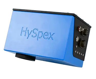
The HySpex Mjolnir-1024 Hyperspectral Camera for small UAVs
Norsk Elektro Optikk (NEO) & Applanix have developed the first directly georeferenced scientific hyperspectral camera solution for UAV applications.
The HySpex Mjolnir-1024 is a “complete solution” for producing high-quality georeferenced scientific data; it includes a hyperspectral camera, a powerful computer and the Applanix APX-15 UAV (GNSS-Inertial component), all inside a small chassis that weighs less than 4.5kg in total. With rugged design, various downlink capabilities, good thermal and mechanical stability, it is ideal for a wide range of UAV applications.
Applanix and NEO together integrated the Applanix APX-15 UAV for Direct Georeferencing. “After careful examination of the available GNSS-Inertial solutions out there, we found that Applanix APX-15 UAV was the most suited in weight, performance and price,” said Trond Løke of NEO. “The APX-15 UAV is lightweight, easy to integrate, and offers good performance with an easy procedure for processing data.”
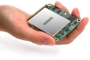
APX-15 UAV – Survey-grade
multi-frequency GNSS
receiver and MEMS inertial
sensors on a single board.
The integration of Applanix’ APX-15 UAV and the HySpex Mjolnir-1024 offers tremendous cost and time efficiencies for many hyperspectral mapping tasks by:
- Enabling hyperspectral surveys to be undertaken from smaller unmanned platforms
- Enabling more frequent flights for temporal as well as spatial analysis of a changing survey site
- Providing highly accurate ground truth in a very short time using the included Applanix POSPac UAV processing software
- Flying in smaller, tighter, more difficult spaces than it has ever been possible to scan using traditional equipment
APX- 15 UAV is a complete and ready-to-integrate mapping solution which provides Direct Georeferencing for small UAVs. Following the principles of the Direct Mapping Solution for Unmanned Aerial Vehicles (DMSUAV, an Applanix framework for direct georeferencing UAV payloads), APX-15 UAV features a high-performance, survey-grade, multi-frequency GNSS receiver and state of-the-art low-noise MEMS inertial sensors all on a single board. It is compact (7 x 6cm) and lightweight (60g). And with the included POSPac UAV post-mission software, it produces a highly accurate position and orientation solution for direct georeferencing of your sensors.


