Cardno Announces New UAS and Remote Sensing Data Analytics Services

By Mike Ball / 28 Oct 2015

Smart Sourcing for Unmanned Systems

Discover cutting-edge solutions from leading global suppliers
SUPPLIER SPOTLIGHT
Follow UST

Cardno UASCardno, a infrastructure and environmental services company, has announced that it has added Unmanned Aircraft Systems (UAS) and Remote Sensing Data Analytics services to its portfolio.

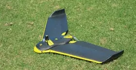
Cardno’s fleet of UAS includes both fixed wing and octocopter solutions, which carry mapping grade fixed focal length cameras, HD video, and infrared data/image collection capabilities. The UAV take high-resolution color imagery, producing digital terrain models and other high-tech mapping for a wide range of applications.

By adding UAS capabilities, Cardno strengthens its cutting-edge portfolio of geospatial, mapping, and survey services – including mobile GIS, large format photogrammetry surveys, remote sensing, mobile mapping LiDAR, underground utilities mapping, amongst others – and complements its information management services such as environmental data and compliance management, application and website development, business process modeling, decision support systems, and systems integration.

UAS technology is revolutionizing critical data capture, and Cardno’s Remote Sensing Data Analytics team has the flexibility to provide sensor and platform combinations that are cost-effective and meet client needs in a variety of industries and services: emergency response, mining, railway inspection, biological resources, oil & gas, utilities, refineries, water resources, and vegetation analysis.

Cardno’s Remote Sensing Data Analytics scientists have the expertise and experience to provide the highest-quality orthoimagery and point cloud data for developing base products for projects. These base products can then be further analyzed to create an extensive list of value-added products to aid clients in achieving their end goal while staying on schedule and budget.

Cardno’s Jason Kack, West Business Manager, stated, “Cardno has the largest fleet of subsurface utility vehicles in the U.S. and our SUE/survey team comprises over 450 professionals. Cardno also operates with a global network of around 8,100 staff in over 250 offices, giving us the resources to successfully deliver complex projects while leveraging local knowledge and relationships. We are excited to offer this diverse talent to our clients, along with UAS and Remote Sensing Data Analytics — two innovative and crucial next steps to support client projects.”

Posted by Mike Ball Mike Ball is our resident technical editor here at Unmanned Systems Technology. Combining his passion for teaching, advanced engineering and all things unmanned, Mike keeps a watchful eye over everything related to the unmanned technical sector. With over 10 years’ experience in the unmanned field and a degree in engineering, Mike’s been heading up our technical team here for the last 8 years. Connect & Contact

Latest Articles

Klein Marine Systems Integrates Exail Navigation Solution into Side Scan Sonar

Klein Marine Systems has integrated Exail’s advanced AHRS into its 5900 sonar, enhancing accuracy, stability, and efficiency for demanding underwater mapping missions

Apr 24, 2025
Expanding Modular Maritime Autonomy with TSUNAMI USV Line

Textron Systems is expanding its USV capabilities with the TSUNAMI™ family, a series of modular, scalable platforms designed to meet the demands of autonomous maritime operations

Apr 24, 2025
Strategic Value of Protective Coatings in Electronic System Reliability

HZO highlights the role of protective coatings like Parylene in delivering long-term operational value for sensitive electronic components across a wide range of industries

Apr 24, 2025
Inspired Flight CEO Discusses Leadership, Innovation & the Future of Drone Technology

Inspired Flight Technologies CEO, Rick Stollmeyer, discusses advancing drone technology, highlighting innovation, leadership, and the mission of reshoring critical manufacturing to America

Apr 24, 2025
Vision-Based Traffic Detection Enhances BVLOS Safety for Xer X8 Hybrid UAV

Xer Technologies teams up with Daedalean to enhance BVLOS drone safety, integrating vision-based traffic avoidance into the robust, hybrid-electric Xer X8 multirotor drone

Apr 24, 2025
Sierra-Olympia Launches Long-Wave Infrared OGI Camera for Continuous Gas Monitoring

Sierra-Olympia Technologies unveils the Viento LWIR OGI, a cost-effective infrared camera designed for continuous, reliable gas leak detection in industrial environments

Apr 24, 2025

Featured Content

Apollo & Moonrock Launch $122.5m Drone, eVTOL Insurance Facility

Apollo and Moonrock take the lead on new $122.5m drone, eVTOL and aviation innovation insurance facility

Apr 22, 2025
ParaZero Unveils Advanced Parachute Recovery System

ParaZero launches the SafeAir M4, an advanced parachute recovery system designed for the DJI Matrice 4, enhancing drone safety, compliance, and mission readiness

Apr 17, 2025
Compact High Resolution MWIR Zoom Lens Released for UAV & ISR Platforms

MKS Instruments introduces the Ophir SupIR 10-135mm f/1.8 zoom lens, engineered for compact MWIR systems demanding long-range detection and high-resolution thermal imaging

Apr 17, 2025
Advancing Unmanned Systems Through Strategic Collaboration UST works with major OEMs to foster collaboration and increase engagement with SMEs, to accelerate innovation and drive unmanned systems capabilities forward.