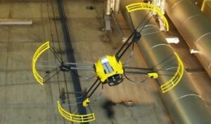
Novadem, a manufacturer of micro-UAVs for civil and military applications, has developed a new positioning technology for UAVs that will allow automatic
inspection of structures without GPS coverage.
“Some of our customers have been using the U130 micro-UAV for more than five years. Consequently we have acquired an in-depth knowledge of the needs linked to the use of UAVs for complex structures’ inspections,” explains Pascal Zunino, Director of Novadem. Some of their customers’ needs include the precise positioning of the UAV close to and even under structures. Under such conditions, it is impossible to make measurements using GPS because of the lack of satellites within view. Operators thus have no other choice but to perform these inspections in manual piloting mode, which can be difficult and even dangerous. Furthermore, the analysis of images to find and locate the structures’ defects is time-consuming and tedious. To face this challenge, Novadem has spent the last two years developing its new Local Positioning System Technology.
The Novadem LPS technology is similar to GPS technology, but instead of using satellites, it uses terrestrial beacons which create a local positioning network under the structure. This network can easily be extended with additional beacons, each of them covering a 200-meter radius area. As a result, the solution is fully independant from GPS satellite coverage. So far, the technology can claim the following achievements:
- A positioning precision of 10 centimeters in three dimensions.
- A fast acquisition rate of 25 measurements per second.
- A constant quality of measurement and constant signal availability.
- A position measurement unaffected by area parameters such as brightness or type of surface
- A user-specified origin of measurement.
These performances give new perspectives to inspections performed by UAVs, thanks to flights that can be 100% automated even under structures. It is now possible to ensure the repeatability of the inspection over time. As a result, the security and efficiency of missions has been significantly increased compared to manual piloting. Furthermore, more precise georeferencing of images allows for optimization of inspection area flight plans, and rationalization of data volumes, thus simplifying processing.
With LPS technology, Novadem has created a breakthrough in the field of inspection by allowing the automatisation of flights and the georeferencing of data in environments without GPS coverage. Difficult inspections will no longer be reserved for expert pilots but accessible to all, and will be compatible with both indoor and outdoor inspections. The LPS technology is due to be made commercially available during 2015.


