


Drone LiDAR
Discover cutting-edge solutions from 4 leading global suppliers
SUPPLIER SPOTLIGHT
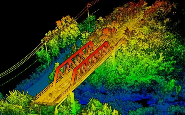
OxTS has released a case study highlighting how their xNAV650 INS (inertial navigation system) has been used by professional drone services provider Dronezone in conjunction with a Velodyne VLP-16 LiDAR scanner to undertake a high-accuracy 3D bridge survey.
Download the full case study from OxTS’ website here
The case study covers:
- How LiDAR surveys are ideal for spotting potential weaknesses in bridges
- The challenges involved in recreating an accurate 3D model of the bridge
- Details of the survey solution, which was composed of a DZX8 heavy-lift drone, a Velodyne VLP-16 LiDAR scanner, and the xNAV650 INS
- The importance of calibrating the system
To find out more about conducting high-accuracy 3D infrastructure surveys with UAV LiDAR and inertial sensing, download the full case study from OxTS’ website.


