Aliaksei Stratsilatau, CEO of UAVOS, shares insights into the development of the company’s AI Report Generator, a powerful new tool designed to enhance drone data processing.
In this Q&A, he explains how the system reduces analyst workload, enhances accuracy through automation, and delivers actionable insights across industries ranging from infrastructure monitoring to agriculture and environmental management.
1. What was the main driver behind developing the AI Report Generator?
The main trigger was the demand from our partners and customers for fast, accurate, and human-independent data interpretation. In missions where dozens of flight hours are accumulated, manually processing visual data becomes a major bottleneck. We wanted to change that.
2. What pain point in the industry did you aim to solve with this software?
Primarily, we targeted the workload on analysts and engineers who have to review and tag large volumes of data. We also wanted to eliminate subjective interpretation, especially when working with infrastructure monitoring data. The AI Report Generator allows for a standardized, objective approach right from the start.
3. How does the anomaly detection mechanism work?
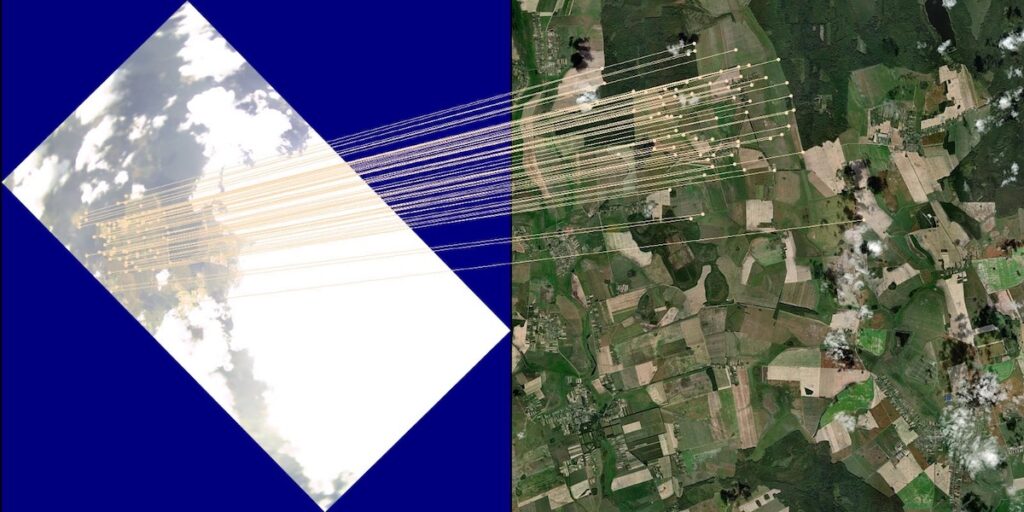
We use a technical stack that includes image preprocessing and deep neural networks. The system autonomously identifies regions of interest (ROIs) and then classifies them by type and confidence level.
4. How does the system know what to look for? Is it rule-based or a trained model?
It is a trained model with the ability to be calibrated for specific projects or industries. We use historical datasets and engineer feedback to teach the system how to detect relevant objects and classify them accordingly.
5. What types of objects can your system detect?
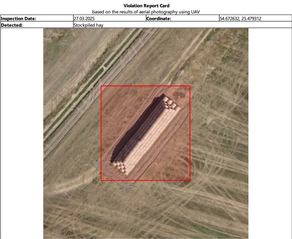
Currently, the system supports detection of vegetation and obstacles, including those along pipelines and power lines. We’re working on adding support for thermal imaging and multispectral analytics, as well as use cases in agriculture and environmental monitoring.
6. What results did the pilot deployment in the Caspian region deliver?
The results were impressive. We reduced the report preparation time from five working days to under 8 hours. Additionally, the system identified three potentially hazardous pipeline sections that had been missed during manual inspection due to human oversight. The client was more than satisfied.
7. How do users perceive the visual reports?
Very positively. The key value is that all information is aggregated into a single report – complete with hyperlinks to media, GPS coordinates, and automatically tagged anomalies. Engineers appreciate the clarity, and managers value the concise KPI summaries.
8. What systems is your AI Report Generator compatible with?
The system is easily integrable with GIS platforms. It also supports third-party drones, as long as they can transmit standard video and telemetry formats.
9. How deeply is AI Report Generator integrated with UAVOS drones?
It’s actually not tied to UAVOS drones. We intentionally designed it as a universal solution, so that it can be used by operators of various drone platforms.
10. You say “the future of drones is not just in flight, but in data.” What do you mean by that?
Yes, drones are just the starting point. The real value is created not by capturing data, but by how we interpret it. We want UAVOS drones to be part of a larger ecosystem for intelligent data analysis.
11. Are you planning to expand into other industries?
Absolutely. Our focus includes energy, construction, agriculture, and environmental sectors. We are currently working with partners on individual projects for thermal analysis of solar stations and crop growth control.
12. Do you plan to use this solution in stratospheric platforms?
Definitely. We view the AI Report Generator as a scalable module for analyzing data from stratospheric platforms — especially in long-duration monitoring and telecommunications relay missions.
Find out more on the UAVOS website.