Phase One

verified This business has been claimed by Phase One and verified by UST.
Verified companies work with us to ensure we display the most up-to-date and comprehensive product information, articles and other material to help you choose the right solution for your requirements.
High-Resolution & Multispectral Aerial Imagery Cameras for Drones / UAVs Denmark
Visit Website
Saved
Save
Contact
Phase One

High-Resolution & Multispectral Aerial Imagery Cameras for Drones / UAVs

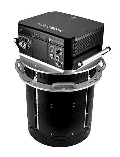
Phase One is a global leader in digital imaging technology. The company provides unrivaled imaging quality for a wide range of applications, from professional photography to heritage digitization, industrial inspections, aerial mapping, security and space.

With over three decades of innovation, Phase One has pioneered core imaging technologies and a range of digital cameras and imaging modules, setting new standards for image quality in terms of resolution, dynamic range, color fidelity and geometric accuracy. Together with its customers, technology partners and its global network of distributors, Phase One drives the imaging industry forward.

We deliver Imaging Beyond Imagination – www.phaseone.com

iXM-Series Cameras

Professional drone cameras for high resolution aerial imaging

The iXM series of cameras has been specially designed to provide superior-quality sharp aerial imagery for UAV-based applications. The high-productivity medium-format metric cameras can be integrated with a wide range of UAVs, and can be fitted with one of five specially-developed RSM lenses with focal lengths ranging from 35mm to 300mm.

PhaseOne100-MP-Drone-Camera-kit

The iXM cameras feature full wireless control, allowing users to easily define ISO, shutter speed, aperture, focus distance and more. HDMI output as well as USB-C and 10G Ethernet data connectivity provide versatile integration options for a variety of UAV platforms.

Explore the game-changing iXM 100 UAV Camera series from Phase One.

Specifications

iXM-50 iXM-100
Dimensions 90x90x68 mm (excluding lens)
90x90x164 mm (including 80mm lens)
90x90x68 mm (excluding lens)
90x90x164 mm (including 80mm lens)
Weight 630g (excluding lens)
1100g (including 80mm lens)
630g (excluding lens)
1100g (including 80mm lens)
Resolution 50MP
8280×6208
100MP
11664×8750
Dynamic Range 84 dB 83 dB
Aspect Ratio 4:3 4:3
Pixel Size 5.3 µm 3.76 µm
Effective Sensor Size 43.9×32.9 mm 43.9×32.9 mm
ISO 100 – 6400 50 – 6400
Capture Rate 2 fps 3 fps

More Information: iXM-Series Cameras

iXM Camera Lenses

High-performance lenses for iXM Series Drone Cameras

The lenses specially designed for our iXM series of drone cameras feature shutters with an innovative direct drive technology, utilising electronic charging that increases exposure speed up to 1/2500s, with a lifespan of 500,000 exposures.

This high reliability and exceptional performance allow aerial imaging drones to fly faster and execute demanding aerial photography missions with greater operational efficiency.

Aerial Camera Lenses for Drone

Five RSM lenses are available, with focal lengths of 35mm, 80mm, 150mm and 300mm.

More Information: iXM Camera Lenses

4-Band Drone Camera Solution

Multispectral drone camera for aerial photogrammetry

Phase One’s 4-Band Solution combines synchronized metric calibrated RGB and achromatic cameras to provide a high-accuracy 150MP solution designed specifically for UAV aerial photogrammetry. The flexible combined NIR & RBG drone camera solution is ideal for agricultural use, such as crop analysis and environmental contamination, as well as urban applications such as green site monitoring.

4-Band-Drone-Camera-NIR

The two cameras can be used together or as stand-alone units for a variety of mission types. The simplified workflow provides easy post-processing, using Phase One’s iX Capture software to automatically generate distortion-free images and perform fine co-registration of pixels from the NIR to the RGB images.

RGB Aerial Image
RGB Image
CIR Aerial Image
CIR Image
NIR Aerial Image
NIR Image
NDVI Aerial Image
NDVI Image

Users can generate the following products with the Phase One 4-Band Solution:

  • 4-Band combined NIR and RGB (RGBN) TIFF (4-Band CIR)
  • 3-Band combined NIR and RGB (NRG) TIFF (3-Band CIR)
  • NDVI (Normalized Difference Vegetation Index) TIFF
  • Distortion-free / corrected RGB TIFF
  • Distortion-free / corrected NIR TIFF
  • RGB TIFF
  • NIR TIFF
See the 4-Band Camera Solution in Action…

More Information: 4-Band Drone Camera Solution

PAS 880 Aerial Imagery System

Large-format nadir & oblique imagery

PAS 880 Aerial Imagery SystemPhase One’s PAS 880 is a high-accuracy imaging system that combines a 280MP nadir with four 150MP oblique cameras in a single payload, providing over 20,000 pixels across flight lines for the nadir and 14,000 pixels per oblique sensor.

With excellent performance at 2 frames per second and shutter speeds of up to 1/2500 second, the lightweight and compact system is capable of simultaneously capturing photogrammetric 2D and 3D digital imagery.

The PAS 880 includes an advanced Trimble Applanix GNSS/IMU receiver, with a choice of two IMU accuracy options.

System specifications:

Dimensions (diameter x height) 408 x 716 mm
Weight 45 kg
Power Consumption 380 W (average)
450 W (max)
Operating Temperatures -10 to 40 degrees C
Internal Storage 6 x 2TB

Sensor specifications:

Nadir Oblique
Sensor Type BSI CMOS Bayer Array BSI CMOS Bayer Array
Sensor Size 280MP
20,150 x 14,118
150MP
14,204 x 10,652
Pixel Size 3.76 µm 3.76 µm
Max Shutter Speed 1/2000 s 1/2500 s
Dynamic Range 83 dB 83 dB
Aperture F/5.6 F/5.6
Field of View 32.9° along track
45.7° across track
Left/Right: 42°
15.2° along track
20.2° across track
Forward/backward: 45°
15.2° along track
20.2° across track

More Information: PAS 880 Aerial Imagery System

P3 Payload

Turnkey solution for drone-based inspection

p3 payload for drones

The P3 Payload is a versatile solution designed to suit a wide variety of drone-based inspection requirements, designed to enhance productivity for even the most demanding projects.

Offering a choice of the Phase One iXM 100MP or 50MP cameras and a range of RSM lens options, the customizable solution also features a specially-designed gimbal with integrated rangefinder.

The P3 Payload is designed as a ready-to-fly plug-and-play solution for the DJI M300 drone, and is also available in a fully MAVLink-compatible version that is ideal for bundling with OEM packages. The MAVLink version also features full integration with the Auterion open drone ecosystem.

The P3 Payload is ideal for a variety of inspection applications:

  • High Value Assets – bridges, dams, and energy facilities requiring frequent, accurate, and detailed data
  • High-Risk Assessment – electric transmission lines, oil refineries, and other complex sites where high-resolution inspection from a distance is required for maximum safety
  • Time-Critical Assets – wind turbines, offshore oil rigs, and other facilities where inspection windows are limited and downtime must be minimized

See more videos of the P3 Payload in action…

Specifications (for DJI M300 version):

Weight 2.6 kg (with iXM-100 and RSM 80mm AF lens)
Power consumption 22-24 W max
Gimbal mechanical range Roll: +80.5 to -264.3°
Pan: ±345°
Tilt: -90 to +45°
Lens options 35mm, 80mm, 80mm AF, 150mm AF
Rangefinder 180m max range
90m max effective operating range

iX Controller MK5

Control up to six Phase One Aerial Drone Cameras independently

Multiple Camera-Controller

The iX Controller MK 5 is a small-footprint computing solution optimized for integration with Phase One aerial cameras and capture software. With the ability to control up to six aerial cameras, as well as the gyro-stabilizing mount and GNSS/INS, it allows efficient capturing, monitoring and storage of aerial imagery and the ability to adjust camera settings in real time.

Built around an 8th Generation Intel Core i7 processor, the rugged iX Controller MK 5 features two easily-removable SSD hard drives with optional RAID mirroring. It supports up to three monitors via wired or wireless network connection.

iX Capture Software

Professional capture and RAW conversion application for Phase One aerial camera systems

Camera RAW Conversion Software

iX Capture is a professional image capture and RAW conversion software solution designed exclusively for Phase One aerial camera systems. Featuring an intuitive touchscreen or mouse-driven interface, it allows full control of all aspects of aerial image capture missions and up to six aerial cameras.

iX Capture enables direct control and inflight adjustment of aperture, shutter speed, ISO, and other essential settings. Its advanced post-processing capabilities provide rapid production of distortion-free RGB and CIR images, as well as 3- and 4-band CIR and NDVI TIFF files from data captured by Phase One’s 4-Band Solution.

More Information: iX Capture Software

Aerial Imaging Applications

Mapping & Surveying

Mapping-and-Surveying-drone camera

Our high-precision aerial imaging solutions simplify UAV mapping and surveying missions, providing unlimited aerial coverage and accurate, reliable data every time. High resolution images captured in flight can be used for professional photogrammetry to create both 2D and 3D maps.

Agriculture & Forestry

Agriculture-and-Forestry-drone-camera-imagery

Our fully-automatic combined NIR and RGB aerial imagery solution is ideal for a wide range of multispectral imaging requirements, including precision agriculture, crop analysis for growth optimization, vegetation health, forestland management, environmental contamination, and more.

Inspections

imaging-camera-industrial-inspection-drone

Our specially designed UAV aerial cameras provide invaluable data for predictive maintenance of power lines, wind turbines, roads, bridges, and pipelines. Large surface coverage at extremely high resolution enables millimeter-sized damage detection, reducing costs and allowing for timely, efficient repair.

P3 Payload Power Line Inspection Test Flight

Our P3 Payload for DJI M300 was put to the test to see how it executes a power line inspection. Take a look at the drone in action with the Phase One P3 Payload ready-for-flight solution:

Phase One introduces its new Case Studies Portal

Fly over the interactive map and click on one of the “+” to dive into a success story! Each case study is packed with useful information and a zoom-in showing the amazing results obtained with our cameras.

Products

PAS 880 Oblique and Nadir Aerial System

Bringing a New Dimension to Aerial Mapping

iXM-50 50MP Camera for UAVs

50MP professional drone camera for high-resolution aerial imaging

RSM 35mm f/5.6 iXM Camera Lens

High-performance lens for iXM Series Drone Cameras

RSM 80mm f/5.6 iXM Camera Lens

High-performance lens for iXM Series Drone Cameras

RSM 80mm AF f/5.6 iXM Camera Lens

High-performance lens for iXM Series Drone Cameras

RSM 150mm AF f/5.6 iXM Camera Lens

High-performance lens for iXM Series Drone Cameras

RSM 300mm AF f/8 iXM Camera Lens

High-performance lens for iXM Series Drone Cameras

4-Band Drone Camera Solution

Multispectral drone camera for aerial photogrammetry

iX Controller

Control up to six Phase One Aerial Drone Cameras independently

iX Capture Software

Professional capture & RAW conversion application for Phase One aerial camera systems

iXM-100 100MP Camera for UAVs

100MP professional drone camera for high-resolution aerial imaging

Articles

Latest
New Partnership Brings Phase One P3 Imaging Payload to Benelux

Phase One has partnered with DroneStars to expand access to the high-precision P3 imaging payload in Benelux, enhancing aerial inspection capabilities with superior image quality and efficiency

Feb 21, 2025
Partnership for UAV Inspection Growth in Canada

Phase One has officially partnered with Measur for strong UAV inspection growth in the Canadian market, providing impressive image quality captured from the safest distance

May 24, 2024
Long-Range Dual Sensor System Integrated with Fixed-Wing VTOL

Phase One, RIEGL, & Carbonix have joined forces to fly an airborne laser scanner and a medium format camera on a fixed-wing VTOL platform, serving critical use cases across sectors

Mar 07, 2024
Cyberhawk & Phase One Partner on Drone-Based Industrial Inspections

Through a Global Partner Agreement, Cyberhawk and Phase One will continue to bring the highest standard of industrial inspections to customers using the P3 iXM100 payload

Jan 10, 2024
Phase One Partners to Enhance Visual Inspection

Phase One and partner SPH Engineering will use advanced cameras to capture precise details of structures such as power lines, cell towers, wind turbines, and more

Oct 23, 2023
Case Study: Tackling Challenges in Asset Inspection with P3 Payload Sensor Technology

Phase One has released a case study exploring the challenges employees face in asset inspection, the disadvantages of using traditional...

Aug 14, 2023
Case Study: Asset Inspection Using High-Resolution UAV Imagery

Phase One discusses how AM/NS Calvert Steel Mill uses a Phase One Industrial iXM 100MP medium format camera to meet...

Jul 17, 2023
Bridge Inspection: Achieve Close-to-1mm GSD with a Large Footprint

Phase One discusses how Eyefly uses the Phase One iXM-100 to fly closer to Buggenum Railbridge and achieve a resolution...

Jul 03, 2023
Sub-Millimeter-Resolution UAV Dam Surveys with iXM 100 Camera

Phase One explains how drone-based critical infrastructure inspection company Orthodrone uses its iXM 100 camera for photogrammetric data acquisition for...

Jun 19, 2023
Case Study: Interactive 360° High-Resolution Aerial Imaging

Phase One has released a case study detailing how its iXM-100 cameras were purchased by Phoenix LiDAR Systems and Black...

Jun 05, 2023
Phase One Launches iXM-SP150 Space-Hardened Camera at GEOINT

Phase One has introduced its iXM-SP150 space camera with high-quality components for both Earth Observation and Space Domain Awareness applications....

May 25, 2023
The Benefits of Mapping with a 100MP Camera

Phase One details the experience that its client EyeFly has had whilst using the Phase One 100 Megapixel camera to...

May 22, 2023
New Partnership Brings Phase One Aerial Imaging Solutions to GCC Region

The Drone Centre will offer Phase One’s medium format P3 payload and 100MP cameras to the Gulf Cooperation Council (GCC)

May 10, 2023
Phase One P3 Camera Integrates with IF1200A Drone for Aerial Mapping 

The Inspired Flight and Phase One P3 integration solution enables complete camera control and the ability to write GNSS data directly on the image for photogrammetry and inspection applications

May 03, 2023
Aerial Camera Solution for Comprehensive Rail Infrastructure Surveying

Phase One discusses the use of the Phase One Industrial 100MP medium format aerial camera in a drone-based system to enable...

Apr 24, 2023
Using Drone Technology for Flare Stack Inspection

Phase One has released a case study explaining how SkyeBase was tasked by a multinational oil and gas company to...

Mar 30, 2023
Phase One to Unveil Fusion Shutter Technology at InterGeo 2022

Fusion Shutter technology leverages electronic and mechanical global shutters to enable capturing of images with very short exposure times without the adverse effects of the parasitic light sensitivity of electronic global shutters

Oct 17, 2022
Turnkey Solution Launched for Aerial Mapping & Inspection

The turnkey bundle with Acecore Technologies’s Zoe drone and the Phase One P3 payload offers a plug and play solution designed for aerial mapping and inspection.

Oct 12, 2022
Freefly Systems & Phase One Offer New Aerial Imaging Solution

Freefly's Alta X UAV and the Phase One P3 camera plug and play solution will enable customers to integrate real-time, best-in-class inspection data into their preferred applications and workflows

Sep 08, 2022
Partnership to Increase Automation & Productivity of Power Grid Inspections

Phase One's P3 100mp camera has been integrated with LINIA’s drone software solutions to empower customers to achieve increased productivity and automation during difficult and high-risk power grid inspections

Sep 02, 2022
Smart Focus Features for P3 Camera Increase Robustness & Productivity

Phase One’s P3 Smart Focus is purpose-built for the inspection of complex high volume industrial assets such as wind turbines or power towers

Aug 18, 2022
Phase One & Drone Harmony Collaborate to Offer Automated Mission Planning Tool 

This new partnership aims to empower customers to increase productivity and consistent image quality for reliable and scalable operations

Jul 14, 2022
New Collaboration Streamlines High Quality Photogrammetric Workflow

A new integration between Phase One and Trimble Inpho Suite will simplify the process to transform raw images into final mapping products

Jul 05, 2022
Phase One Unveils Aerial Solutions with Near Infrared Capabilities

The addition of a near-infrared sensor to the PAS 880 and PAS 280 solutions expands their utility in applications related to agricultural monitoring, environmental preservation, and land use/land cover programs

May 27, 2022
Phase One Selects New Distributor for Germany and Austria

Phase One has selected Globe Flight GmbH as a reseller for the company’s range of unmanned aerial vehicle (UAV) imaging...

Feb 10, 2022
Wide-Area 120MP UAV Camera Launched

Phase One has launched the iXM-GS120, a new camera for UAVs (unmanned aerial vehicles) designed to meet the demanding needs...

Jan 17, 2022
3D Thermal Mapping with Autonomous Unmanned Airship

Phase One has released a case study showing how its iXM-100 camera has been integrated into the Airbus Defence and...

Nov 26, 2021
Aerial Inspection of Automated Shipping Yards

Phase One has released a case study showing how its medium format camera has been used as part of a...

Nov 03, 2021

Videos

Webinars

Watch anytime
Consortiq - Utilizing the right sensor for the right job
Phase One
Dec 20, 2021
Watch anytime
How hydro-power digital-twins support plant operations
Phase One
Jul 12, 2021
Regional Offices & Locations
Phase One A/S Denmark Roskildevej 39, DK-2000, Frederiksberg, Denmark +45 36 46 0111 Contact Website
Phase One USA United States of America Rocky Mountain Metropolitan Airport, 11755 Airport Way, Suite 216, Broomfield, CO 80021, USA +1 (303) 469-6657 Website
Phase One Germany Germany Lichtstr. 43h, 50825 Koln,
Germany
+49 (0)221/5402260 Website
Phase One Japan Japan 8F VOLT-Nagatachou, Bldg. 2-7-2 Hirakawachou, Chiyoda-ku, Tokyo, 102-0093, Japan +81-3-6256-9681 Website
Phase One Asia Hong Kong Room 1009, 10/F Eight Commercial Tower, 8 Sun Yip Street, Siu Sai Wan, Hong Kong +852 28967088 Website
Advancing Unmanned Systems Through Strategic Collaboration UST works with major OEMs to foster collaboration and increase engagement with SMEs, to accelerate innovation and drive unmanned systems capabilities forward.