


UAV/Drone Cameras
Discover cutting-edge solutions from 4 leading global suppliers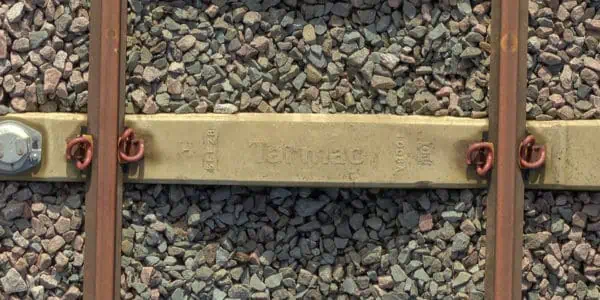
Phase One discusses the use of the Phase One Industrial 100MP medium format aerial camera in a drone-based system to enable comprehensive surveying of rail infrastructure.
Creating a “Digital Railway”
 One of the major challenges that railway networks are facing is prevention of failures in railway tracks. The task of inspecting thousands of miles of tracks stretching across the land must be performed with speed, efficiency and safety to avoid risk and traffic interference.
An innovative methodology of inspection is by creating a “digital railway” – an accurate and dynamic visualization tool, for fast and accurate potential damage identification, enabling professionals to take informed decisions while planning and prioritizing rail development, maintenance, repairs and renewal projects.
Recently, the use of drone-based platforms in the aerial imaging market is increasing rapidly, and remote sensing is becoming a preferred method for acquiring qualitative aerial data. These platforms offer easy and safe aerial access to challenging areas, a larger surface coverage in a single flight, higher resolution images, and efficient, cost-effective aerial data acquisition.
Plowman Craven is a measurement survey company that specializes in providing laser scanning, surveying, and measurement data services, to both public and private sectors. Having spent many years conducting railway track surveys for Network Rail, and recently created a world-first technical solution for Cross rail, Plowman Craven’s Rail team spent more than two years researching whether the drone surveying capabilities used for buildings surveys, rooftops and landscapes, could be applied to the rail environment.
Vogel R3D – Expanding Rail Infrastructure Surveying Accuracy
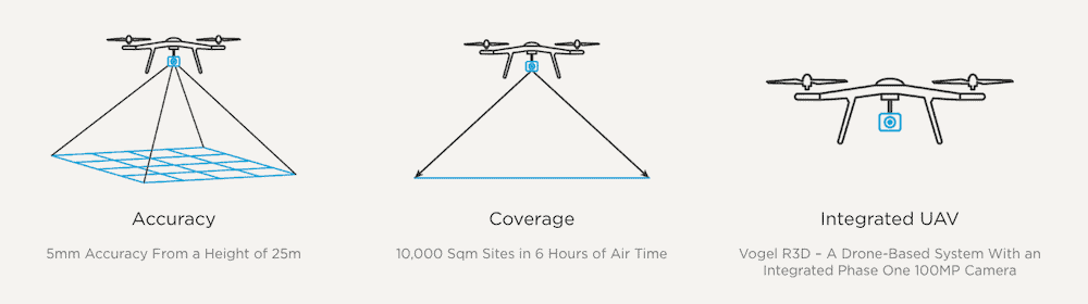
In collaboration with Network Rail, Plowman Craven developed the Vogel R3D – a drone-based system with an integrated Phase One 100MP medium format camera, that enables comprehensive surveying of rail infrastructure to a sub-5mm accuracy from a height of 25m. The system captures overlapping aerial images of an entire site that are then converted into high-accuracy 3D data by bespoke software and algorithms.
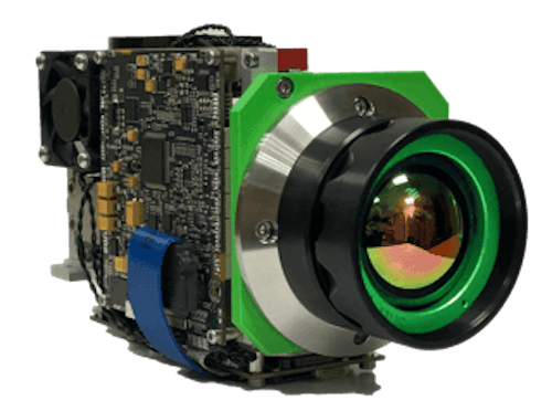
The reasons to integrate Phase One’s 100MB camera were the fact that it is the lightest weight camera in its category, the large sensor that captures large amounts of light and improves data quality, and the high dynamic range that enables accurate capture of high and low-intensity objects.
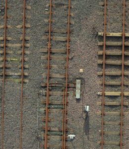
With enhanced permissions and an ‘Operation Safety Case’ from the Civil Aviation Authority, Plowman Craven’s UAV team is able to fly at a low altitude, closely inspecting live railways. Operating at a height of 25m, Vogel follows a series of pre-programmed flight paths to capture hundreds of overlapping high-resolution images using Phase One’s 100MP Aerial Camera.

Ultra High-Resolution Imagery

The value of this visualized data is significant. It enables stakeholders to ‘walk’ the site from anywhere in the world using a tablet or computer, making imagery interrogation and the extraction of measurements possible. The high level of detail and the accuracy of the extracted data supports decision-makers in monitoring, planning, predicting and preparing for railway maintenance projects in an efficient, safe and cost-effective manner.
Recommended Phase One Solution
- IXM-100 Camera
- 80mm RSM Lens


