


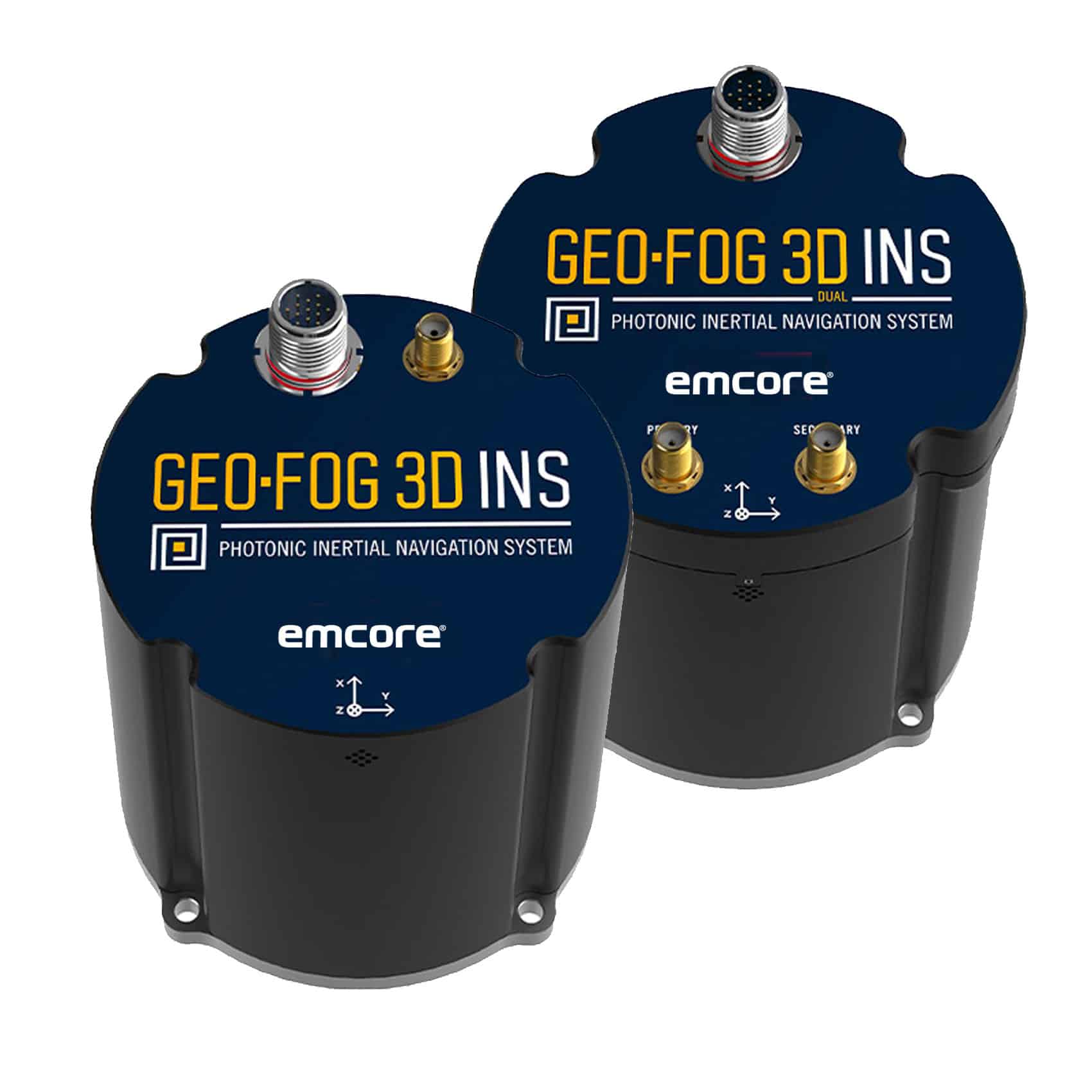

The GEO-FOG 3D™ inertial navigation system (INS) is a commercial off-the-shelf navigation and control solution built upon the company’s landmark high performance Fiber Optic Gyro (FOG)-based 1750 inertial measurement unit (IMU). The GEO-FOG 3D INS uses sensor fusion to deliver reliable, high-accuracy navigation and control to a wide variety of unmanned, autonomous, and manned aerial, ground, marine, and subsurface marine applications and platforms.
The advanced GEO-FOG 3D contains three DSP-1750 gyros, the world’s smallest high performance Fiber Optic Gyro (FOG), integrated with three low noise MEMS accelerometers, three axes of magnetometers, a pressure sensor and a triple frequency RTK GNSS receiver. Available as a single or dual antenna INS (GEO-FOG 3D Dual), this highly accurate inertial system includes an innovative algorithm capable of extracting significantly more data from the IMU core processor.
Designed for Critical Control ApplicationsDesigned for demanding navigation and control applications, the GEO-FOG 3D has performance monitoring and instability protections to ensure stable and reliable data. The rugged GEO-FOG 3D INS is designed and tested to ensure that the hardware is both secure and reliable. It is protected from reverse polarity, overvoltage, surges, static and short circuits on all external surfaces. The embedded GNSS includes Receiver Autonomous Integrity Monitoring (RAIM) to assess the integrity of satellite signals. The system also contains a backup MEMS IMU providing seamless inertial data collection for redundancy and backup purposes.
Embedded RTK GNSS Receiver & Integrated North-seeking GyrocompassThe GEO-FOG 3D contains a triple frequency GNSS receiver providing 8 mm positioning accuracy. It supports all of the current and future satellite navigation systems including GPS, GLONASS, GALILEO, and BeiDou. It also offers data rates up to 1000 Hz, and data can be output over a high-speed RS-422 interface or RS-232 interface. The GEO-FOG 3D features a north-seeking algorithm. This provides accurate heading as fast as 10 seconds after power-on from a hot start, and 10 minutes from a cold start. The north-seeking algorithm runs continuously while the INS is operating, and is unaffected by velocity or angular motion. This means the GEO-FOG 3D provides high accuracy heading in environments in which magnetometers and GPS-heading cannot be used.
Features- Commercial Off-the-Shelf high performance INS
- Precision navigation & positioning even when GNSS is unavailable
- Supports all current & future satellite navigation systems including GPS, GLONASS, GALILEO and BeiDou
- Data rate 10x faster than competing systems
- RS-422 interface or RS 232 interface
- Core processor: 1750 IMU
- 6 DoF IMU consisting of integrated FOGs and accelerometers
- Trimble GNSS receiver
- North-seeking gyrocompass
- Altitude and Heading Reference System (AHRS)


